
- Hikes in Arizona
- Northern Arizona
- Kachina Trail
Kachina Trail

Location
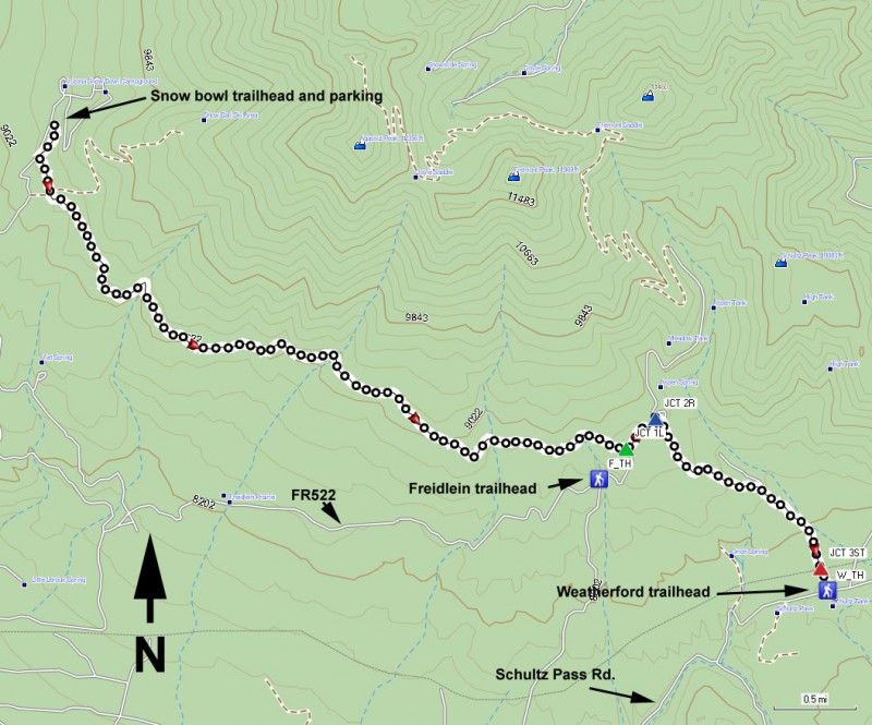
To the Trailhead start: From the Flagstaff area, take HWY 180 towards the south rim of the Grand Canyon. About 7 miles from Flagstaff (Mile marker 223) is the road leading to the Snowbowl Ski Resort. From HWY 180, it is about 6.5 miles to the parking area just below the lodge. Follow the sign pointing to the right for the Kachina Trail.
For the short hike shuttle: Take the road leading to Snowbowl Ski resort as mentioned above. Drive 2.4 miles and turn right onto Freidlein Prairie Road (FR522). This road is signed, but you cannot see the sign from the road, so pay attention to your odometer. Drive this dirt road 4 miles to the Freidlein trailhead access to the Kachina Trail. FR522 is quite rocky, so a high clearance vehicle would be helpful here.
For the longer hike shuttle: From HWY-180, turn right onto Schultz Pass Road (FR42). Schultz Pass Road is located between mileposts 218 and 219, about 4.4 miles south-east from the turn-off to the Snowbowl Ski Resort towards Flagstaff. Once on Schultz Pass road, you will quickly reach a junction with Elden Lookout Road (FR557) turning off to the right. Stay left to remain on Schultz Pass Road. Go 5.5 miles to the Weatherford Trail parking area on your right (the trailhead is signed on the left side of the road). Schultz Pass road is a rocky dirt road in good enough shape for most vehicles.
Hike details
Season
- June
- July
- August
Solitude
Difficulty
Permits
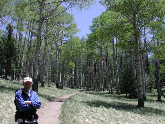
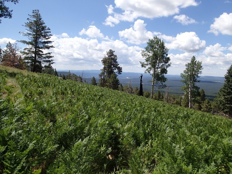
Hike along the Kachina trail near Flagstaff, Arizona.
This shuttle hike travels more or less horizontally across the San Francisco Peaks. The first decision you need to make is whether to try the short hike or the long hike. The benefit of the long hike is that the approach to the car shuttle is on a better dirt road and you get to walk through the Freidlein Meadow. After deciding which hike you want to do, drop your shuttle car at the appropriate trailhead as described in the HOW TO GET THERE section.
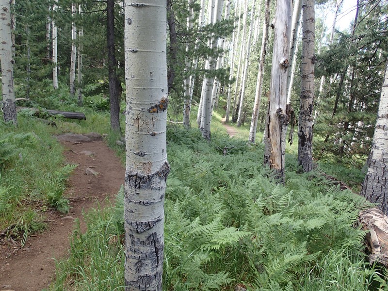
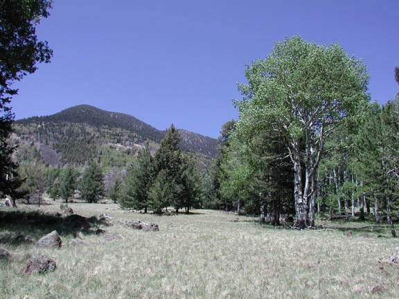
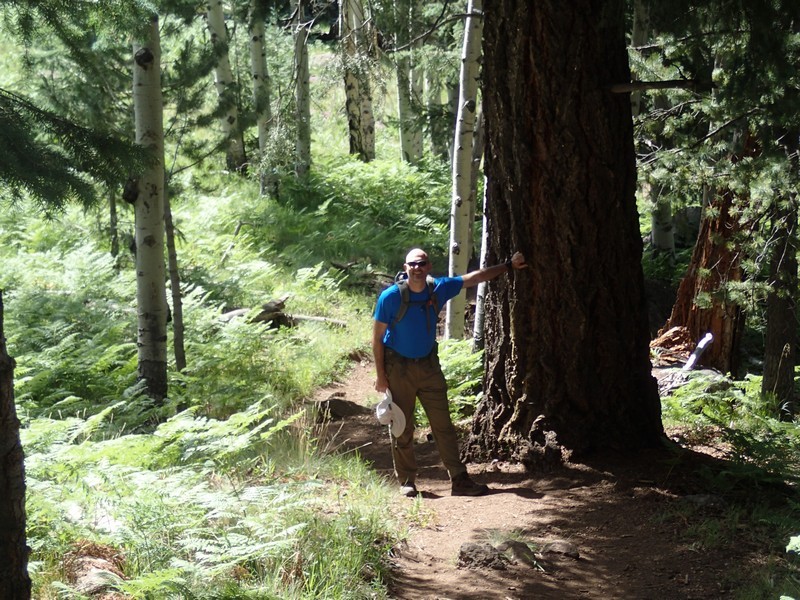
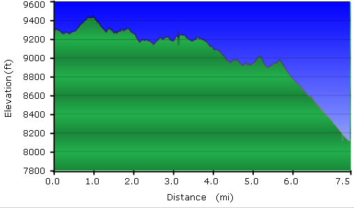
This trail starts from the lower parking lot at the Snowbowl Ski resort. The well marked and easy to follow trail starts starts at about 9600 ft of elevation and generally stays there as it cuts across the San Francisco Peaks. This trail gets rave reviews from most hikers for its variety. Aspen, Fir, and Spruce trees are mixed in with the pine tree forest. On multiple occasions, the trail may open into a wide meadow with good views of the San Francisco Peaks or the surrounding countryside. Parts of this hike pass through some old growth trees that were spared any attempt at logging. During this hike, we were consistently pleased at the mixture of scenery for our eyes.
While staying mostly at 9600 ft, the trail does meander up and down a bit. After five very enjoyable hiking miles, you reach a signed junction to the 'Freidlein Road' (JCT 1L on the map). If you chose the SHORT HIKE then you will turn right here and take this descending trail 0.4 miles back to your car. If you chose the LONG HIKE, go left on the main trail towards Schultz Tank and the Weatherford trail.
If you chose the LONG HIKE, you are now entering the Freidlein Meadow. The meadow is nice because of the mountain views to the north and the Flagstaff city views to the south. Shortly after entering the meadow, you reach another trail junction. At this signed junction (JCT 2R on the map), you want to turn right, toward Schultz Tank. The trail is now part of the Weatherford trail, which was an old road and it descends quickly. After about 1.5 miles of hiking, you reach the pipeline road. The trail signage is confusing here, but you need to go straight across the wide pipeline road here to another signed trail junction (JCT 3ST on the map). Follow the arrow to Schultz Tank and the final 0.1 miles to your car shuttle.
Watch the weather closely. If dark clouds begin to form or you hear thunder or see lightning, call it a day and hustle down the mountain. Lightning strikes the peak of Humphreys on a regular basis and you don't want to be near it when it does.
This is a great Arizona hike. Enjoy!
NOTE: The Richard and Sherry Mangum 5th edition Flagstaff Hikes is in error when describing this hike. Their hike description describes the LONG HIKE, while their car shuttle placement is for the SHORT HIKE. This was very disappointing for us when we took this hike and realized we needed to back track another 2.5 miles to our actual car location. If you follow the hike as written in the above, you will be OK. Special thanks to John V. for helping me get the directions and distances correct!
