
- Hikes in Arizona
- Prescott Area
- Constellation Trails
Constellation Trails


Location
From the Phoenix area, take I-17 to the junction of HWY-69. Turn left onto HWY-69 towards Prescott. When you enter the city of Prescott Valley, turn right on the signed road for Prescott Lakes Parkway. Take this road to HWY-89 and turn right. From here, its about 3.6 miles to the Phippen Museum of Western Art (it will be on the right). Turn right here and park at the location signed for 'Trailhead parking'.
Hike details
Season
- April
- May
- September
- October
- January
- February
- December
Solitude
Difficulty
Permits
Hike the Constellation trail system near Prescott, Arizona.
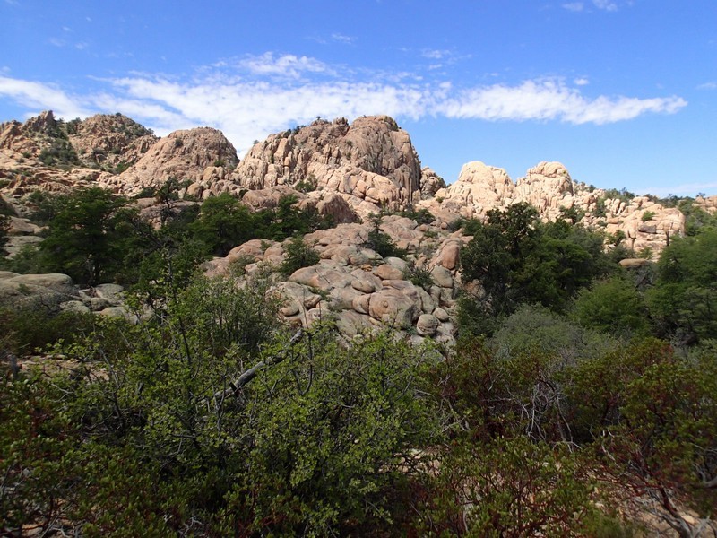
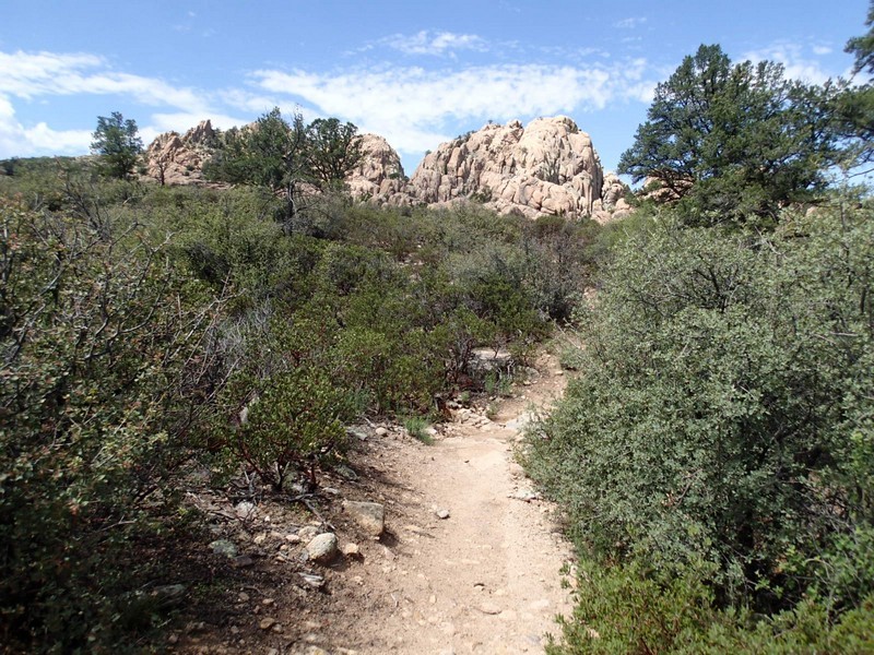
The Constellation trail system is a group of trails near the Phippen Museum of Western Art that allows for some close up views of the various unique rock formations of the area.
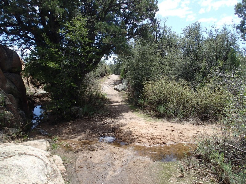
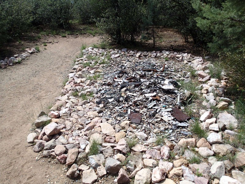
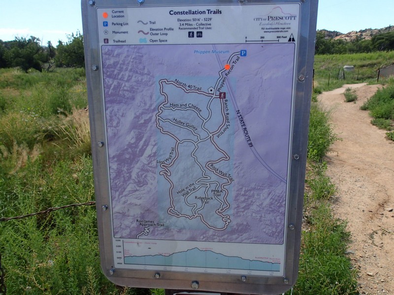
From the Phippen Museum trail parking area, backtrack towards the highway and cross under the highway (low ceiling, watch your head) to the Constellation trail system. On the other side of the passage and after a short walk there is a good map of the trails of the area. This trail system is named for a 1950's airplane crash that occurred in this area. Nearby, people have placed the discovered metal remains of this crash.
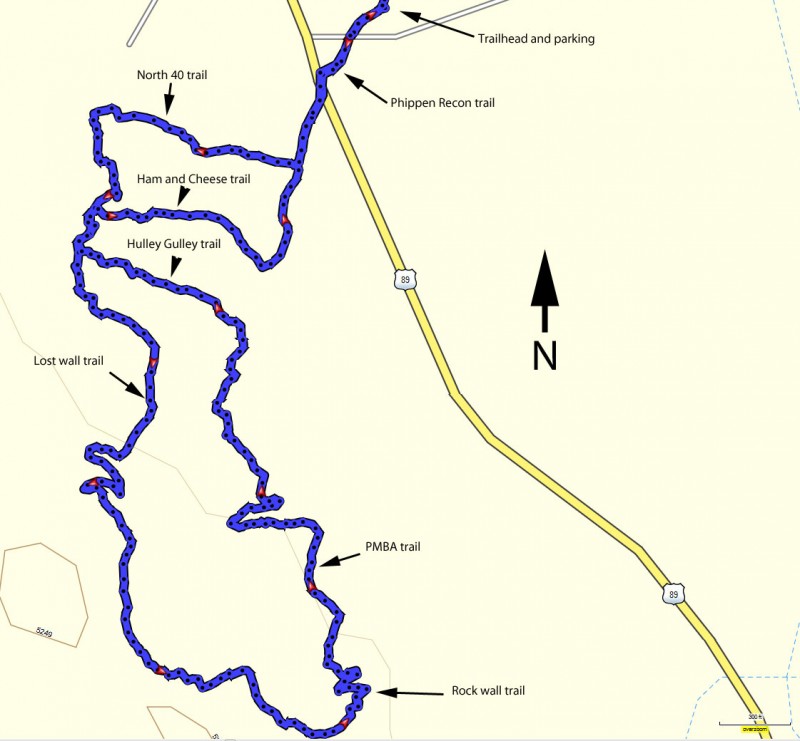
Since this area holds many trails, you can pick a direction and just start walking. All the trail junctions are well signed and there is a map and 'you are here' location at each, so route finding is easy. We chose a zig zagging path to explore the majority of this area, but fell free to customize your hike to any length you like.
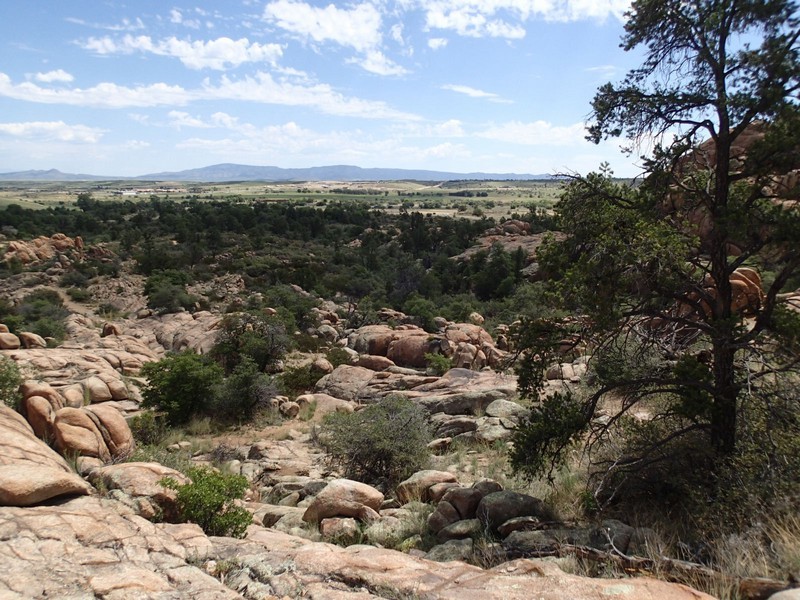
We took a right and started hiking on the North 40 trail. This trail gains some elevation gradually as it passes by trail junctions for the 'Ham and Cheese' trail and the 'Hulley Gulley' trail. Pass by these for now (we'll take them on the return). There's more elevation gain on the 'Lost Wall trail' as well as great views of the unique rock formations (Granite Dells) of the area. You'll reach the high point of the hike is it bends East.
Continue on the 'Rock wall' Trail until you hit the 'PMBA' trail junction. Turn left onto this trail and hike to the intersection with the 'Hulley Gulley' trail. Hiking through this neat little gully is one of the many highlights of the trip. Continue to the intersection with the 'Ham and Cheese' trail, which goes through another gully, turning left at the trail junction to reach the starting point.
