
- Hikes in Arizona
- Phoenix Area and Central Arizona
- San Tan Regional Park - Goldmine Trailhead Loop
San Tan Regional Park - Goldmine Trailhead Loop


Location
From the Phoenix area, take US-60 East to the Higley Road Exit. Go South on Higley Road, which eventually turns into the Hunt Highway going East. Take the Hunt Highway, turning right onto signed Wagon Wheel Road. Take this road South 1.1 miles to the trailhead and parking area. This is a fee area and it is $6 to park (self service as of November 2015).
Hike details
Season
- January
- February
- March
- April
- October
- November
- December
- July
- August
Solitude
Difficulty
Permits
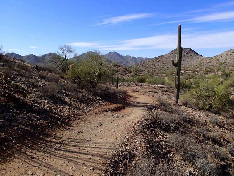
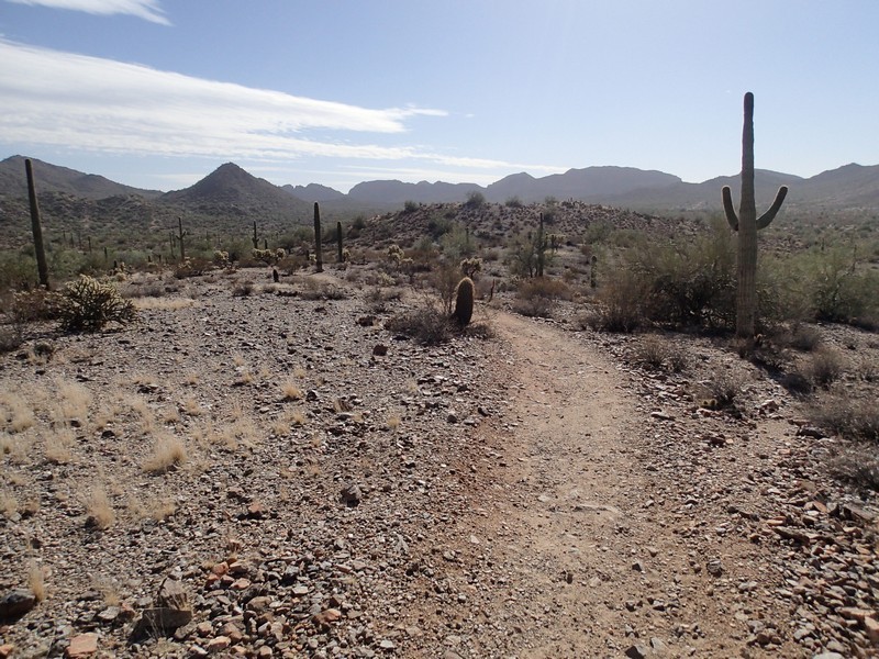
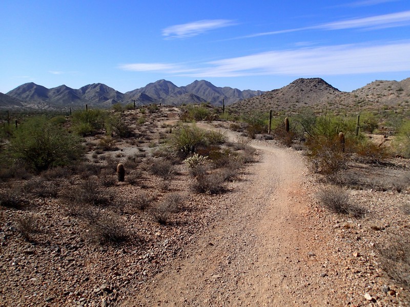
Loop hike on the Goldmine Trail in the San Tan Regional park in Arizona.
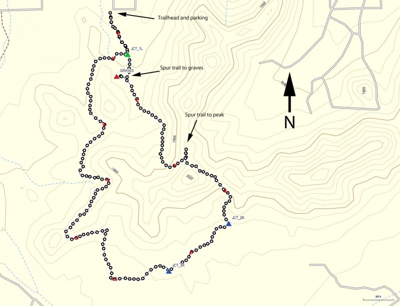
The San Tan Regional Park has several hiking trailhead access points. The Northern Goldmine Trailhead is the starting point for a fun loop hike with some interesting scenery. Parking here is self serve and is $6 per car (as of November 2015).
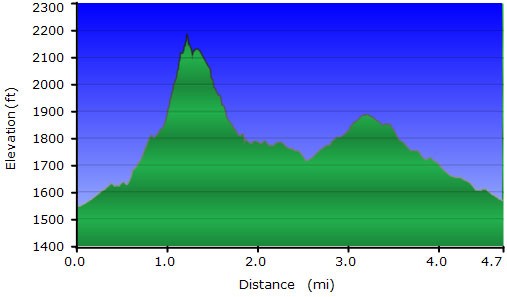
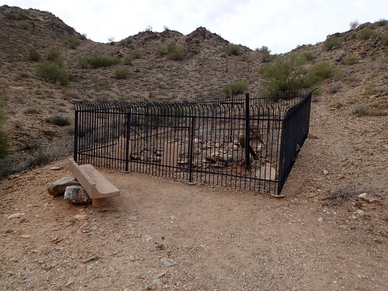
From the trailhead, take the Goldmine Trail South. The trail is a bit rocky, but easy to follow. After 0.2 miles, stay left at the trail junction (JCT_1L on the map). Now keep your eyes open to the right to see the black fencing protecting the graves of two folks. This is a nice little detour. Continue on the rocky Goldmine Trail up to the saddle, about 700 ft of climbing. At the saddle, there is also a little spur trail here to the top of a nearby peak, which is also worth the detour for the views. Continue walking until you've hiked 1.5 miles from the trailhead start. Turn right here (JCT_2R on the map) onto the signed San Tan Trail. This section of the trail flattens out for a while. It's a short 0.4 miles along this trail until you turn right again (JCT_3R on the map) onto the signed Dynamite trail. This is a more quiet section of trail and it is easy to forget that there's a huge metropolis to the North. Continue along this trail section, enjoying the scenery of the sonoran desert for 2.6 miles where you return to the start.
Link to San Tan Regional Park website: http://www.maricopa.gov/parks/santan/
