
- Hikes in Arizona
- Prescott Area
- Salida View Trail #95
Salida View Trail #95


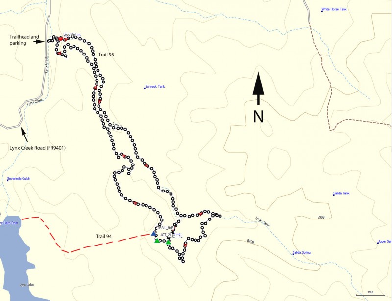
Location
To get to the trail head: from the Phoenix area, take I-17 North toward Flagstaff. At Cordes Junction, take HWY-69 towards Prescott. Just after leaving Prescott Valley, you'll turn left onto Walker Road (near the Costco). Take this paved road 1.2 miles to the signed dirt road to Lynx Creek Ruin. Turn left on this well graded dirt road (Lynx Creek Road, FR 9401) and take it 1.0 miles to its end at a large parking area. For the most part, this dirt road is in good shape, but when we took this hike, there were a few sections that washed out in recent rains and had large (and hopefully temporary) trenches. No problem for even a mediocre clearance vehicle, but probably too deep for some passenger cars.
Hike details
Season
- May
- June
- August
- January
- February
- December
Solitude
Difficulty
Permits
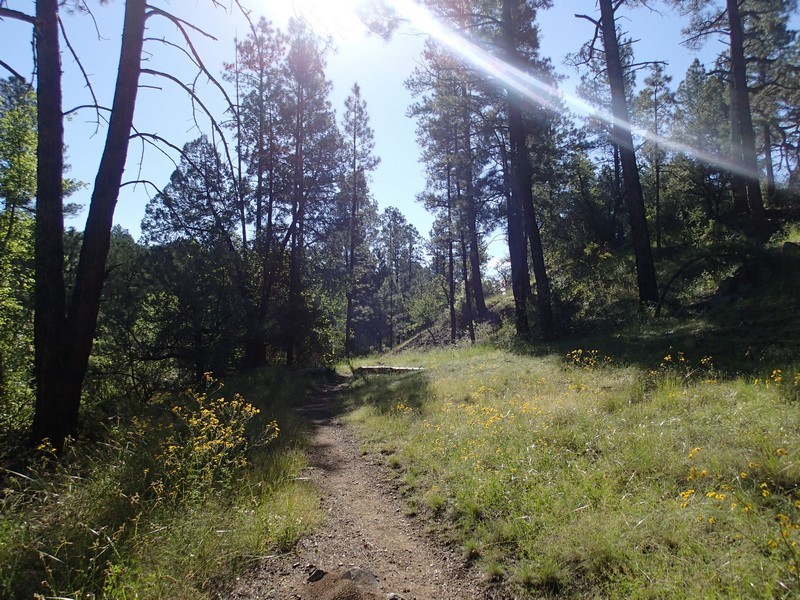
Hike up the Salida view trail near Prescott, Arizona.
From the parking area, look for the trailhead signed as #9263. You'll follow this connector trail only a few hundred yards, crossing over Lynx creek (which was flowing when we did this hike, but still an easy cross) until you get to the junction with the the Salida View Trail #95, also signed (marked as LoopStart on the map). Turn right here and after a few feet you need to decide if you will take this loop hike clockwise or counterclockwise. We chose clockwise, so the hike write up will reflect this.
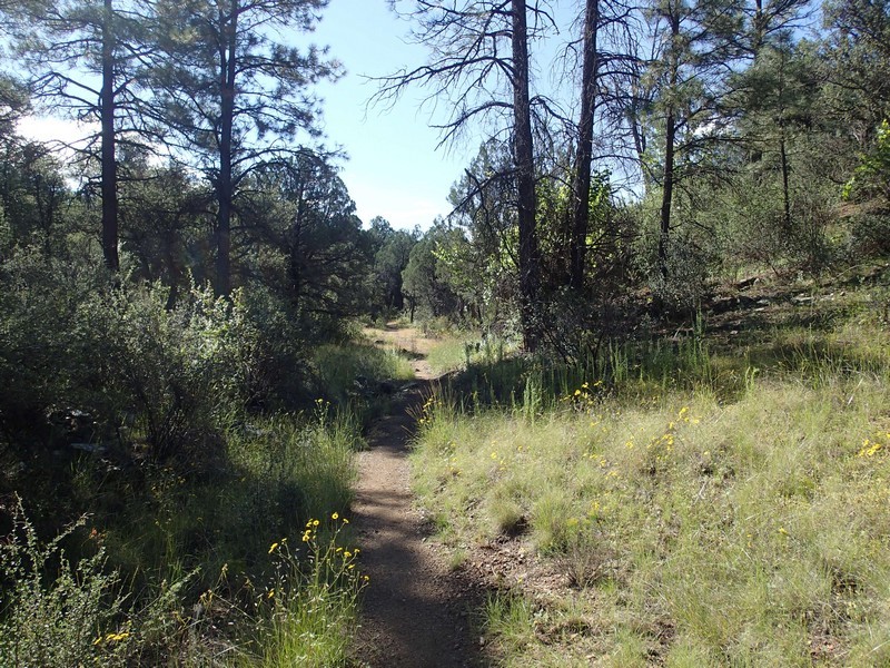
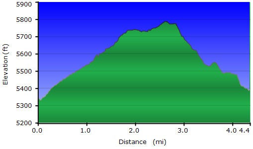
The trail mixes pine forest, meadows, and chaparral. This section is somewhat shaded and heads through the pine forest section as it follows along side Lynx creek, which is a seasonal stream. The elevation gain is gradual for the length of the hike and the trail is easily followed. A little farther then the half way point of this hike (2.1 miles) you'll see a fence on your right with a break in it (JCT 1L on your map). This break in the fence allows access to John's Tank and there's a short, steep trail that backtracks onto where you previously hiked. Instead of going through this break in the fence, stay left at this unsigned junction. Continue walking another 0.1 miles and you'll see another break in the fence on your right that again provides access to the water tank (JCT 2L on your map). Stay left here again.
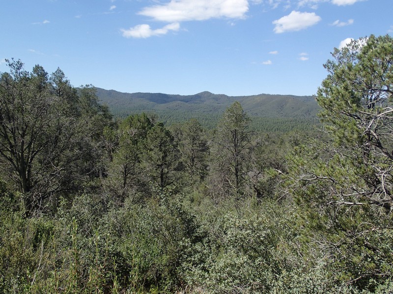
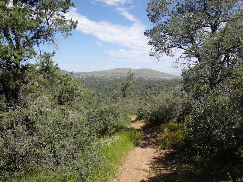
Another 0.1 miles of hiking will get you to a signed trail junction with trail 94 to the left (TRAIL_94R on the map). Trail 94 heads generally West and goes to Lynx lake. Stay right here to stay on trail 95. From here, the views are more wide open and you'll get some nice scenery, including Granite Mountain and the hills of Prescott Valley off in the distance. Continue on this easy to follow trail as it gently descends back down to the valley created by Lynx creek. After about 3.9 miles of hiking, you'll get back to where you started the loop. Turn left here, cross Lynx creek, and walk the short distance back to the parking area.
