- Hikes in Arizona
- Tucson Area and Southern Arizona
- Lorraine Lee-Bowen Loop Hike (Tucson Mountain Park)
Lorraine Lee-Bowen Loop Hike (Tucson Mountain Park)
Location
To get to the Trailhead: From the Tucson area, headed South on I-10, get off on the Speedway Blvd exit and head West (right turn). Turn left (South) onto Greasewood Road, then turn right (West) onto Anklam Road. After driving 0.8 miles, turn left onto Players Club drive. Take this road 1.1 miles and turn right onto Starr Pass Blvd (follow the signs to the JW Marriott resort). As you near the backside of the resort property, you'll see the signed trailheads on your left (assuming you are driving clockwise around the loop that circles around the property). Parking is tricky here, as the proximity to the resort restricts where you can park along the road. Be aware of the no parking signs. Your best bet is to park near the Lorraine Lee trailhead, as there is parking along the road available here.
Hike details
Season
- January
- February
- December
- June
- July
- August
Solitude
Difficulty
Permits
Loop hike with the Lorraine Lee and Bowen trails in Tuscon Mountain Park near Tuscon, Arizona.
Tucson mountain park was created back in 1929 and boasts a number of scenic trails through the sonoran desert. If you're looking for an easy introduction hike to this area, a loop made with the Bowen trail and the Lorraine Lee trail would be a good choice.
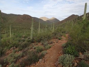
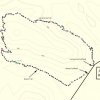
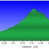
For this loop hike, you can start on either trailhead. I was staying at the JW Marriott hotel and I saw the trailhead sign for the Bowen trail first, so that's where I started. The rocky path is easy to follow through the Saguaro lined trail. There are plenty of cacti here representative of the sonoran desert. After hiking 0.4 miles, keep an eye out on your right for a pile of rocks. This is a cairn and marks the trail junction between the Bowen trail and the Lorraine Lee trail. Please note this trail junction is not signed, so it is important that you don't miss this junction (JCT 1R on the map). Turning right at this junction puts you on the Lorraine Lee trail and begins a climb up to a saddle. The switchbacks are frequent enough to keep the climbing steady without being too strenuous. At the top of the pass, you'll get the best views of the hike. The views include not only the surrounding desert, but the outskirts of the Tucson area. Continue to follow the Lorraine Lee trail as it turns East and hugs the edge of a desert wash. Keep an eye out for wildflowers in this section. The steady downhill walking eventually gets you back to the road and a right turn with a short walk along the road returns you to your car.

