
- Hikes outside of Arizona
- Outside AZ
- United States - National Parks
- Piedra River trail
Piedra River trail


Location
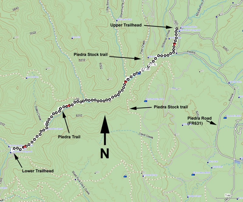
UPPER TRAILHEAD: From HWY-160 through Pagosa Springs, take the Piedra Road (FR631) out of town headed North. This road starts out as a paved road and turns into a well graded dirt road. After about 16 miles of driving along this road, you'll cross the Piedra River. A few hundred yards later, you'll see a parking area on your left with the signed trailhead for the Piedra River. Park here.
LOWER TRAILHEAD: Take HWY-160 West from Pagosa Springs. Turn right (North) on the well signed First Fork Road (FR622) just after you cross the Piedra River. Take this well graded dirt road 8.5 miles to the signed trailhead on the right side of the road just after you cross the Piedra River.
Hike details
Season
- July
- August
- January
- February
- December
Solitude
Difficulty
Permits
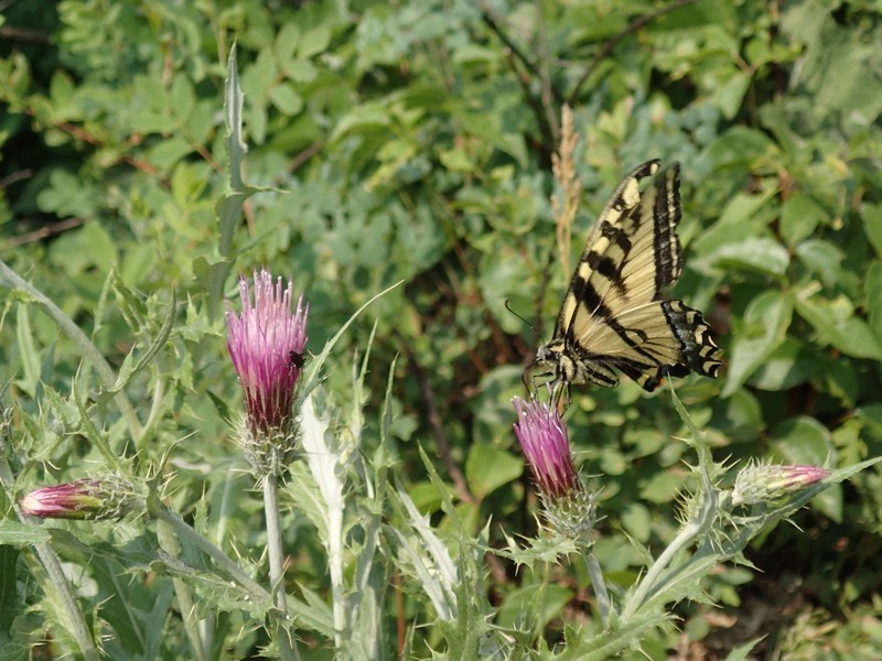
Hike along the Piedra River trail in Colorado.
The San Juan National forest has a plethora of wonderful trails. We were looking for a long, scenic day hike in this area, and the Piedra River trail definitely fit our target. The only drawback to this hike is the long shuttle needed. However, it is worth it to be able to hike the full length of the river.
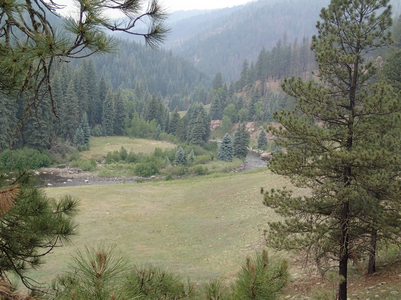
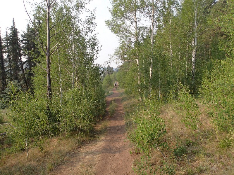
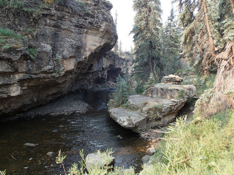
From the upper trailhead, you'll briefly head through an Aspen forest before the easy to follow trail parallels the river. The canyon walls narrow up nicely here and the combination of the canyon and water is very scenic. Watch out for the abundant poison ivy along the trail in this area (and popping up occasionally throughout the hike).
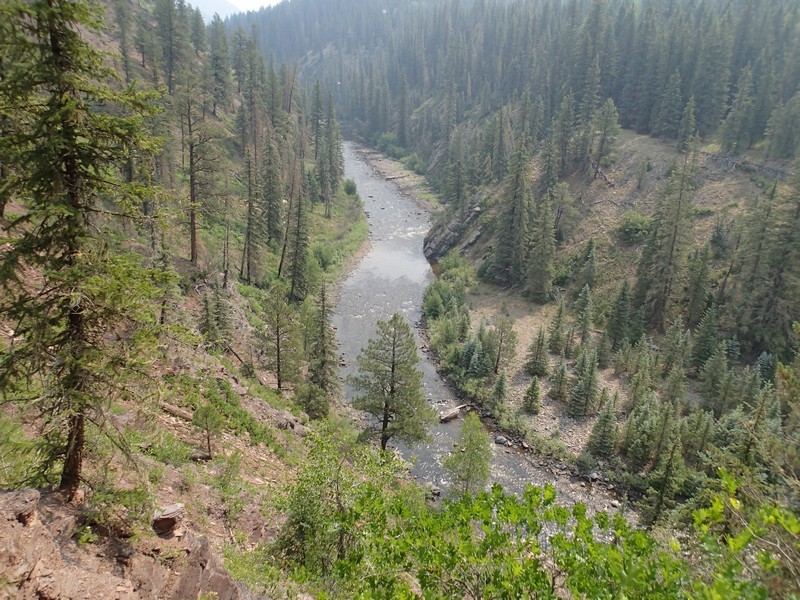
Although the lower trailhead is 600 ft lower, there is still some decent climbing on this hike. Sometimes the trail follows the river closely and other times the trail ends up high on the forested canyon walls. All the water crossings either have bridges or are easily negotiated without getting wet. After about 2.3 miles of hiking, the canyon opens up and you'll reach a signed trail junction with the Piedra Stock trail (JCT 1L on the map). Stay left here to stay on the Piedra River trail. After 2.8 miles of total hiking, the Piedra stock trail branches off to the left at a signed trail junction (JCT 2R on the map) and crosses the river on a bridge. Stay right here to stay on the Piedra river trail. The trail alternates between open meadows and pine forest in this section.
After about 6.3 miles of total hiking, you'll start a healthy and sustained climb away from the river. This section of the trail was burned by the Little Sand fire in 2012. Even though the fire was so recent, you can see evidence of the forest starting to recover. The climbing peaks out at the high point of the trail (7800 ft) before descending once again.
Eventually after just over 11 miles and one final, gradual descent, you'll reach the lower trailhead and your shuttle vehicle.
