
- Hikes in Arizona
- Northern Arizona
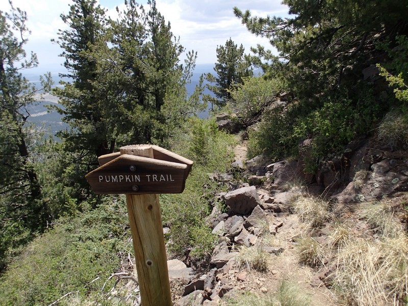
- Kendrick Mountain (via the Pumpkin trail)
Kendrick Mountain (via the Pumpkin trail)
Location
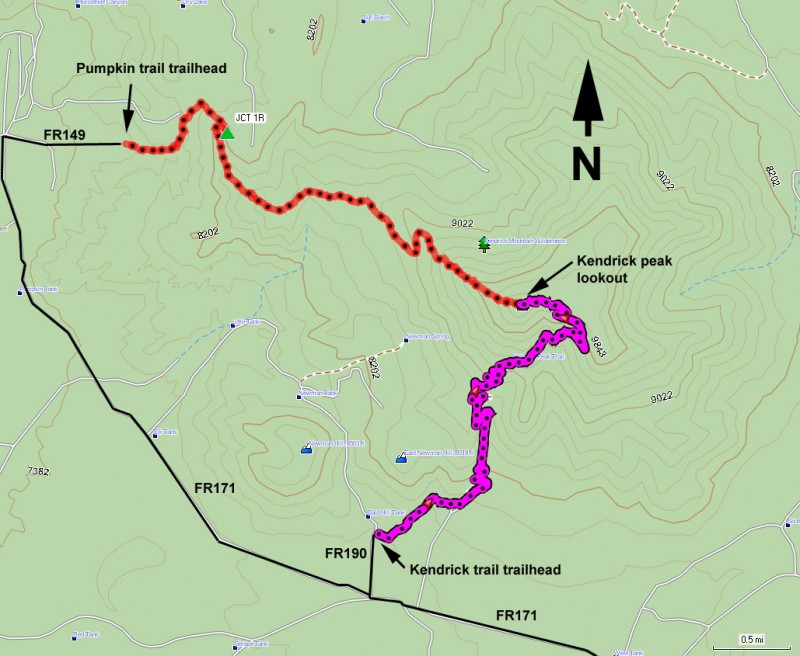
To get to the trailhead: from the Phoenix area, take I-17 North toward Flagstaff, AZ. Once in Flagstaff, take HWY-180 towards the Grand Canyon. About 14 miles from Flagstaff, turn left on signed FR 245, which is very close to mile marker 230. After going 3.1 miles on this flat, graded dirt road, turn right on FR 171 (signed for Kendrick mountain trail). After driving 7.2 miles on FR 171, turn right onto FR 149 (signed as Pumpkin trailhead). Go another 0.8 miles to the signed trailhead and parking. This road may be impassable to some cars after heavy rains, so use good judgment.
Hike details
Season
- April
- May
- September
- October
- January
- February
Solitude
Difficulty
Permits
Hike along the Pumpkin trail to the top of Kendrick Mountain near Flagstaff, Arizona.
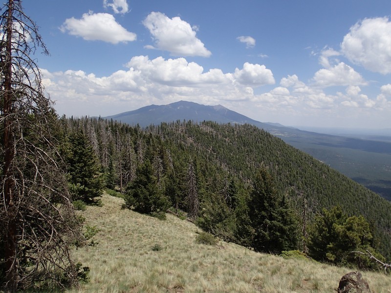
Kendrick mountain lies to the West of the San Francisco peaks and makes for a good all around hike on a spring or fall day.
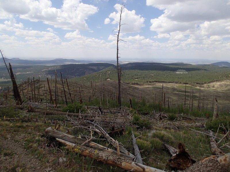
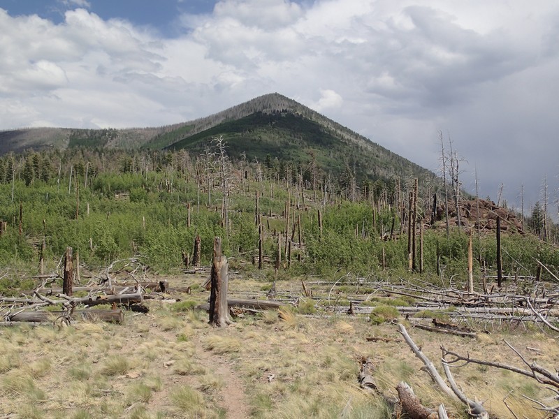
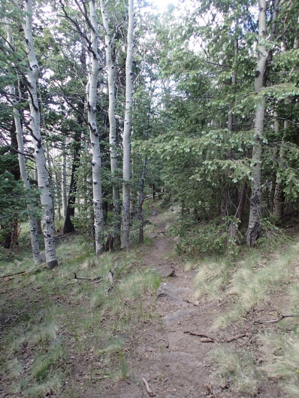
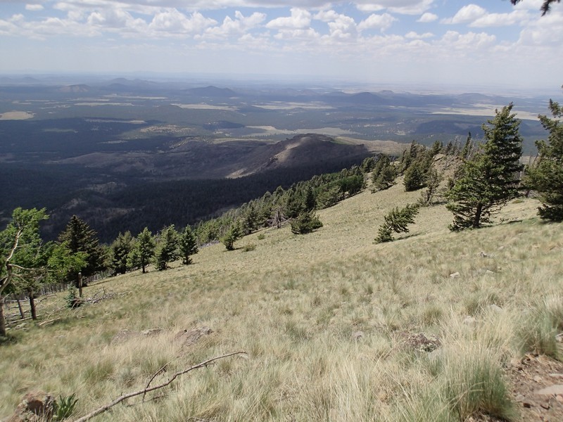
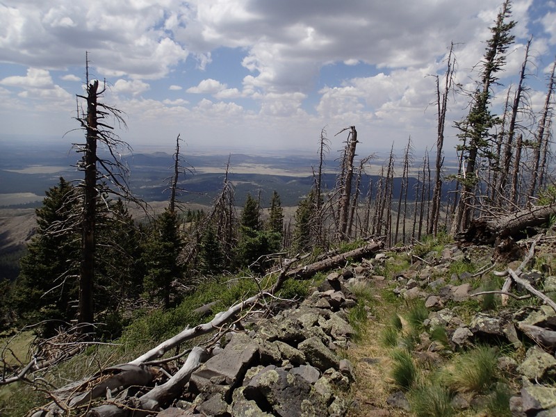
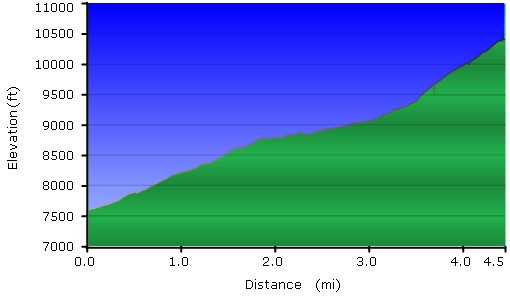
There are three trails to the top of Kendrick mountain. The Kendrick trail is the best choice in the summer months, as that trail is pretty well shaded. On a cold Spring or Fall day, the Pumpkin trail is likely a better choice, as the effects of the Pumpkin Center fire (started by lightning) cleared out the shade trees so the direct sun will help keep you warm. The results of the fire are evident here in burned out trees and meadows of wildflowers. Compared to the Kendrick trail, this trail is more rocky and difficult to follow in places.
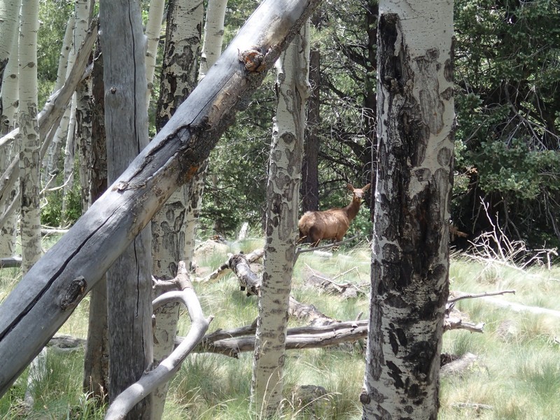
The trail starts through a pine forest, but soon emerges into a meadow. The dead trees are your constant companion for much of the rest of this hike. The nice thing is that the views of the are are unobstructed. Another benefit of this trail is that it is easier to spot wildlife (I saw two Elk on this hike). You can see some of the trees starting to return. The Aspen are especially tenacious in their effort to reestablish themselves. After about 1 mile of hiking, you'll reach the signed junction (JCT 1R on the map) with a connector trail that leads to the Bull Basin trail. Turn right here to stay on the Pumpkin trail. The nearer you get to the top, you'll need to start using those route finding skills, as the trail can get faint and sometimes dead trees have covered the trail. Once at the top, a fire lookout provides the best vantage point for the 360 views of the San Francisco peaks, Oak Creek Canyon, and the Grand Canyon.
Snap a few pictures, enjoy lunch with a view, and head back when you're ready.
There are two other routes to the top of Kendrick. The Kendrick trail and the Bull Basin trail also reach the top, so make sure you pick the right trail to get back to your car.
