
- Hikes in Arizona
- Phoenix Area and Central Arizona
- Saddle Mountain trail
Saddle Mountain trail

Location
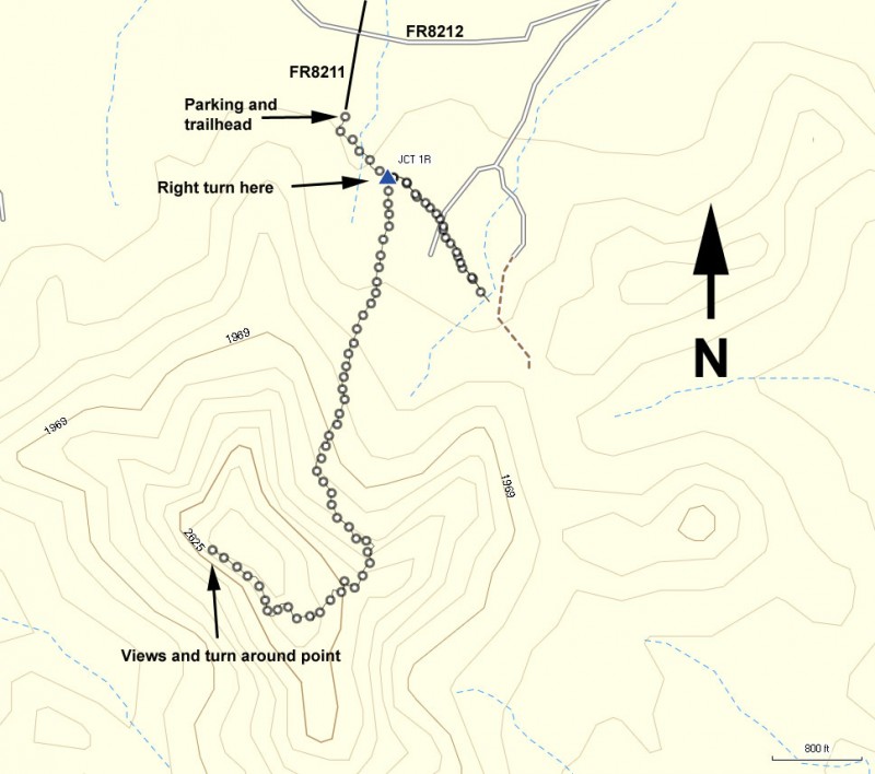
To get to the trailhead: from the Phoenix area, take I-10 West towards Los Angeles. Once you near Tonopah you'll take exit 94 and turn left onto 411th Avenue. Take this road 2.9 miles to the junction with the Salome Highway. Turn right onto the Salome Highway and drive 5.1 miles to another road junction, this time with Courthouse road. Turn left onto Courthouse Road. Drive 0.9 miles and look for a faint dirt road on your left signed as FR8211. Turn left here onto this dirt road. The road itself is in good shape but you'll likely need a high clearance vehicle. Take this road for 0.9 miles to the intersection with signed FR8212. Keep going straight here and soon enough the road will end at a parking area. You'll know you've reached the parking area as the dirt is a reddish color. The trailhead starts from the southwest corner of the parking area.
Hike details
Season
- January
- February
- March
- November
- December
Solitude
Difficulty
Permits
Hike the Saddle mountain trail in the Phoenix area of Arizona.
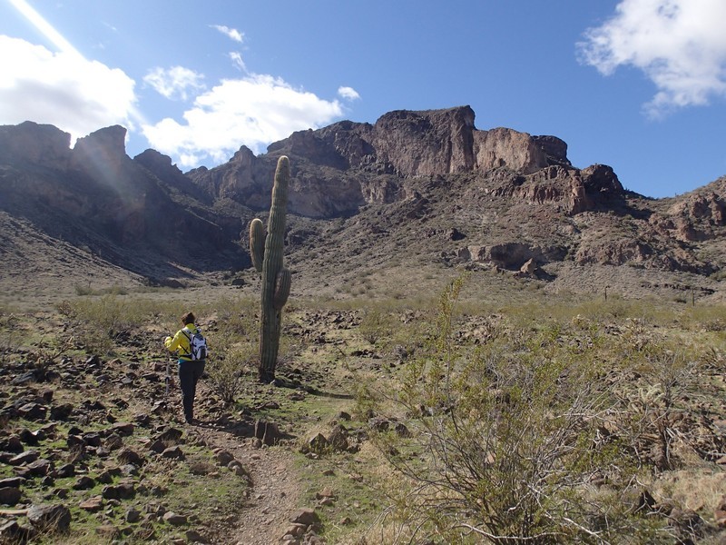
This lovely and remote hike West of the Phoenix area is a great winter hike destination, especially for those of us looking for a nice climb without having to share it with anyone. First locate the trailead starting from the Southwest corner of the parking area. Some folks have done a nice job with trail maintenance in this section, and the trail is easy to follow. A short 0.1 miles from the parking area, you'll reach an unsigned trail junction. Turn right here to head towards the top of Saddle Mountain (if you turned left on accident like we did, you'll end up at a 4WD road in 0.4 miles).
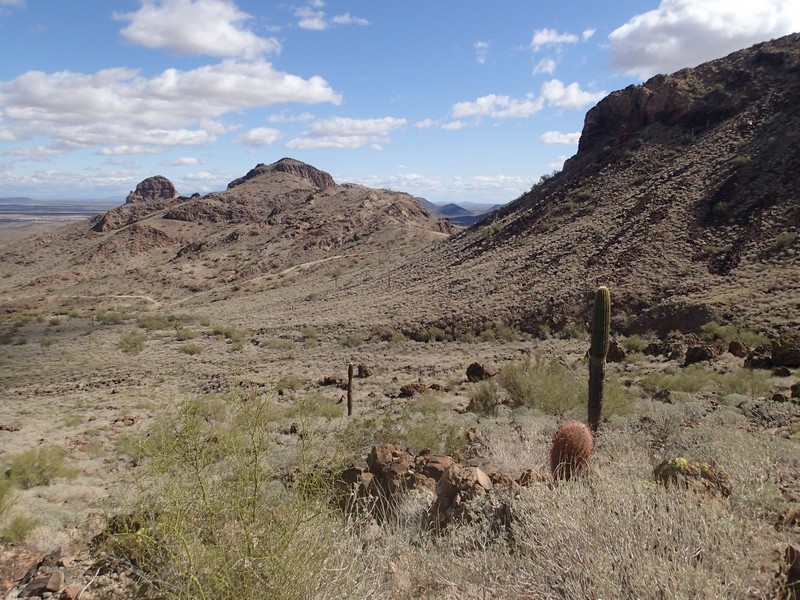
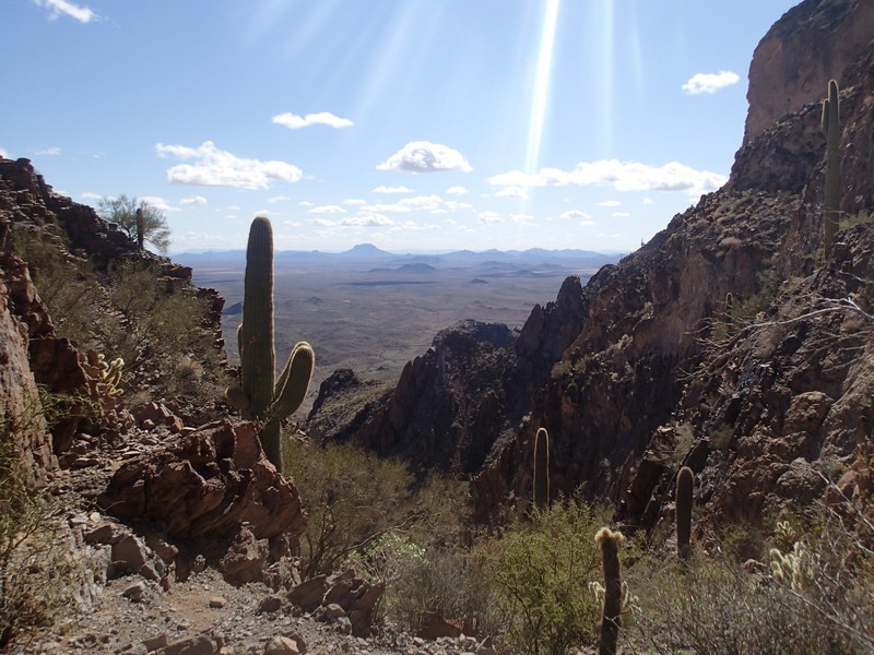
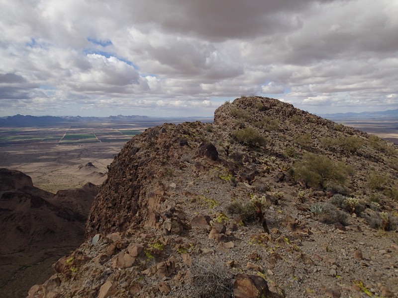
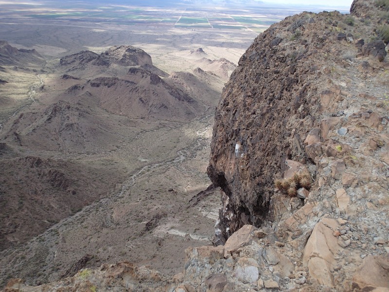
The trail starts to climb along the base of Saddle mountain, gradually at first, but more steeply soon enough. The trail stays easy to follow until you reach a very clear saddle where you can see the South side of the desert. From here, the trail becomes more faint, finally becoming mostly indistinguishable from game trails. Each time I thought I had found a trail again, the small animal scat (likely Bighorn sheep, which frequent this area) convinced me I was on a game trail. Anyway, it isn't too hard to scramble and route find your way to the top of the mountain. At the top is a USGS marker, as well as a register to sign. The register was a bit tricky to find, as it had been buried in rocks. The 360 views of the surrounding area are unmistakable. You can even see the Palo Verde nuclear power plant off to the East.
After enjoying the view, return the way you came.
