
- Hikes outside of Arizona
- Outside AZ
- United States - National Parks
- Caines Head Coastal Trail
Caines Head Coastal Trail


Location
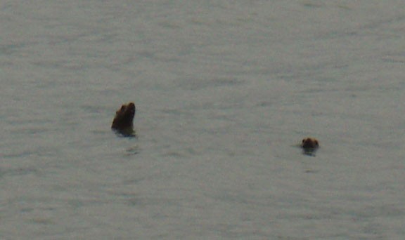
To get to the trailhead: Walk down (or take a taxi) down the dirt road South of Seward (past the aquarium) to Lowell point. I would recommend walking, as there are harbor seals and otters to be seen if you scan Resurrection Bay.
Hike details
Lowell Point Trailhead to Tonsina Point: 1.5 miles
Tonsina point to Derby Cove: 2.25 miles
TOTAL Lowell point to North Beach: 4.5 miles
North Beach to Fort McGilvray: 2.0 miles
- Water
- Wild Animals
Season
- July
- August
- January
- February
- December
Solitude
Difficulty
Permits
Multi day back pack and hike on the Cains Head Coastal trail in Alaska.
Although there is very little route finding on this hike, it does present some unique challenges. The costal trail section of this hike can only be hiked at times near low tide. You will have to familiarize yourself with the tide schedule before setting out on this hike. The tidal book can be acquired free of charge from either of the two banks in Seward. It was also posted at Lowell Point when we did this hike. The low tide will determine your schedule for the hike. For our experience, low tide was around 7am and 7pm. Not wanting to wake up ridiculously early, we decided on the evening hike. This wasn't bad at all, since we were only a few days away from the summer solstice, with sunshine from 4am to midnight.
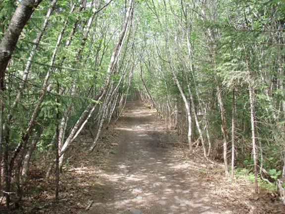
Starting from Lowell Point, the marked trail is easy to follow as you walk through costal rain forest. You'll travel up and over, but the climbing is pretty mild. After about 1.5 miles, you'll end up at a bridge across Tonsina creek. This bridge was damaged when we took this hike, so we needed to wade across the creek. While cold, the water is not too deep. Speaking to some locals, it seems that the bridge is pretty consistently being repaired across this creek, so be prepared. Karen had seal skin watertight socks for the cold. I just went barefoot.
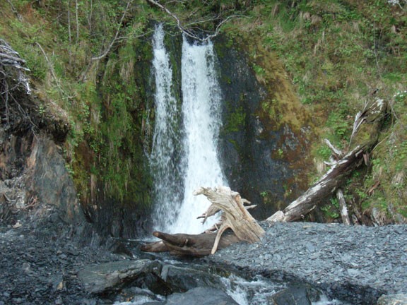
From this point, you'll be walking along the coastline, so your timing is critical. We started along the coastline about 2 hours before low tide, which worked out just fine. There are some slippery spots that need to be negotiated and a fall here could be very painful. If you're lucky, you may be visited by some of the sea creatures in the area (Harbor Seals, Otters, Humpback Whales, or Orcas).
You'll be able to mark your progress by noting the location of the two public use cabins on the way to Derby Cove. These cabins must be reserved through the Alaska state park service (www.alaskastateparks.org) and are nearly impossible to reserve last minute. You can see their location on the map.
Once you've reached North Beach, there will be a ranger station, a pit toilet, and several campsites. Pick any region you like to camp and enjoy the area. North beach is easily identified by the ruins of an old pier leading to the beach.
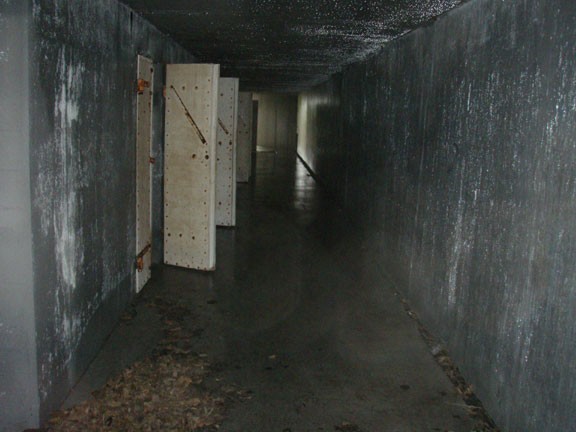
The next day we took the opportunity to day hike to the ruins at Fort McGilvray, about 2 miles hiking (and about 650 ft of elevation gain) from North beach. Back in 1942, the Imperial forces of Japan had seized the Alaskan islands of Attu and Kitska, which shook up the Alaskan authorities. In response, Fort McGilvray was quickly built overlooking the entrance into Resurrection Bay to protect the strategic town of Seward. There were two costal guns installed, along with several ammunition magazine storage facilities and a barracks. After the war ended, the fort and barracks were quickly closed. The area was later opened as a state park and the concrete fort is still intact for visitors to explore. Make sure you have a good flashlight and follow the map provided at the entrance to the fort. The location of the fort commands an excellent view of the bay. If you have time and energy, you can also investigate the barracks, which are located at South Beach.
After enjoying all the scenery and exploration this area has to offer, head back the way you came.
