
- Hikes outside of Arizona
- Outside AZ
- United States - National Parks
- Black Canyon of the Yellowstone (Yellowstone National Park)
Black Canyon of the Yellowstone (Yellowstone National Park)

Location
To get to the Gardiner trailhead: While in the town of Gardiner, Montana, take Jardine Road (well graded dirt road) about 0.2 miles and turn right onto White Lane. After about 0.1 miles, there is a sign on your right for the Yellowstone river trail. Parking here is very limited.
To get to the Hellroaring trailhead: Drive West from Tower junction about 3.7 miles and turn at the signed road for Hellroaring trailhead. Travel about 0.3 miles along a well graded dirt road to the trailhead. There is ample parking here.
To get to the Dunraven trailhead: Drive South from Tower junction about 13.3 miles and park at the signed trailhead. There is a bathroom here.
Hike details
- Water
- Wild Flowers
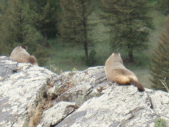
- Wild Animals
Season
- July
- August
- September
- January
- February
- December
Solitude
Difficulty
Permits
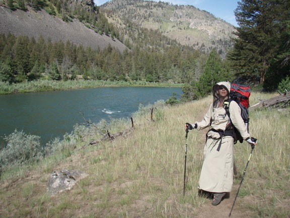
Hike and multi day backpack through the Black canyon of Yellowstone National park
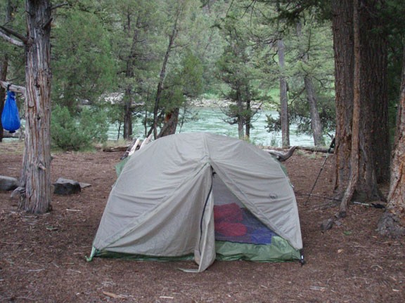
When we took this hike, we started at the Hellroaring trailhead so we could head generally downhill and end the hike in the town of Gardiner. The trail is easy to follow for the entire distance, with most trail junctions signed. Before starting this hike, you will need to reserve a campsite from the national park service. The backcountry sites are very secluded and come with a place to hang your packs to keep them from bears (but bring at least 30' of rope to do it!). Also make sure you bring mosquito repellant along for this hike. The later in the season you can do this hike, the less you'll have to deal with mosquitoes. Since this is bear country, it is critical to follow the National Park service guidelines on camping here. Especially be aware of 'leave no trace' camping and preventing bears from associating hikers with food. Your fellow backpackers will thank you.
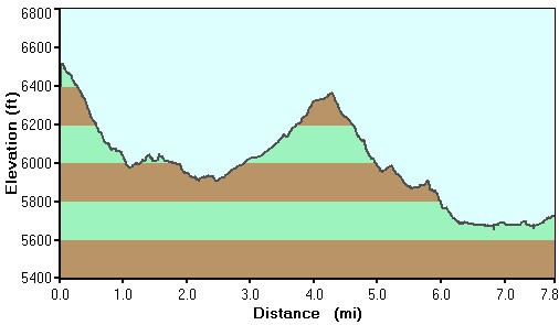
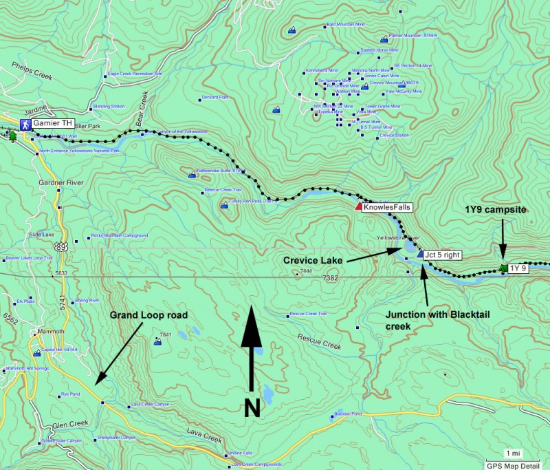
Major milestones (hint - at all trail junction signs except the ford at Hellroaring creek, follow the signs that point towards Gardiner):
0.8 miles - Junction with trail to Tower, stay left
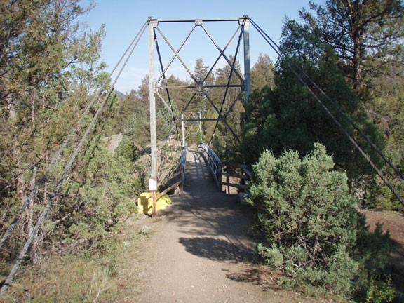
1.0 miles - Bridge over Hellroaring creek
1.6 miles - Junction with Coyote butte trail, stay left.
2.0 miles - ford of Hellroaring creek
8.3 miles - Campsite 1Y9 (only listed since that's where we camped. There are several others)
10.0 miles - Junction with Blacktail creek trail, stay right.
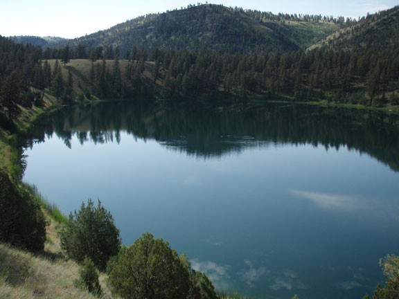
10.1 miles - Crevice Lake
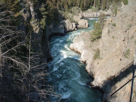
11.9 miles - Knowles falls
16.4 miles - Bear creek
18.5 miles - Gardiner Trailhead
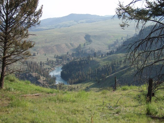
From the Hellroaring trailhead, start the descent down into the Black canyon. The trail is well worn and easy to follow through the pine forest. You'll get some early views of the Yellowstone river and Hellroaring creek in this section. At the first signed trail junction (Jct 1 on map) you'll stay left. Soon afterwards, you'll cross an impressive suspension bridge across Hellroaring creek. At the second signed trail junction (Jct 2 on map) you'll again stay left.
After about 2 miles of hiking, you will have reached the bottom of the Black Canyon. There is a water tank here and a sign pointing towards the stock crossing for Hellroaring creek to the right (Jct 4 on map). You have a decision to make here. If you go right, it is an easy crossing along the stock bridge, however it is 1.5 miles out of your way. A better option is to go left here and after about 0.1 miles, ford Hellroaring creek. When we did this in early August, it was an easy ford. However, you need to use good judgment to decide if the creek is safe to ford.
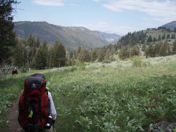
From Hellroaring creek, the trail climbs onto a bench above the Yellowstone river and you will enjoy walking through a lush, green forest. This section will rejoin the river a few miles before campsite 1Y9. I've shown this campsite only because that is where we reserved to stay the night.
After enjoying a peaceful night sleep, continue along the trail. The Yellowstone river is never far from the trail in this section, which makes it particularly enjoyable. You'll soon reach the trail junction with Blacktail creek (Jct 5 on Map). Stay right here and enjoy the views of lovely Crevice lake.
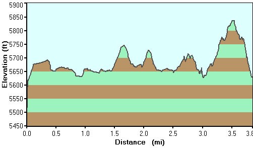
The trail climbs here because of the narrowing of the canyon around Yellowstone river. The reward for the uphill climb is a view of Knowles falls after you head back down to near river level.
As you continue along the trail, you'll climb again through some rocky areas before dropping back down to river level. The scenery will begin to change, with the forest thinning out as you continue to loose altitude approaching Gardiner. In this section, we came face to face with a small black bear cub (luckily, the mother was no where to be seen!). We moved through this area pretty quickly to prevent a dangerous situation.
Eventually, you'll reach the last creek crossing, which is a bridge across Bear Creek. From this point, the trail hugs along a clay hillside. Soon, you'll be back to walking along the Yellowstone river for the final time, as you bisect private property to reach the Gardiner trailhead. Please be respectful of the well signed private property so we can continue to have access to this area.
Luckily, Gardiner is well stocked with suitable restaurants serving good food and cold beer. Feel free to toast your successful hike and relive the new memories of your hike through this wonderful area.
