
- Hikes in Arizona
- White Mountains and Eastern Arizona
- Los Burros Trail #631
Los Burros Trail #631


Location
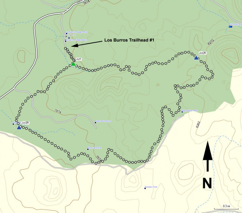
To the Trailhead: From the Show Low area, take highway 260 through Pinetop-Lakeside and continuing on to McNary. Once in the small town of McNary, turn left at the small (easy to miss) sign for Vernon. In the town of McNary this is signed as North Cody Ave. This road is also referred to on maps as FR224, AP3140, Vernon-McNary Rd., and Vernon Rd. This paved road quickly turns into a well graded dirt road. After 7.2 miles from McNary, turn right towards the signed Los Burros campground. About 1/4 of a mile on this road will get you to the campground. The signed trailhead is towards the back of the campground.
Hike details
Season
- June
- July
- August
- January
- February
- December
Solitude
Difficulty
Permits
Hike the Los Burros trail in the White Mountains of Arizona.
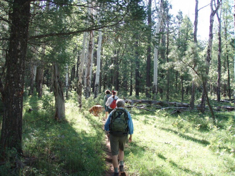
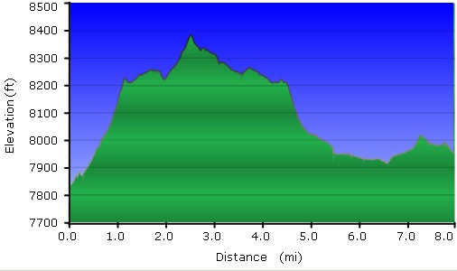
The Los Burros trail is a series of loops through a pondorosa and aspen forest. It's really pretty here and well worth the hike. There are several options to hike as well, depending on how much of a hike you are interested in. We had a dog with us and it was her first time hiking, so we chose the shorter (8 mile loop). This write up will reflect this.
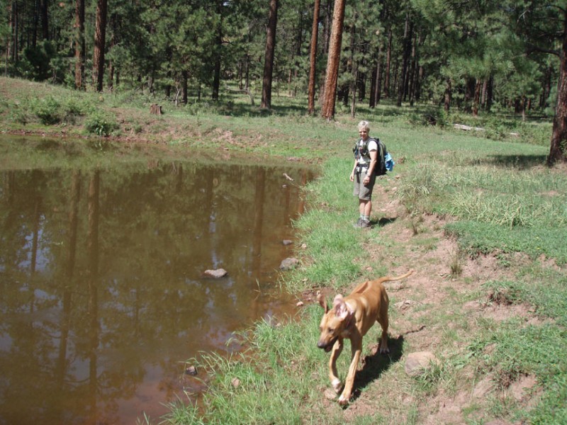
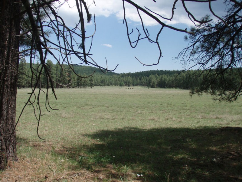
From the signed trailhead, start following the clear trail into the forest. After about 1/4 of a mile of hiking, you'll reach a signed four way junction. If you turn left, you have the option of a big (13 mile) loop or a near big (10 mile) loop. We chose the smaller (8 mile ) loop so we went straight ahead at this junction (JCT 1 on the map). The trail narrows and climbs pretty steadily into the forest. After about 1.8 miles of hiking from the junction, you'll reach another signed junction (Jct 2R on the map). Turn right here. If you're ever unsure if you're on the right trail, check for the blue diamonds on the trees next to the trail. Continue along this trail as you pass a water tank on your left. There's a few wide open meadows along this stretch of the trail as well. When we were hiking, a big meadow was populated by a dozen happy cows munching the grass. Continuing on the trail, you'll reach a second tank and nearby is a trail junction (Jct 3R on the map). Turning left puts you on the Chipmunk Springs connector trail to the Country Club trail. We'll stay right here and head back to the four way trail junction (Jct 1). Turn left at this signed junction to make it back to the trailhead and your parked car.
