
- Hikes in Arizona
- Phoenix Area and Central Arizona
- Shadow Mountain (Circumference Trail and Summit Trail)
Shadow Mountain (Circumference Trail and Summit Trail)


Location
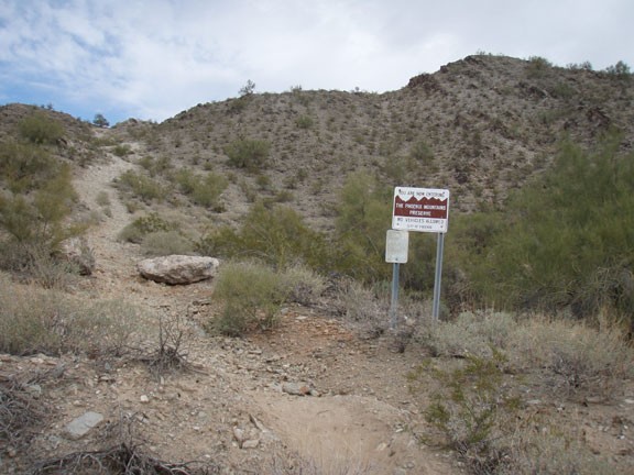
In the Phoenix area, take state HWY-51 North to the Greenway Road exit. Turn left after taking the exit and head West. Where Greenway Parkway splits from Greenway Road, turn left onto Greenway road. Then make a quick left turn onto 27th Street. Take this street until you reach East Acoma drive and make a right. The trailhead signed for Phoenix Mountains Preserve is on the left within a neighborhood. Please be respectful to the homeowners here so we can continue to enjoy access to this area from this trailhead. There is a water fountain about 100 yards up the trail.
Hike details
Season
- January
- February
- March
- April
- November
- December
- July
- August
Solitude
Difficulty
Permits
Hiking up Shadow Mountain in Phoenix, Arizona.
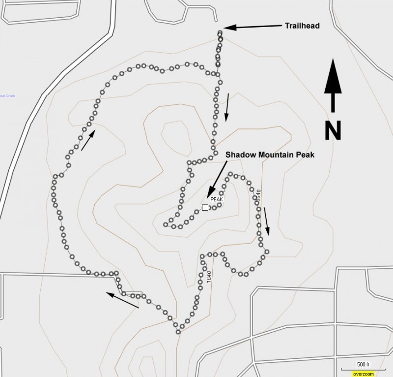
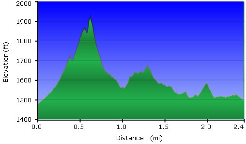
Shadow Mountain is part of the Phoenix Mountains Preserve. This area in particular has trails, both official and unofficial, crisscrossing the area. The nice thing about this is that your options can be as creative as you like. Short hike or longer hike, you can pick whichever you prefer. On this day, we wanted to climb to the top of the highest point of Shadow Mountain. But this didn't take very long, so we decided to follow this up with a hike around the circumference of the area.
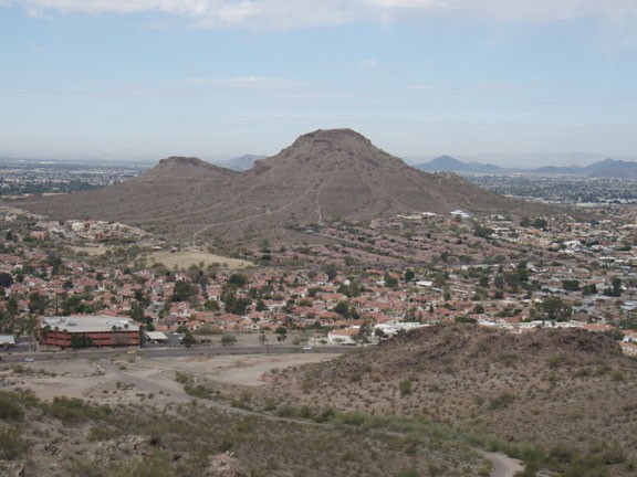
From the small residential parking area, follow the clear trail towards Shadow Mountain. After about 100 yards, you'll reach a water fountain and a small water trough. There are many trails that start to criss cross the area, so there will be a good bit of route finding here. We headed generally towards the knobby mountain peak in front of us. The clearer trail headed right, so we followed it. As spur trails forked off towards the top of the peak, we would follow those until we reached (by some scrambling at times) the peak of Shadow Mountain. There are good views here of Lookout mountain nearby to the West and Piestewa peak to the South. We still had plenty of energy, so we followed other spur trails downwards (steeply at times) until we reached the clear trail that circles the Shadow Mountain area. Sometimes the trail is very strong and sometimes it is more faint, but there was always a trail to follow. We circled back to the parking area after about an hour of hiking.
Enjoy!
