
- Hikes in Arizona
- Sedona
- Secret Canyon
Secret Canyon


Location
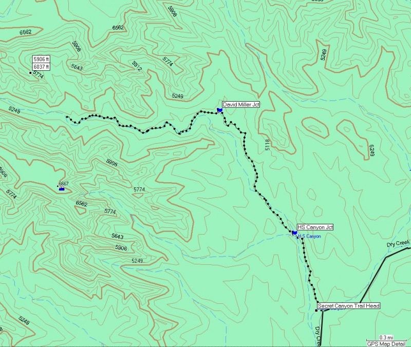
From the Sedona area, take HWY 89 about 3 miles after the junction of HWY 179 and HWY 89 in Sedona. Turn right on Dry Creek Road and go 2 miles to the dirt road of Dry Creek Road (FR152). Follow the signs here that point to Vultee Arch. After about 3.4 miles on a sometimes rough road, park at the signed trailhead for the Secret Canyon trail.
Hike details
Season
- April
- May
- October
- November
Solitude
Difficulty
Permits
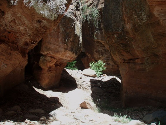
Hike in Secret Canyon near Sedona, Arizona.
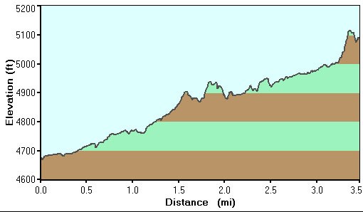
From the cozy parking area, you pick up the trail for Secret Canyon by crossing Dry Creek. Once across dry creek, the trail is easy to follow as it winds through a manzanita and juniper forest. After about 0.5 miles, you will reach the junction for the HS Canyon trail to your left. Stay right here to stay on the Secret Canyon trail. After this section, some elevation is gained and nice views of the surrounding red rock appear. After about 2 miles, you reach the junction for the David Miller trail to the right. Turn left and head into Secret Canyon
Secret Canyon soon earns its name by morphing into a pine and oak forest canyon. The walls of the canyon close in and some very pretty narrows arrive to entertain you. When we did this hike in June, there was no water in the canyon, so we left the trail at some point to hike through the narrows of the canyon. We picked up the trail again as it crossed the creek.
We hiked a total of about 3.5 miles before we found a nice place on a log to eat lunch and enjoy the peacefulness of the canyon. Unfortunately one drawback of this hike is it seems to be a popular attraction for the Sedona helicopter tours. There is supposed to be some poison ivy in this canyon, so be cautious around 'leaves of three' plants in shady areas.
The trail is easy to follow throughout its length and the two trail junctions are well signed. This is a good introductory hike for the Sedona area. When you're ready, return the way you came.
