
- Hikes in Arizona
- Phoenix Area and Central Arizona
- San Tan Regional Park - Out and Back to the Graves
San Tan Regional Park - Out and Back to the Graves

Location
From the Phoenix area, take US-60 East to the Ellsworth Road Exit. Go South on Ellsworth Road, which eventually turns into the Hunt Highway going East. Take the Hunt Highway, turning right onto Thompson Road. From Thompson Road, turn right on Phillips Road and park in the designated parking area. The turn-offs to Thompson Road and Phillips Road are both signed for the San Tan Mountain Regional Park.
Hike details
Season
- January
- February
- March
- April
- May
- September
- October
- November
- December
Solitude
Difficulty
Permits
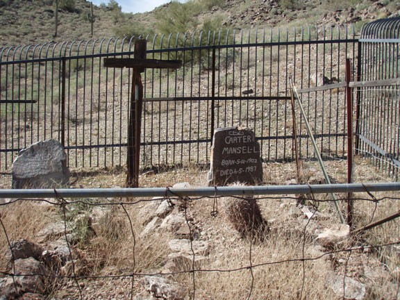
Hike to the graves in San Tan Regional park, Arizona.
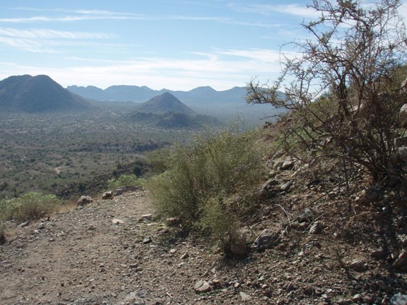
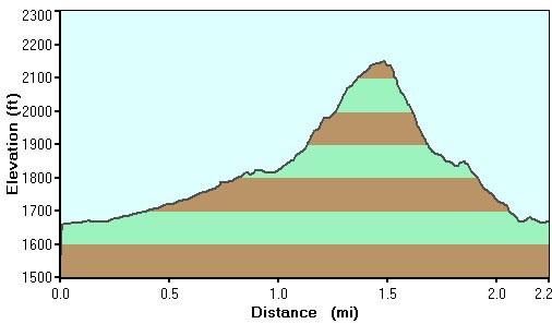
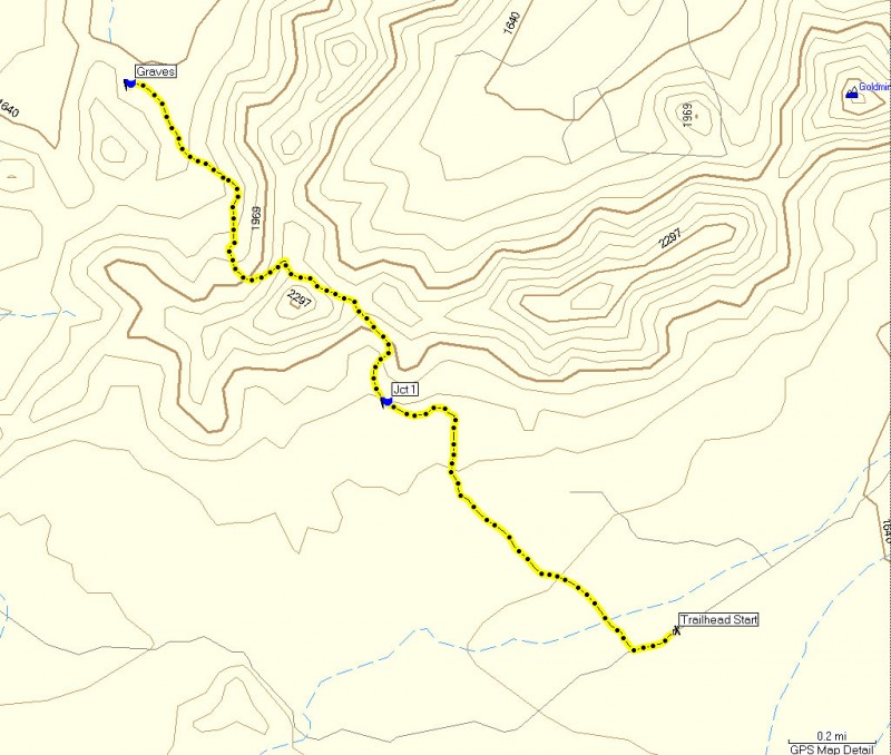
If elevation hiking gives you joy, there is a new trail added to the San Tan regional park just for you. The trail starts at the same location of all the other trails. From the visitor center, take the signed Goldmine trail. After about 1.1 miles, the Goldmine trail ends and you reach a junction with the San Tan trail. Turn right here and start the climb up the Goldmine mountain range. This section of the trail is easy to follow, but it is steep and the rock is a bit loose. After some 500 ft of climbing, you'll reach a saddle with great views (Queen Creek on one side and the regional park on the other). Continue to follow the trail back down the other side of the mountain. Before you reach civilization again and as the trail flattens out completely, you'll see black fencing to your left protecting the graves of two prospectors.
Return the way you came.
Link to San Tan Regional Park website: http://www.maricopa.gov/parks/santan/
