
- Hikes in Arizona
- White Mountains and Eastern Arizona
- Land of the Pioneers #629
Land of the Pioneers #629


Location
To the Trailhead: From the Show Low area, head East on US-60 towards Springerville. From the junction with HWY-77 and US-60 (stay on US-60) drive 18.6 miles past mile marker 361. Turn right at the signed Vernon Rd (also FR224). This paved road eventually turns into a well graded dirt road. After 5.1 miles, turn right (West) at the sign marking trail #629 (Also FR5). The signed trailhead and parking area is 0.6 miles along this road.
Hike details
Season
- June
- July
- August
- January
- February
- December
Solitude
Difficulty
Permits
Hike the Land of the Pioneers trail in Eastern Arizona.
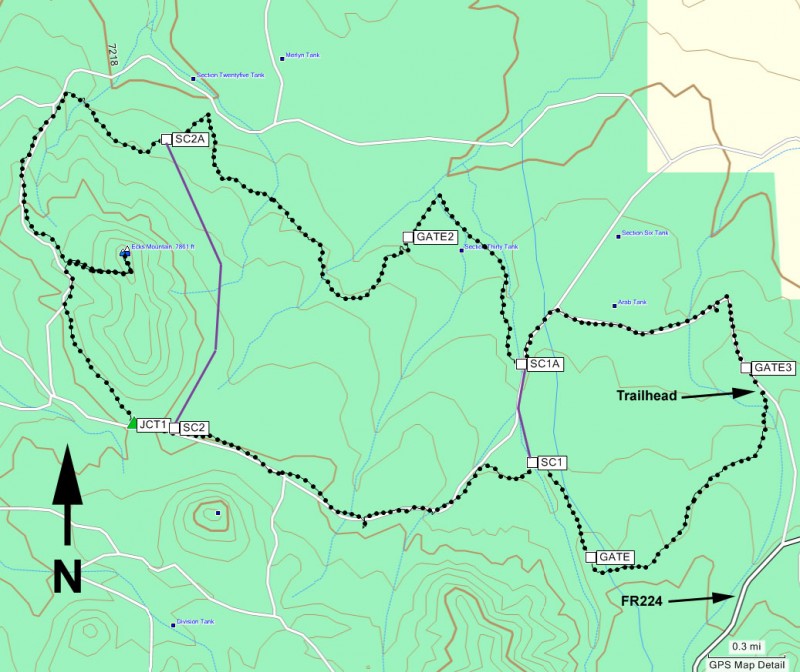
Loop hike are great. It's a nice treat to not have to travel over the same terrain twice. The Land of the Pioneers trail #629 is an excellent example of a long, enjoyable loop trail. We decided to take this hike in a clockwise direction, so the write up will reflect this.
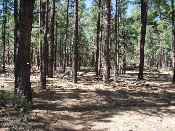
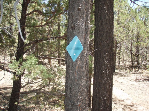
From the signed trailhead, look across the road to the signed trail marker leading to a well defined trail to the South. The Southern half of this loop hike is pretty consistent, traveling through a flat ponderosa pine forest that alternates between single track trails and old logging roads. This trail requires constant vigilance to look for the blue diamonds marking the trail. It is very easy to loose the trail if you zone out.
After going through the gate (please close all gates behind you) you will soon reach the first of two possible short cuts. If you're interested in a significantly shorter loop, turn right at the signed junction (SC1 on the map) for a 3.5 mile loop. For the full loop trail, stay left.
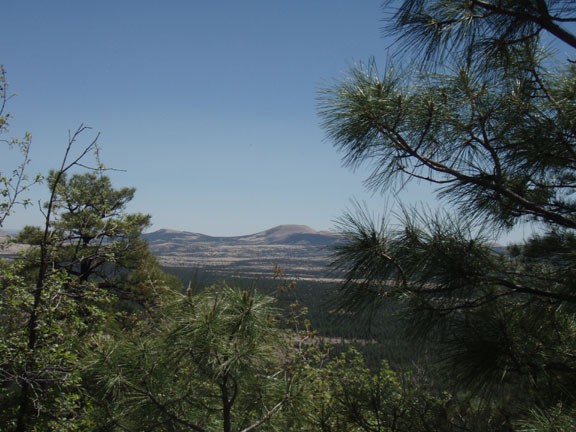
The trail heads generally West until reaching the signed junction for the second shortcut (about 3.1 miles of total hiking). Turning right here will create a 8.5 mile loop hike. Stay left to continue on the main loop. This junction is particularly confusing, as there are blue diamonds in both directions. You want to go straight as stated above. Another 0.2 miles on this wide old dirt road will get you to the right turn (North) towards Ecks Mountain. The trail starts to climb here. Keep following the blue diamonds marking the trail until you reach the signed junction to the Ecks Mountain lookout. Take this short (0.4 miles) spur trail to the peak of Ecks Mountain. The views from the top are somewhat shaded by the pine trees, but the surrounding area peaks through the trees. This is a nice place to have lunch and congratulate yourself on reaching the halfway point.
Backtrack along the spur trail until you are back on the main trail. This section of the trail is more of an open forest, following an old logging road. There is less shade on this section, with more meadows and open views of the surrounding area. Continue past the two short cuts (stay left at both junctions) as you pass through the meadows and even some water tanks.
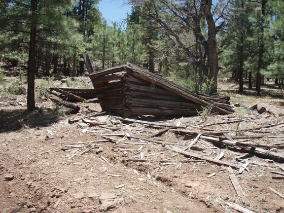
Towards the end of the hike, you'll pass a ruined homestead. It's a good opportunity to ponder the rough life these folks endured to chase their dreams of owning their own land. Continue on the trail to finish the loop (through one final gate) and back to your car.
