
- Hikes in Arizona
- Northern Arizona
- Secret Mountain
Secret Mountain


Location
To get to the trailhead:
from the Flagstaff area: take HWY-66 West out of town, turning South (left) onto Woody Mt Road (FR231). This road starts off as paved. Soon after it passes over I-40, the road turns into good graded dirt. Follow this road 14 miles to FR583. Make a right turn onto FR583 and take it 5.7 miles to the intersection with FR538E. At this point, the road turns a bit nasty... high clearance vehicles recommended. Turn left to stay on FR538 and go 3.8 miles. You will pass intersections with FR538D, 538A, 538H, and finally reaching the intersection with 538B. Turn left here to stay on FR538 and go 1.6 miles. You'll reach the intersection with 538K. Stay left to stay on FR538. Travel the final 1.2 miles to the well signed parking area for the Secret Mountain trail.
From the Sedona area:
High Clearance vehicles recommended for this route in. From Sedona, take HWY-89A up Oak Creek Canyon towards Flagstaff. Soon after you pass the Oak Creek Overlook, turn left onto signed FR535 (this road junction is 9.8 miles past the popular Slide Rock recreation area). Zero your odometer here and follow the instructions below:
2.6 miles Junction with FR9018H, stay left to stay on FR535
3.3 miles Stay Right at unmarked junction
4.9 miles Junction with FR535A, stay right to stay on FR535
5.5 miles Junction with FR536, turn left here to get on FR536.
6.5 miles Stay Right to stay on FR536. This road becomes FR 236A
7.0 miles Stay left at the unmarked junction
7.8 miles Stay right at the unmarked junction
9.1 miles Turn left onto the gravel FR231.
11.0 miles Turn right to stay on FR231
13.4 miles You'll cross a single lane bridge
15.5 miles At this signed junction, turn left to stay on FR231.
16.1 miles Junction with FR539, turn right here to get on FR539
17.4 miles Turn right at the unmarked junction. Say hi to the cows!
18.7 miles Turn right at the unmarked junction.
19.7 miles Left at the Y intersection, FR538 (also listed as Jerome Road).
20.1 miles Intersection with FR538B. Turn left to stay on FR538
21.7 miles Intersection with 538K. Turn left to stay on FR538
22.9 miles Parking area for the Secret Mountain trail.
Hike details
Season
- June
- July
- August
Solitude
Difficulty
Permits
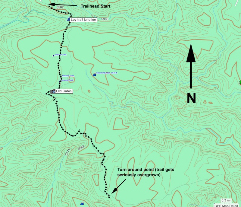
Hike the Secret Mountain trail in Northern Arizona.
One of the main attractions of this hike is the remoteness. The drive to the trailhead illustrates this, as it is over 20 miles from a paved road to get to this trailhead. Driving this forested area is pleasant in itself, but make sure you have a high clearance vehicle.
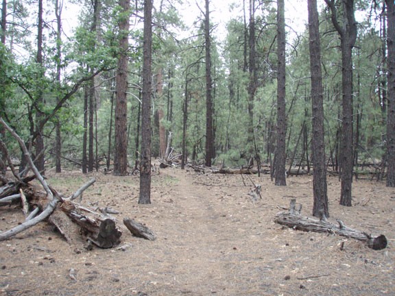
From the well signed trailhead, follow the sign to the Secret Mountain trail. This trail walks primarily through a mature pine forest along the ridgeline that makes up some of the more famous Sedona canyons. The first canyon you see is Loy canyon. About 0.25 miles from the start is the junction with a trail that traverses the length of this canyon. Stay left here to stay on the Secret Mountain trail.
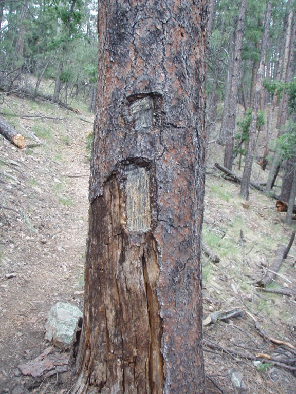
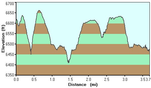
There are several ups and downs to this hike, which helps keep the heart rate up. In addition, the thick pine tree forest provides good shade and a pleasant feel. About 1.8 miles from the start are the remains of an old cabin and corral. This area has had a varied past. According to Mangum's Flagstaff Hikes, since 1870 this cabin has housed failed homesteaders, polygamists fleeing the law, and horse rustlers.
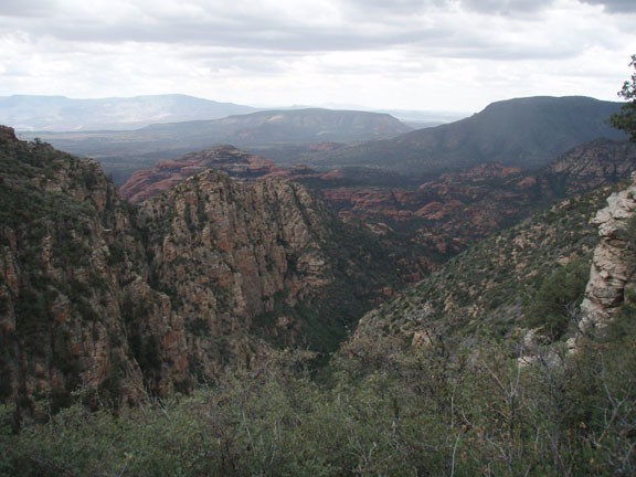
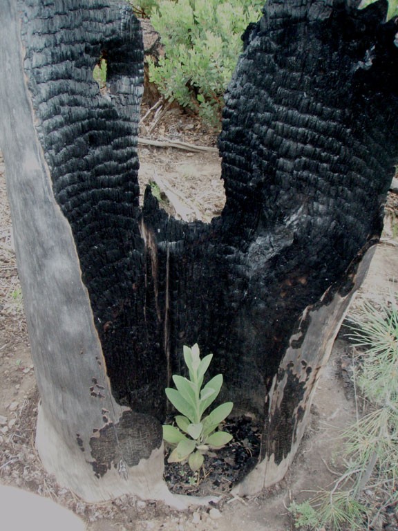
Continuing along the trail opens up viewpoints of Bear Mountain and eventually Boynton canyon. After about 3.7 miles of hiking, you'll enter a recent burn area that is recovering. The towering Pine trees have mostly disappeared, opening views to an impressive valley. Unfortunately, the trail has become seriously overgrown with Manzanita. The trail used to continue to the East edge of the ridge with views of Secret Canyon and Long Canyon, however to continue on the tail would be a seriously unpleasant bushwhack. Until some significant trailwork is done here, this makes a good turnaround point.
