
- Hikes in Arizona
- Grand Canyon / Marble Canyon
- Saddle Canyon
Saddle Canyon


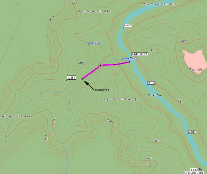

Location
Hike details
Season
- April
- May
- September
- October
- January
- February
- December
Solitude
Difficulty
Permits
Hike in Saddle canyon in Grand Canyon national park, Arizona.
From either the upper or lower campsites at Saddle canyon, look West towards the canyon. On the left slope, you will see a trail that switchbacks up the left side of Saddle Canyon. This section marks most of the elevation gain of the hike. After about 400 ft of climbing, the trail flattens out and drops into Saddle Canyon.
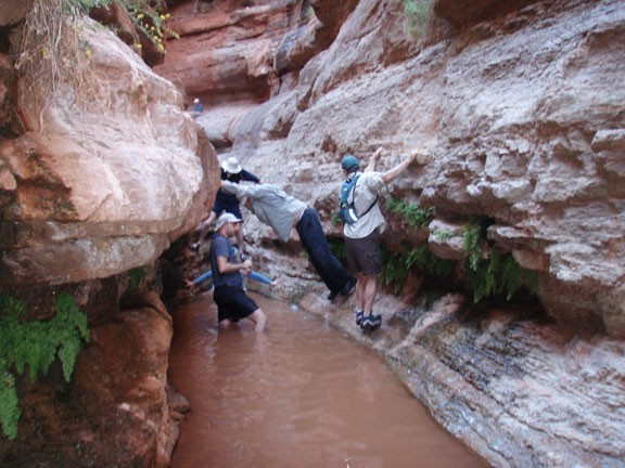
Soon the walls begin to narrow, and water appears, allowing for ferns and Ash trees to flourish. Continuing up the narrow slot, water wading will eventually become unavoidable. There is a tricky bouldering move to get around the first fall and you may need help from your friends to complete it safely. The extra effort is rewarded, as you are treated to a lovely waterfall and the turnaround point for the hike.
