- Hikes in Arizona
- Tucson Area and Southern Arizona
- Wasson Peak
Wasson Peak
Location
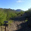
To get to the Trailhead: From the Tucson area, take I-10 South to the Speedway exit. Take Speedway west into Saguaro National Park. This road is narrow and steep in places, so oversized vehicles are not recommended. Follow the signs to Saguaro National Park and the Arizona Sonora Desert Museum by making a right turn onto Kinney Road. After about 2 miles, you will reach the turn off for the Arizona Sonora Desert Museum. Drive past the turn off and park at the first dirt parking area on your right. The parking area for the trailhead isn't signed, although if you walk a bit up the trail, you can see the sign.
Hike details
Season
- March
- April
- September
- October
- June
- July
- August
Solitude
Difficulty
Permits
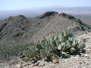
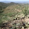
Hike up Wasson Peak near Tuscon, Arizona.
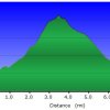
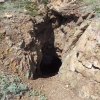
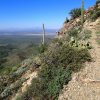
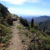
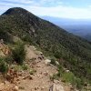
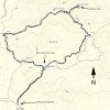
The hike starts on the King Canyon Trail. The trail starts as an old jeep road as it slowly climbs 0.9 miles to the Mam-a-gah picnic area (JCT_1R on the map). As you can imagine, since this is part of Saguaro National Park, the Saguaros are everywhere. From here, turn right at the fork and continue on the King Canyon trail as it climbs 1.4 miles up a ridge. At this point, the King Canyon trail intersects the Sweetwater trail (JCT_2L on the map). Take the fork left and follow the well signed trail towards Wasson Peak. The trail switchbacks up 0.9 miles with a hint of the views to come. Several abandoned mine shafts make this climb interesting as the switchbacks end at the junction of a spur trail to the peak. Making a right turn on this trail junction (JCT_3 on the map) and walking an additional 0.3 miles leads you to the top of Wasson Peak, rewarding you with views of Tucson, Kitt Peak, the Santa Catalina mountains, and the other views surrounding the Tucson area.
When you are ready to return, backtrack the 0.3 miles to the Hugh Norris trail. Instead of returning the way you started, make a right here and descend down the opposite ridge. The views and the wildflowers make this smooth downward hike a joy as you walk 1.9 miles to the intersection of the Esperanza trail (JCT_4L on the map). Turn left onto the Esperanza trail and make your way 1.4 miles back to the Mam-a-gah picnic area. When you reach the Gould Mine (JCT_5L on the map) you'll want to stay left to stay on the trail to the Mam-a-gah picnic area. Once you reach the picnic area, the starting trailhead is 0.9 miles away from this point.
If you have the time, the Arizona Sonora Desert Museum is highly recommended. The museum features animals of the Sonora desert, as well as information about the geography, geology, history, flora, and fauna of this region.

