
- Hikes in Arizona
- Superstition and Mazatzal Wilderness
- Salt River Canyon overlook - peak 3042
Salt River Canyon overlook - peak 3042

Location
From the Phoenix area, take HWY 88 North East out of Apache Junction towards Apache Lake. After you hit Tortilla Flats, go another 4.2 miles on this paved road and turn left on well graded dirt road FR80. Take FR80 about 1.6 miles until you see a much rougher dirt road on your left. If you have 4-wheel drive, you can drive down and park. Otherwise, park along side the road.
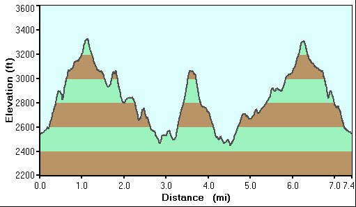
Hike details
Season
- January
- February
- March
- October
- November
- December
Solitude
Difficulty
Permits
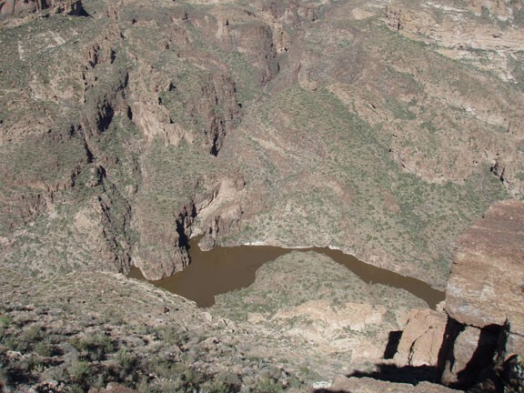
Hike to an overlook of the Salt River canyon, Arizona.
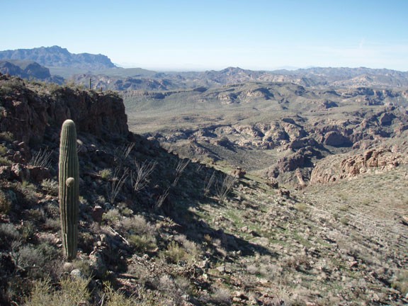
If you've already done Fremont Saddle, Siphon Draw, First Water, and all the other standard Superstition hikes, here's one to satisfy your thirst for the new and challenging. It will be remote, you will have this hike all to yourself, and your hard work will be rewarded with great views of the surrounding area.
The bad news is you need to do a fair bit of bushwhacking on this hike. Wear long pants and sturdy boots. Most importantly, there is a great deal of route finding on this hike, as there is no real trail. It is best to have a GPS and follow the map.
After parking along FR80 (or dropping onto the 4WD road) start walking along the well defined, but rough road. Enjoy it while you can, because this will be the nicest trail of the day. Too bad it doesn't last very long. At the point on the map where it is marked "Leave Road" turn right and follow the tracks up. The cross country adventure starts! This section is tricky, as there is a notch you need to scramble up (labeled on the map as "Notch"). This is the toughest scramble on the trip, so it's nice to get it over with early.
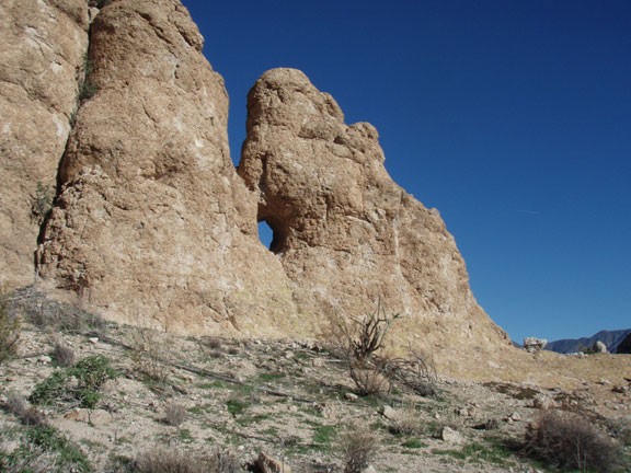
Follow the map and head around the back side of the bluff (called Black Cross Butte). When you start to climb again, keep an eye out for Cairns. They will guide you up and over Black Cross Butte for a while. There are some great views at the top that give you a nice taste of the views to come. Enjoy the Cairns while they last, as they will disappear too soon.
After the descent of Black Cross Butte, you will be walking in a valley that is easy to get lost in. From the map it looks relatively flat, but when you're in it, it is easy to pick a poor route and have to back track to a better one. You'll note on the map that there are two possible routes. Either one works. The more Northern route is more direct, but has more elevation change and scrambling. The more Southern route is less direct, has more bushwhacking, but has less elevation change. We took the Northern route to the view and returned on the Southern route. Since this is a cross country hike, there is really no wrong way.
If you've been good at your route finding, you'll scale the final uphill section to arrive at Peak 3042. Your reward is in every direction, with great views of the Salt River Canyon, the Four Peaks, and a distant Weavers Needle. Snap some pictures and head back the way you came.
