
- Hikes in Arizona
- Superstition and Mazatzal Wilderness
- LaBarge Canyon
LaBarge Canyon


Location
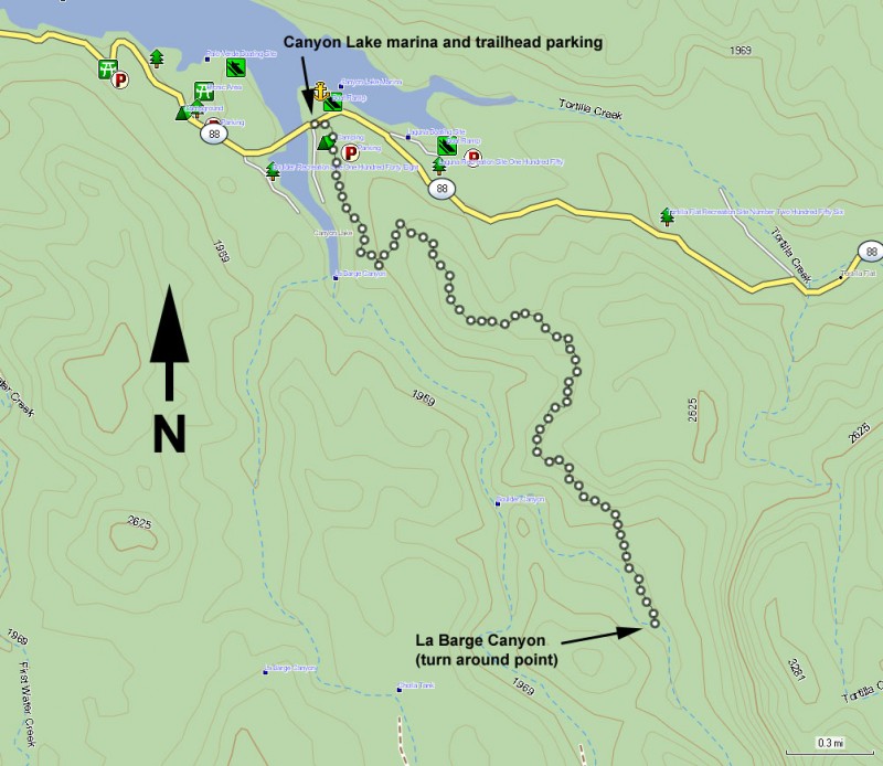
To get to the trailhead: from the Phoenix area, take US-60 East. Take the Idaho Road exit and go North. From Idaho Road, turn onto HWY88 towards Canyon Lake. At Canyon Lake, cross two single lane bridges. After crossing the second of the two bridges, park on the left. The trailhead parking is signed immediately on your right as you enter the marina area.
Hike details
Season
- January
- February
- March
- April
- October
- November
- December
Solitude
Difficulty
Permits
Hike the LaBarge canyon trail near Phoenix, Arizona.
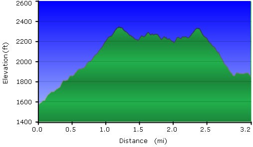
Boulder Canyon Trail #103 from Canyon lake is a popular desert trail for novice hikers. The trail starts on the South side of HWY-88 and is clearly signed as Boulder Canyon Trail #103. The trail climbs through typical Superstition desert steadily onto a ridge, providing excellent views of Canyon Lake and La Barge Canyon as you climb. Once at the top of this ridge, you are treated to 360 views of the Four Peaks, Weavers Needle, and Canyon Lake. If you are looking for a light hiking day, this can be a turn around point.
The trail continues a gradual descent reaching La Barge Creek after 3.2 miles of total hiking. If you still have some energy, exploring off-trail upstream of this point about 0.7 miles gets you to a scenic narrow canyon section of La Barge Canyon. There will be some boulder hopping and scrambing if you choose this option. Otherwise, La Barge Canyon is a good place for lunch and to turn around and head back to the parking area.
