
- Hikes in Arizona
- Superstition and Mazatzal Wilderness
- Flat Iron (Siphon Draw)
Flat Iron (Siphon Draw)

Location
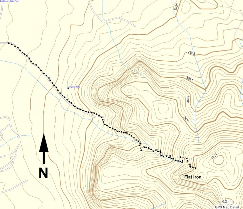
From the Phoenix area, take US-60 East and turn North onto HWY-88 (the Idaho Road Exit). From Apache Junction, drive about five miles to the Lost Dutchman State Park (on your right) and follow the signs to the Siphon Draw trailhead. You'll have to pay a few bucks to enter the Lost Dutchman State Park.
Hike details
Season
- January
- February
- March
- April
- October
- November
- December
Solitude
Difficulty
Leave the young kids and out of shape at home.
Permits
Hike to the top of the Flat Iron via the Siphon Draw trail in Superstition State Park, Arizona.
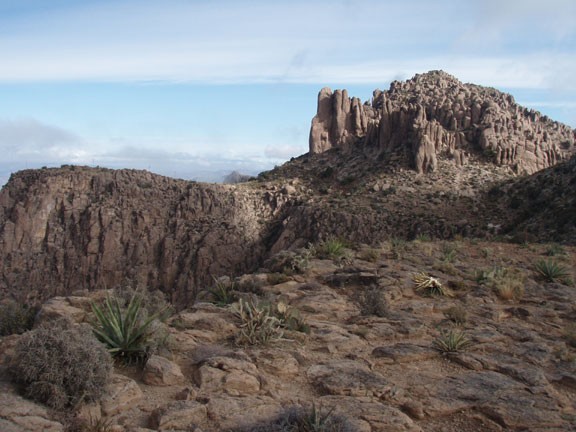
Although most hiking books will call this hike Siphon Draw, most locals know this hike as Flat Iron. The name comes from the ultimate destination of this hike, which resembles an upside down iron.
There's two great things about this hike:
- It's so darned close to the Phoenix area.
- Once you get there, you can quickly escape the city and hike through some pristine desert to really great views.
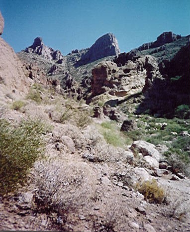
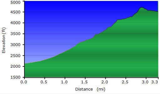
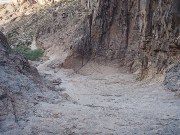
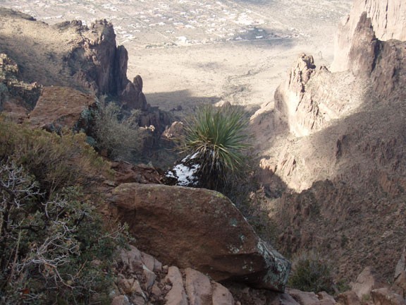
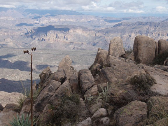
The hike is a constant up, which makes it challenging. The trail is well defined for the first mile. About half way up, you reach a smooth rock face where a waterfall runs after seasonal rains. After this point, the trail starts to fade into a series of white paint dots and steep climbing. Your best bet is to stick in the wash that the white paint dots mark. Usually short cuts turn out to be dead ends. Once at the top, you can look out onto the vastness of the East Valley, or turn around and contemplate the vast Superstition Mountains.
This hike is particularly interesting just after a rain. The colors of the desert show themselves for a few wonderful days.
If you still have some energy, you can continue going up to the top of North Peak from here. The highest point nearby you can see is North Peak. There is a scramble route up to the top of this peak, along with some fairly old graffiti (from 1922!). The real reason to climb the peak is awesome 360 views of the area. To get to North Peak, take the well defined trail towards the peak and keep your eye out for a faint trail that meanders up the top of the peak. Some scrambling and route finding is required here. Cairns are present, but sporadic. If you decide to take this option, count on adding another 1.5 hours and 250 ft of elevation to your hike.
Whether you climbed to the top of North Peak or to the top of the Flat Iron, return the way you came to finish the hike.
