
- Hikes in Arizona
- Phoenix Area and Central Arizona
- Salome Creek (the Jug)
Salome Creek (the Jug)


Location
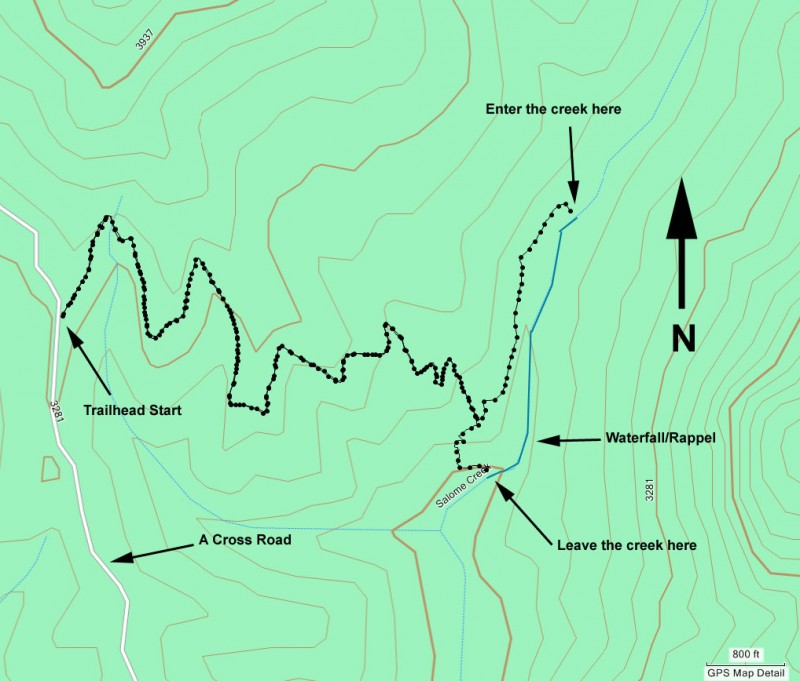
To get to the Trailhead: From the Phoenix area, take US-87 North East towards Payson. From US-87, take HWY-188 South East to Punkin Center. About 8 miles past Punkin Center, turn left on FR60 (A Cross Road). Follow A Cross Road 10 miles to the A Cross Trailhead.
ALTERNATE ROUTE:
From the Phoenix area, take US-60 east to Globe, AZ. In Globe, take HWY-188 North for 14.7 miles to HWY-288. Take HWY-288 for 12 miles to the turn-off for A cross road. Turn left here (near mile marker 270) and take A cross road for about 15 miles. The trailhead is on the right.
Hike details
Season
- May
- June
- September
- October
- January
- February
- December
Solitude
Difficulty
Skills
Permits
Canyoneering the Jug of Salome creek in Arizona.
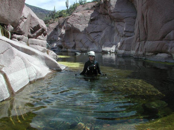
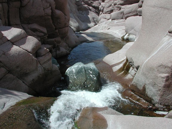
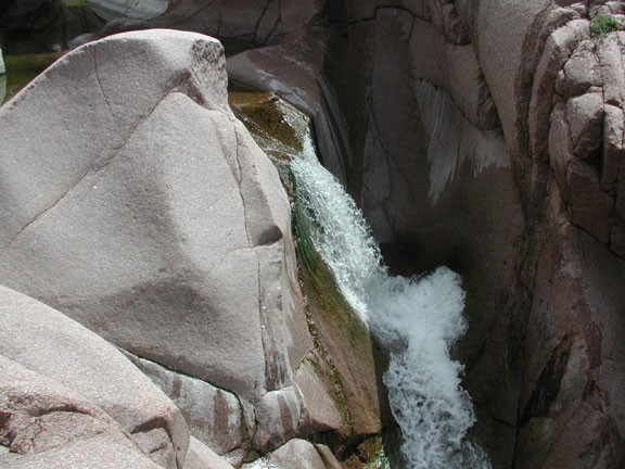
This hike describes a small area of Salome Creek. This area is known as "the Jug" because of its sheer canyon walls and water flowing throughout the canyon. Sometimes the water level can be too high for safe exploration. If there's fast moving whitewater in this canyon, you'll have to try again another day.
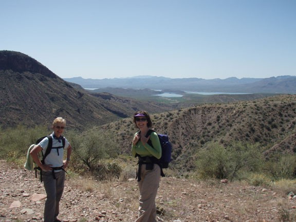
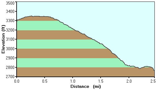
The hike starts on a ridge overlooking Lake Roosevelt. There is an old jeep road that makes its way down to the head of "the Jug". When the trail reaches the creek, it's time for a swim! The only way to make your way downstream is by wading, swimming, and scrambling. You'll swim through cool pools, wade through green reeds, boulder hop across granite boulders, and scramble down rock walls. If this sounds like fun, you're right!
There's a great waterslide about 1/2 the way through the jug. Take your time and really enjoy this special place. The water is usually cold, so dress appropriately. Try to time your hike so that you're in the canyon during the middle of the day for the most warmth. Eventually, you'll reach the climax of this hike... a 20 foot waterfall. There's a bolt here to the right of the falls for rappelling.
After this final rappel, the canyon opens up again. There's a trail on creek right (marked with Cairns) that leads back to the jeep road.
Bring a waterproof camera. The opportunities for amazing photos is outrageous.
Watch out for desert creatures here. On the jeep trail on the way down, I was complaining to one of my fellow hikers about not seeing a Gila Monster since I moved to Arizona (29 years and counting). Not 10 minutes later, we came across one sunning himself in the middle of the trail.
