
- Hikes in Arizona
- Northern Arizona
- Crystal Point
Crystal Point


Location
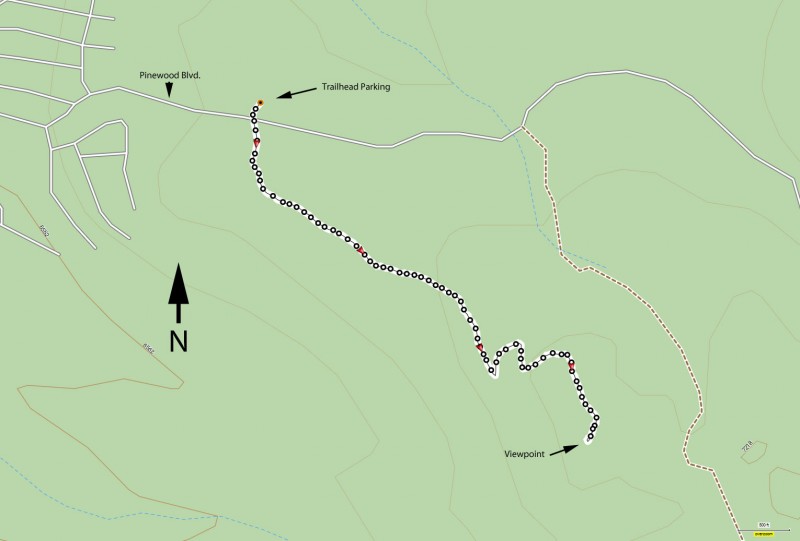
From the Phoenix area, take I-17 North to the Munds Park exit (#322). Take the exit East through the pinewood subdivision. After about 2.2 miles of driving, the pavement ends. Look for a sign on the right showing the distance to Casner park. If you look carefully, you will see the Crystal Point trailhead on the right just past this sign. Don't park here though. Drive another 0.2 miles to the parking area on the left and cross the road to get to another signed trail to the Crystal Point trailhead.
Hike details
Season
- April
- May
- June
- July
- August
- September
- October
Solitude
Difficulty
Permits
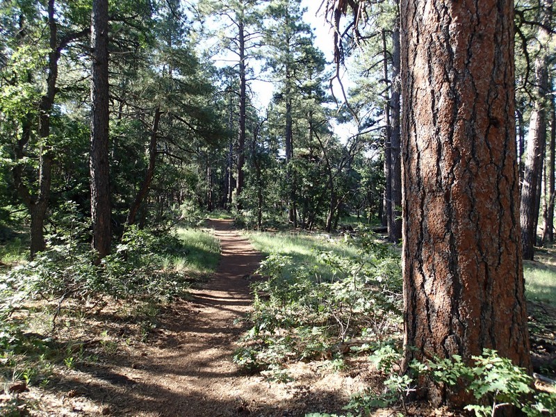
Hike along the Crystal Point trail near Flagstaff, Arizona.
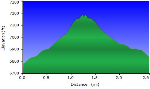
The hike starts from the well signed trailhead for Crystal Point on the other side of the dirt road from the parking area. The trail itself is a bit rocky, but easy to follow. The forest starts out a little sparse, but quickly thickens as you get closer to Crystal Point.
One view opens up about halfway to the point of the far wall of Oak Creek Canyon. You can also see Munds Park from here, but the thickness of the forest blocks some of the views.
After this point, the hike climbs more steeply, but not excessively, towards signed Crystal Point. There is a picnic table here with two ammo cans filled with hiker journals. It's worth resting here to read a few and write your own.
Again, the views at Crystal Point are partially obscured by the forest. Regardless of the big picture view, this hike is still an enjoyable hike through a pleasant forest.
When ready, return the way you came.
