
- Hikes in Arizona
- Northern Arizona
- Kelsey Spring
Kelsey Spring
Location
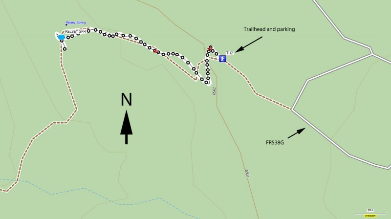
To get to the trailhead: from the Flagstaff area, take HWY-66 West out of town, turning South (left) onto Woody Mt Road (FR231). This road starts off as paved. Soon after it passes over I-40, the road turns into good graded dirt. Follow this road 14 miles to FR538. Make a right turn onto FR538 and take it 5.7 miles to FR538E. At this point, the road turns a bit nasty... high clearance vehicles recommended. Turn right on FR538E and go 0.4 miles to FR538G. Stay right on FR538G for 1.0 miles (VERY NASTY ROAD) and turn left at the sign for Kelsey Spring trail, going the last 0.4 miles to the well signed trailhead.
Hike details
Season
- June
- July
- August
Solitude
Difficulty
Permits
Hike to Kelsey spring near Flagstaff, Arizona.
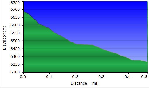
First I need to warn you about the drive. The road is really good until that last 1.40 miles. Drive slow and try not to puncture a tire or scrape the bottom of your automobile. After the long drive from Flagstaff, breathing in the clean air of the Sycamore Canyon wilderness area is welcome. This hike starts at the rim and goes 300 ft into the canyon (but not to the bottom). The turn around point for this hike is Kelsey Spring.
The well marked trailhead starts from the parking area. The well tread trail drops steadily down the side of the Sycamore Creek Canyon to Kelsey spring. The trail is well shaded by the multitude of pine trees in the area.
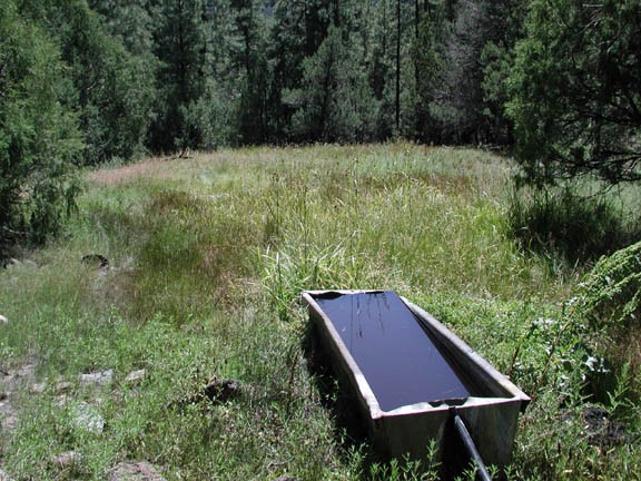
All to quickly, you will have walked 0.5 miles and reach the well signed spring on your right. The perennial spring has been tapped by a black rubber tube into a cement container. The spring and the surrounding area is pretty and worth spending some time.
When you are ready, you can either continue on the same trail 0.7 miles to Babe's Hole and another 0.8 miles to Geronimo Spring. We had already hiked Dorsey Spring, so we turned around at Kelsey spring. Perhaps sometime we will return and complete the hike to Geronimo Spring.
When we did this hike, the bugs were too active for our tastes, so we didn't spend much time exploring this area. Bringing Deet is a good rule of thumb when hiking in this area... just in case of the rare bad bug day.
Enjoy the heart pumping climb back up to the trailhead.
