
- Hikes in Arizona
- Northern Arizona
- Kendrick Mountain (via the Kendrick trail)
Kendrick Mountain (via the Kendrick trail)


Location
To get to the trailhead: from the Phoenix area, take I-17 North toward Flagstaff, AZ. Once in Flagstaff, take HWY #180 towards the Grand Canyon. About 14 miles from Flagstaff, turn left on FR 245, which is very close to mile marker 230. After going 3.1 miles on this flat, graded dirt road, turn right on FR 171 (signed for the Kendrick trail). After driving 3.1 miles on FR 171, turn right onto FR 190. Go another 0.5 miles to the trailhead. This road may be impassable to some cars after heavy rains, so use good judgment. The trailhead has a restroom but no water.
Hike details
Season
- June
- July
- August
Solitude
Difficulty
Permits
Hike up Kendrick trail to the top of Kendrick mountain near Flagstaff, Arizona.
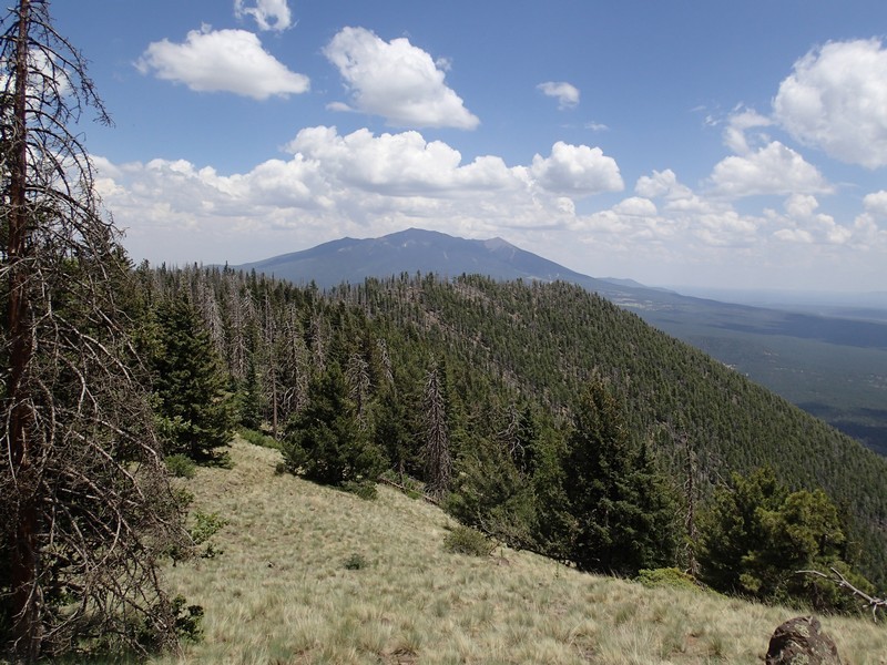
Kendrick mountain lies to the West of the San Francisco peaks and makes for a good all around hike on a summer day.
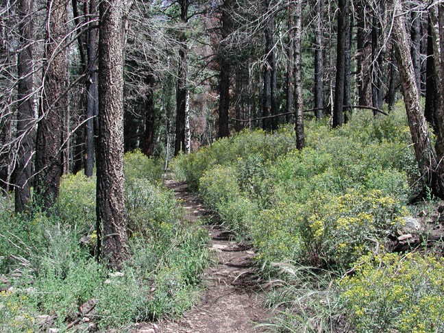
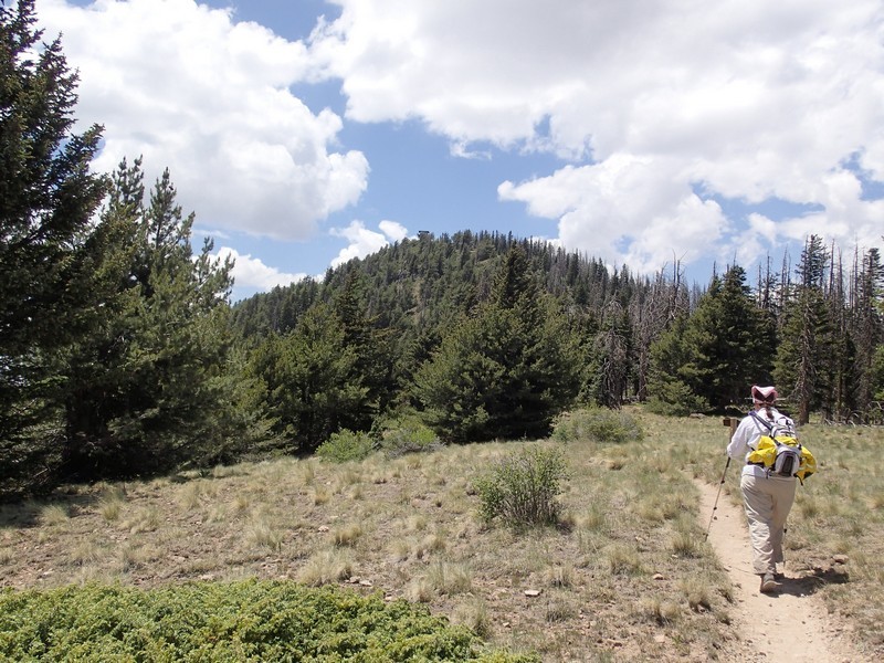
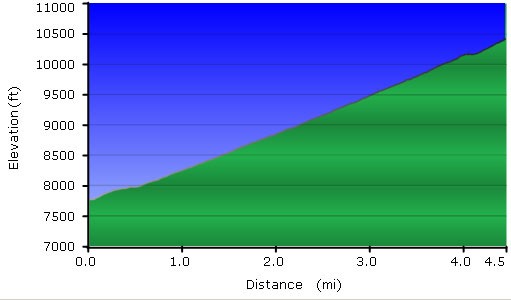
The start of this trail is on a slight incline up through a thinned forest of pine. The effects of the Pumpkin Center fire (started by lightning) are evident here in burned out trees and meadows of wildflowers. The trail itself is well worn and easy to follow throughout.
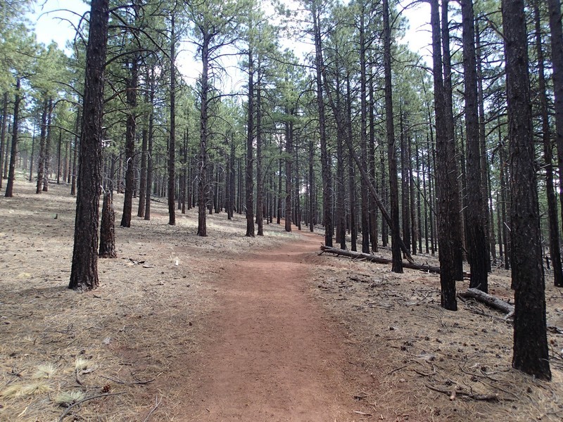
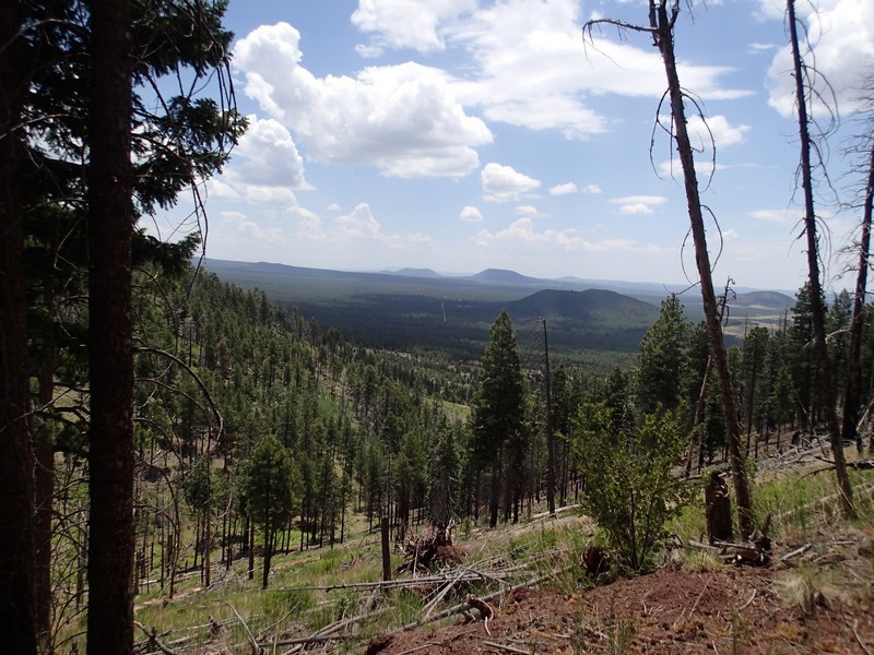
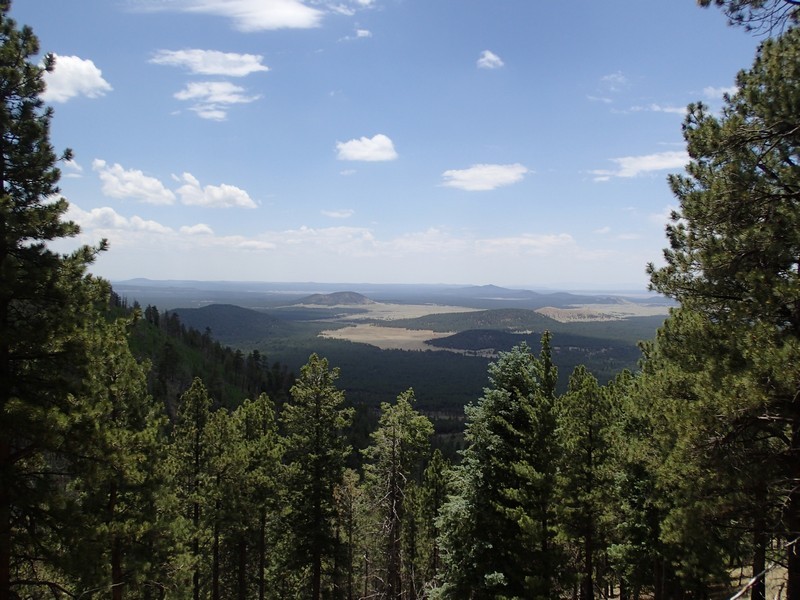
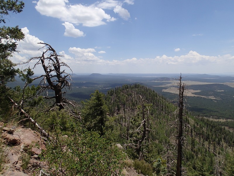
The well marked trail starts to switchback up the mountain, as the pine trees become more dense and the forest starts to include ferns, fir, spruce, and aspen. Be sure to take in the increasingly impressive views as you continue to climb. Just before getting to the top, there is a forest service cabin from the early 1900s, still in pretty good shape. Once at the top, a fire lookout provides the best vantage point for the 360 views of the San Francisco peaks, Oak Creek Canyon, and the Grand Canyon.
Snap a few pictures, enjoy lunch with a view, and head back when you're ready.
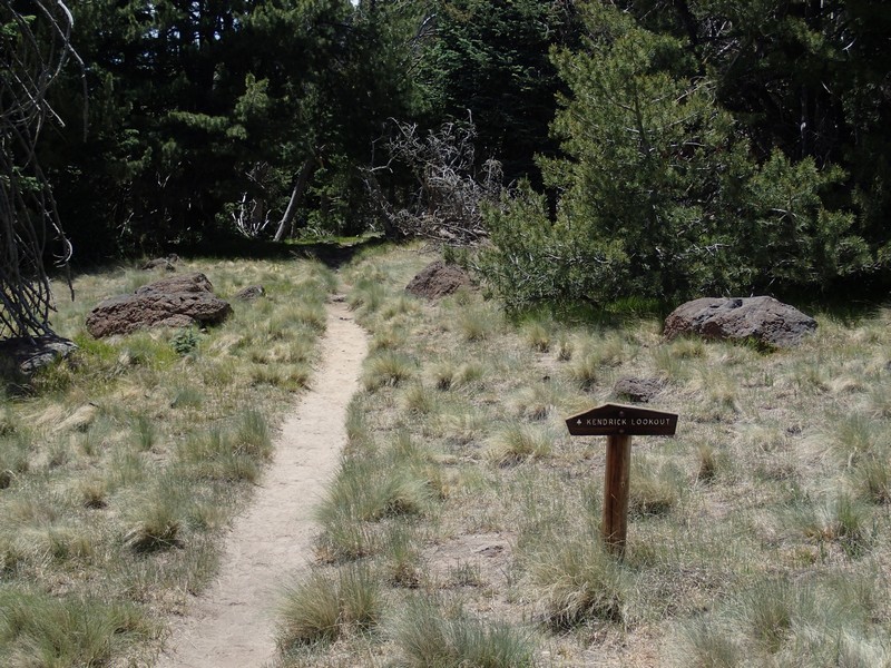
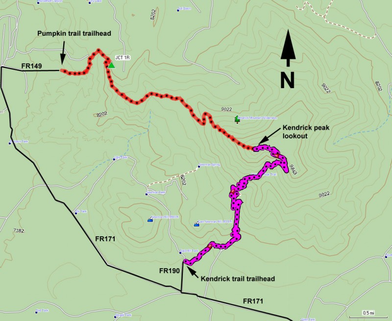
There are two other routes to the top of Kendrick. The Pumpkin Trail and the Bull Basin trail also reach the top, so make sure you pick the right trail to get back to your car.
If you dare, continue reading about the 'Attack of the Ladybugs' that we experienced on this hike. Be warned! This description is not for the bug-phobic.
Attack of the Ladybugs!
When we did this hike, evidently the Aphids had been plentiful this year and so the Ladybugs followed. As we approached the Forest Service cabin, we noticed a bush with lots of red berries. As we grew closer, we realized they weren't berries at all, but Ladybugs. As we moved closer to the top, the Ladybugs were more and more plentiful, covering plants, signs, and other hikers!
