- Hikes in Arizona
- Superstition and Mazatzal Wilderness
- Jacob's Crosscut Trail
Jacob's Crosscut Trail
Location
To get to the Broadway Road trailhead: From the Phoenix area, take US-60 East to the Idaho Road exit and turn left onto Idaho Road (headed North). Turn right onto the Old West Highway and go 0.6 miles and turn left onto signed Broadway Road. Take Broadway Road 3.5 miles though a residential area to the unsigned trailhead and small parking area on the left. Be warned: there are only space for about six cars here.
To get to the Lost Dutchman State Park trailhead: From the Phoenix area, take US-60 East and turn North onto HWY-88 (the Idaho Road Exit). From Apache Junction, drive about five miles to the Lost Dutchman State Park (on your right) and follow the signs to the Siphon Draw trailhead. You'll have to pay a few bucks to enter the Lost Dutchman State Park.
Hike details
Season
- January
- February
- March
- April
- October
- November
- December
Solitude
Difficulty
Permits
Hike the Jacob crosscut trail in the Superstition Wilderness, Arizona.
This well signed and easy to follow trail through the Superstition Wilderness makes for a nice, short day hike. This is a one way shuttle hike, so you'll need two cars unless you want to double the hiking length and time. When we took this hike, we dropped a car at the Lost Dutchman State park trailhead and started the hike from the Broadway Road Trailhead.
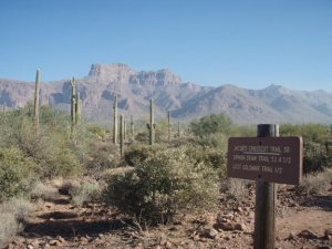
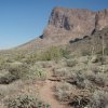
From the small parking area at the Broadway Road Trailhead, the trail start is just to your left if you are facing the Superstition Mountains. The trail starts out headed directly for the ridgeline through the common cacti seen in this area: Saguaro, Prickly Pear, and Cholla. The trail, though rocky along this section, is easy to follow and pretty flat.
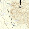
After about 0.5 miles of hiking, you'll reach the junction with the trail that leads to the Lost Goldmine trail. Stay left at this signed junction (Jct1L on the map). After another 0.5 miles of hiking, there is a sign that marks a change in the trail direction. Now you will be mostly walking North along the circumference of the ridgeline. To your right are impressive views of the Superstition Ridgeline, including Flat Iron. To your left are views of Apache Junction and the East Valley.
After about 3.3 miles of total hiking, you'll reach the junction with the Siphon Draw trailhead (also commonly known as the trail to the Flat Iron). Turn left at this signed trail junction (Jct2L on the map).
A quick 0.5 miles of hiking will get you to the campground area of the Lost Dutchman State park. You'll probably have parked at the day use trailhead area, which is an additional 0.3 miles of flat hiking.


