- Hikes in Arizona
- Phoenix Area and Central Arizona
- Arnett Canyon
Arnett Canyon
Location
To get to the Trailhead: From the Phoenix area, take US-60 East toward the town of Superior. Turn right at Airport road. After about 0.3 miles on this well graded dirt road, turn right at the small brown Arizona trail sign on your right. This dirt road now requires a high clearance vehicle. Take this rough road 0.8 miles to the parking area next to the small TR221 sign.
Hike details
Season
- January
- February
- March
- April
- September
- October
- November
- December
- July
- August
Solitude
Difficulty
Permits
Hike through Arnett Canyon near Superior, Arizona
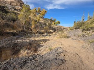
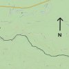
The city of Superior has been working on a trail system they call LOST (Legends of Superior Trails). There are a number of interesting trails created by this system and the trail through Arnett Canyon is well worth doing. From the parking area, look for the trail marker for TR221. This section of the trail meanders across and around Queen Creek and is tricky to follow all of the twists and turns. Thankfully, if you follow the brown trail markers, you'll stay on the path. This section ends on the now closed Perlite Road. This wide 4wd road is easy to follow from this point as it heads south towards the canyon. After about 0.7 miles of hiking on this dirt road, you'll reach the first trail junction (JCT_001ST on the map). Go straight ahead onto the single track trail that gently descends down. After 0.4 miles, you'll go through a gate (close it behind you) and quickly reach another signed trail junction (JCT_002R on the map). Turn right here as you enter Arnett canyon.
This riparian area is quite enjoyable and the trail is well worn and easy to follow. Equestrians really like this section as it weaves around cottonwood and sycamore trees enjoying the submerged water and shady canyon environment. This trail continues all the way to the trailhead for Picketpost Mountain, but we turned around an the second gate (Gate2 on the map), after 3.2 miles of total hiking. If you want to continue to the Picketpost trailhead, it's another 0.9 miles of walking.


