
- Hikes in Arizona
- Northern Arizona
- Big Bang Trail
Big Bang Trail
Location
From the Flagstaff area, take HWY-180 towards the Grand Canyon. About 2 miles out of Flagstaff, turn right onto the signed Schultz Pass Road. After 0.3 miles, this road makes a sharp left turn (going straight will put you on the Elden Lookout Road). Continue on this well graded dirt road for about 0.2 miles to the parking area for the Schultz Creek trailhead on both sides of the road. There is no water or restrooms here.
Hike details
Season
- May
- June
- July
- August
- September
- October
Solitude
Difficulty
Permits
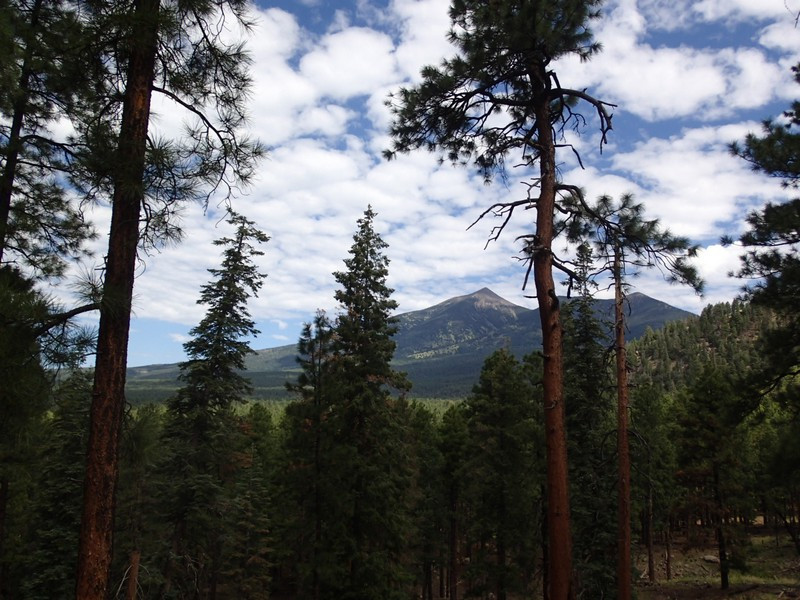
Hike the Big Bang trail near Flagstaff, Arizona.
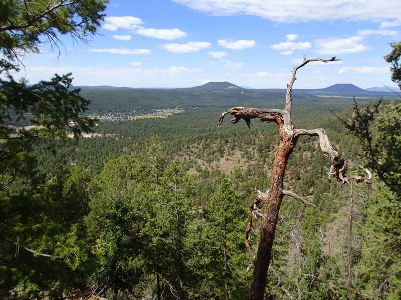
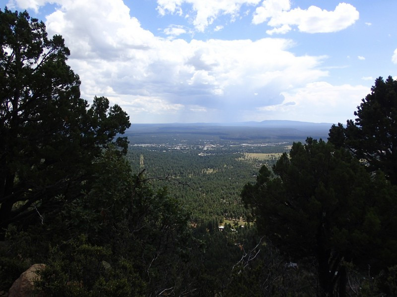
There's an effort to turn some wildcat trails into official forest trails in the Dry Lake hills area of Flagstaff. The Big Bang trail is one of the newest completed trails from this effort and rewards the hiker with great views of Flagstaff.
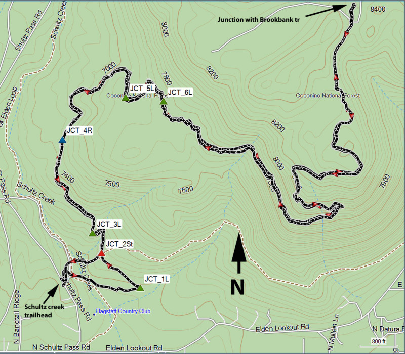
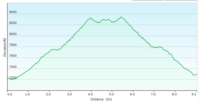
From the Schultz Creek trailhead, follow the signs to the Rocky Ridge Trail for about 0.2 miles to the signed junction with the Big Bang trail. This area is criss crossed with various trails and is tricky to navigate, but thankfully there are a number of signs to help you stay on the trail you want. JCT_2ST on the map shows the start of the Big Bang trail. Turn left here and head north west.
The trail is much easier to follow from this point, as major trail junctions are well signed. This trail is popular with mountain bikers, so be on the lookout for them coming down the trail. There is periodic shade in this section, which climbs steadily. The next trail junction comes after about 0.2 miles of hiking. Stay left at the trail junction with the Dipper trail (JCT_3L on map). After another 0.4 miles of walking, stay right at the signed trail junction with the Afterglow trail (JCT_4R on the map). Hike another 0.6 miles and stay left at the signed trail junction with the Spacewalk trail (JCT_5L on the map) and left again in another 0.2 miles (JCT_6L on the map). The route finding done, now you can focus on the steady ascent and the increasingly great views of the Flagstaff area and the surrounding mountains. This area recently went through a burn, so while there is less shade, there are more views.
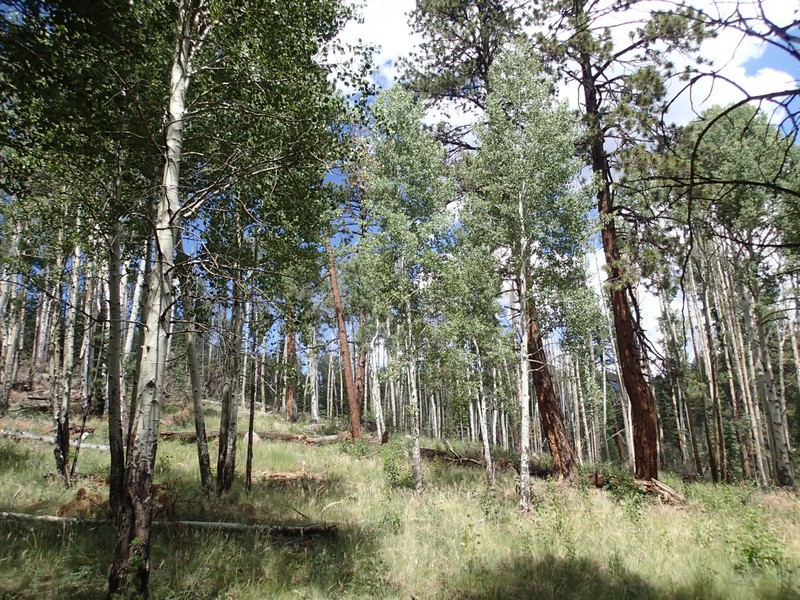
After a total of about 4.5 miles of hiking, you'll see a lovely grove of Aspen, which welcome you to the turn around point of the hike, which is the signed trail junction with the Brookbank trail.
When ready, return the way you came.
