
- Hikes in Arizona
- Sedona
- A.B. YOUNG TRAIL #100
A.B. YOUNG TRAIL #100
Location
From the Phoenix area, take I-17 North to exit 298 to HWY 179 West into Sedona. Follow the signs to 89A North. While driving on HWY-89A, look for mile marker 383, which is just past the Junipine Resort and Bootlegger Campground. Park near the Bootlegger campground on any pullout on HWY-89A. Make sure to get a Red Rock parking pass ($5) in Sedona before parking or you risk a ticket.
Hike details
Season
- April
- May
- June
- July
- August
- September
Solitude
Difficulty
30 yr old Recommendation: It's hard work to get to the top of the West Rim of the Oak Creek Canyon, but the views make for a tasty reward. We found it well worth the effort. This is a Moderately Difficult hike due to the steep climb.
Hike the A. B. Young trail near Sedona, Arizona
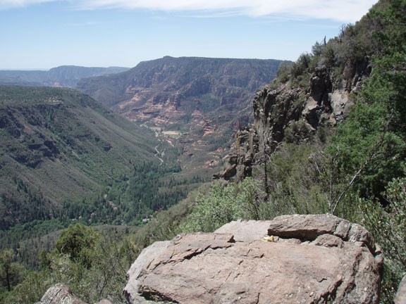
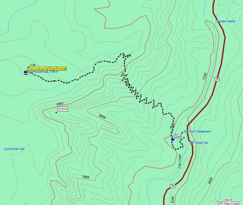
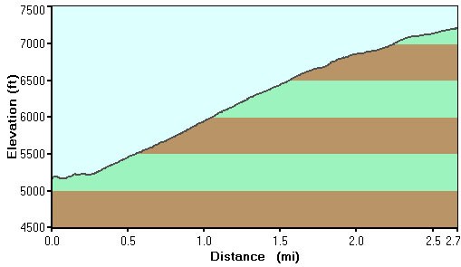
Get ready for some work! Motoring up 1700 ft of switchbacks to great views of Oak Creek canyon is a great way to spend a day. Once you're on top of the rim, you'll want to go the extra 1.25 miles to the fire lookout at East Pocket. The views are well worth the climb.
Don't take this hike if the clouds are rolling in. The fire lookout and the rim get their fair share of lightning strikes.
Warning: Sedona has recently instituted a "Red Rock Pass", which is a fancy way of saying you need to pay to play. As of June, 2007, the fee is $5 per day per vehicle. There are plenty of places in and around Sedona to pay this fee and get the receipt, which you need to put on your vehicle rear view window to keep from being towed. You will need this when you park along HWY-89A.
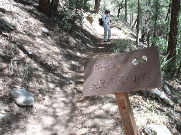
The hike starts on the west side of Oak Creek. Head into the Bootlegger campground and make your way towards the creek. There are a few trails that head down to the creek and any of them will work. Using your rock hopping skills, cross the creek and look for a trail that runs parallel to Oak Creek (it is a very well worn trail and difficult to miss). From this trail, head in the downstream direction of Oak Creek until you see a rusty sign on your right marking the start of the A.B. Young Trail #100 (picture below).
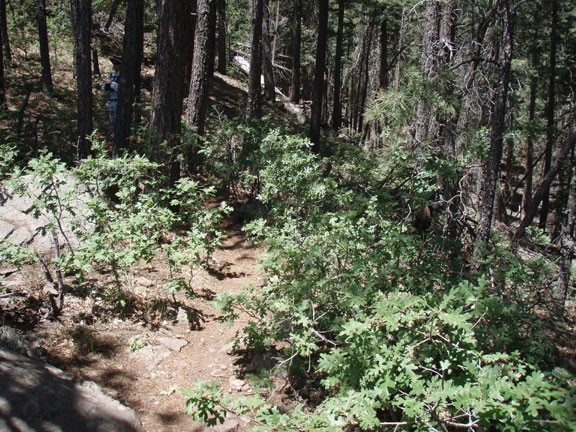
From this point it is a steady climb up numerous switchbacks to the top of the West rim of Oak Creek Canyon. There is no shade during this climb, which makes it hot during the summer but has the benefit of revealing great views of Oak Creek canyon. The trail is in excellent shape and easy to follow. After 1700 ft of climbing, you'll reach the rim and a nice spot to catch your breath and admire the view.
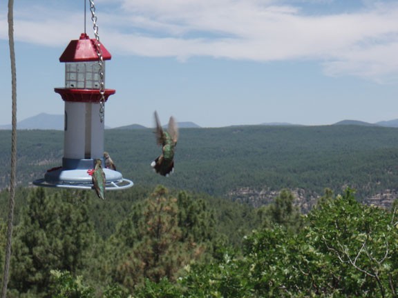
There is a trail along the rim of the canyon here. Remember this junction, as it may be easy to miss on your return. This section of trail can be difficult to follow in the fall, when it is completely covered by falling oak leaves. Take the trail to your left (towards Sedona). You are shaded by pine trees so between the elevation and the shade you will cool down from your climb. By following this trail 1.25 miles (and about 400 ft of elevation gain), you will reach the fire lookout at East Pocket. There is usually someone camped here that has volunteered to look out for fires during the day. They do allow visitors at the fire lookout... please be respectful. The final climb to the top of the fire lookout is well worth it. From the lookout, you have great views of Oak Creek canyon and the San Francisco peaks. As an added bonus, there were a few hummingbird feeders at the top that were doing their job well when we visited.
When you're finished with the views and the hummingbirds, return the way you came.
