
- Hikes in Arizona
- Sedona
- Red Rocks State Park (Sedona)
Red Rocks State Park (Sedona)

Location
From the Phoenix area, take I-17 North to HWY-179. Take HWY 179 through the Village of Oak Creek towards Sedona. At the intersection with HWY89A in Sedona, head west from the traffic circle towards West Sedona. Take HWY89A for 5.4 miles and turn left onto the signed Red Rock Loop Road. Three miles along this road will get you to the signed turn into the park (turn right) and another 0.8 miles of driving will get you to the visitors center parking area. There are restrooms and water here. The entrance fee is $7 per person (June 2022).
Hike details
Season
- March
- April
- May
- September
- October
- November
Solitude
Difficulty
Permits
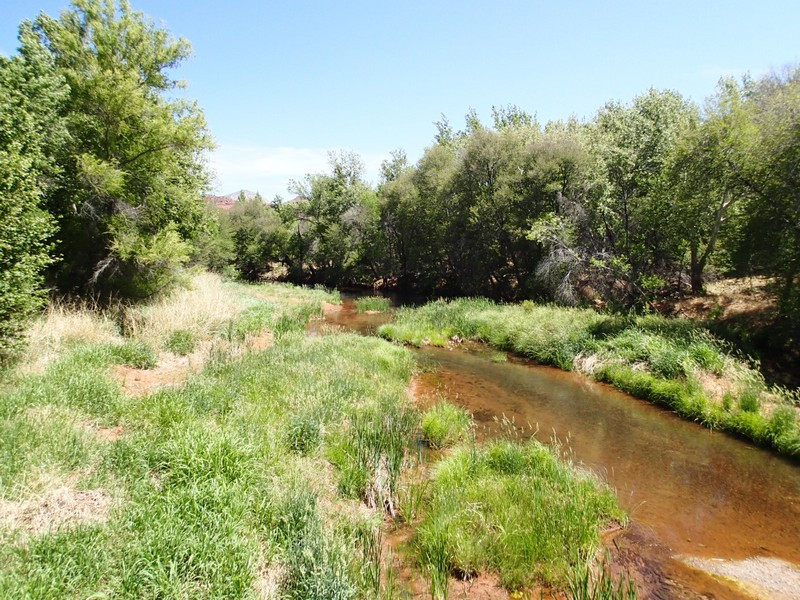
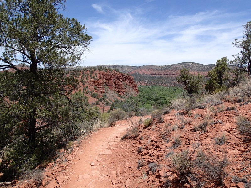
Hiking in the Red Rocks State Park along Oak Creek Canyon near Sedona, Arizona.
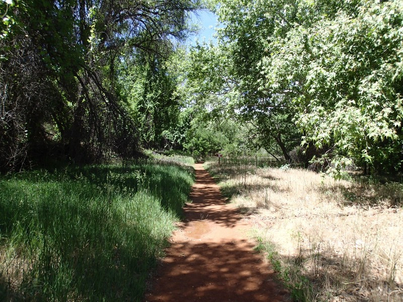
Western Sedona is often overlooked by hikers, even though it shares many of the same lovely hiking characteristics as Oak Creek Canyon and Sedona proper. The Red Rocks State Park makes a compelling argument in encouraging hikers to check this area out. There are multiple trails to enjoy in this area. The hike we took is a mix of walking along Oak Creek and enjoying great views of the area.
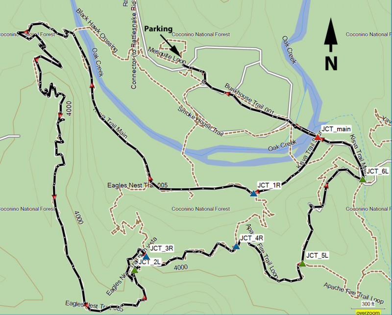
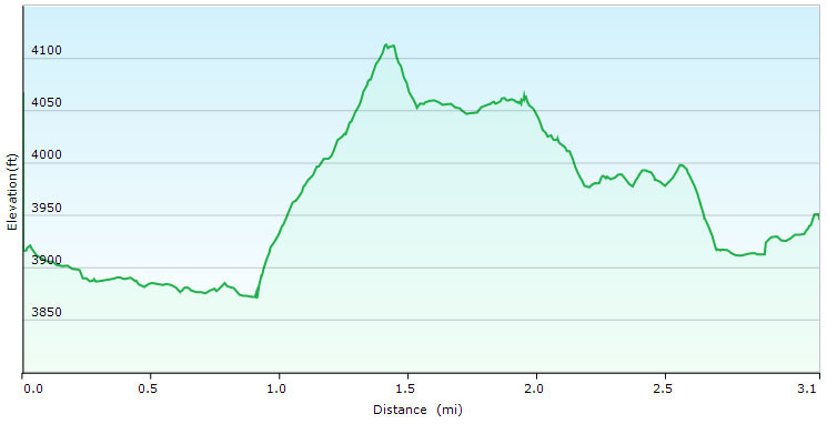
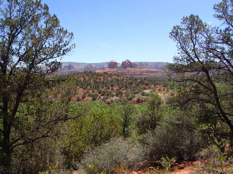
After paying the entrance fee ($7 per person as of June 2022) you'll walk towards the creek on the well signed Bunkhouse trail. All the trails are well worn and easy to follow. All trail junctions are signed and helpful maps are included on the signs. It's a short walk to a bridge crossing Oak Creek. This riparian area is lovely and it's worth enjoying this spot for a few minutes. After crossing the bridge, turn right onto the Kisva trail (JCT_main on the map). The Kisva trail stays relatively close to Oak Creek and you'll enjoy views of it on occasion. After 0.1 miles, stay right at the signed junction (JCT_1R on the map). After 0.6 miles of hiking, the trail makes an abrupt turn left and you'll start climbing up on the Eagle Nest trail. There's an interesting old irrigation canal that was dug by the homesteaders here that has become a riparian area. Soon you'll reach the top of the hill and start walking south along its ridgeline, enjoying great views of the area.
Continue hiking along the ridgeline, staying on the Eagles Nest Trail (JCT_2L and JCT_3R on the map). After about 1.7 miles of total hiking, you'll reach the signed junction with the Coyote Ridge trail (JCT_4R on the map). Stay right here and walk another 0.1 miles to the signed junction with the House of Apache Fires trail (JCT_5L on the map). Turn left here and walk to the impressive house up on the hill. This house has an interesting history, explained with a well designed plaque near the house (which unfortunately is closed to visitors). The trail continues past the house and down to the signed trail junction with the East Gate trail (JCT_6L on the map). From here it's a short walk back to the bridge crossing Oak Creek and to the parking area.
