
- Hikes in Arizona
- Tucson Area and Southern Arizona
- Sonoita Creek
Sonoita Creek
Location
To get to the Trailhead: From the Tucson area, take I-10 South towards Vail. At Vail, take HWY-83 south to Sonoita. In Sonoita, take HWY-82 West (right) to the signed turnoff on the right for Patagonia Lake (about 19.7 miles). After about 3.4 miles, turn left onto Dam Road (signed as the Sonoita Creek Natural Area). Take this well graded dirt road 1.1 miles to the end of the road where there are two trailheads and parking. You will need a permit to park here and can be purchased at the entrance to the lake state park. As of April 2022, the permit is $15 on weekdays and $20 on weekends.
Hike details
Season
- March
- April
- May
- September
- October
- November
- January
- February
- July
- August
- December
Solitude
Difficulty
Permits
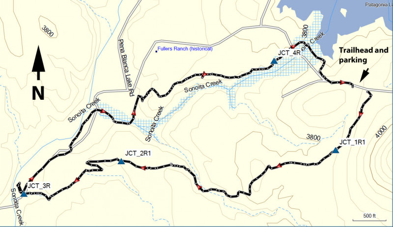
Hike Sonoita Creek trail near Pategonia, Arizona.
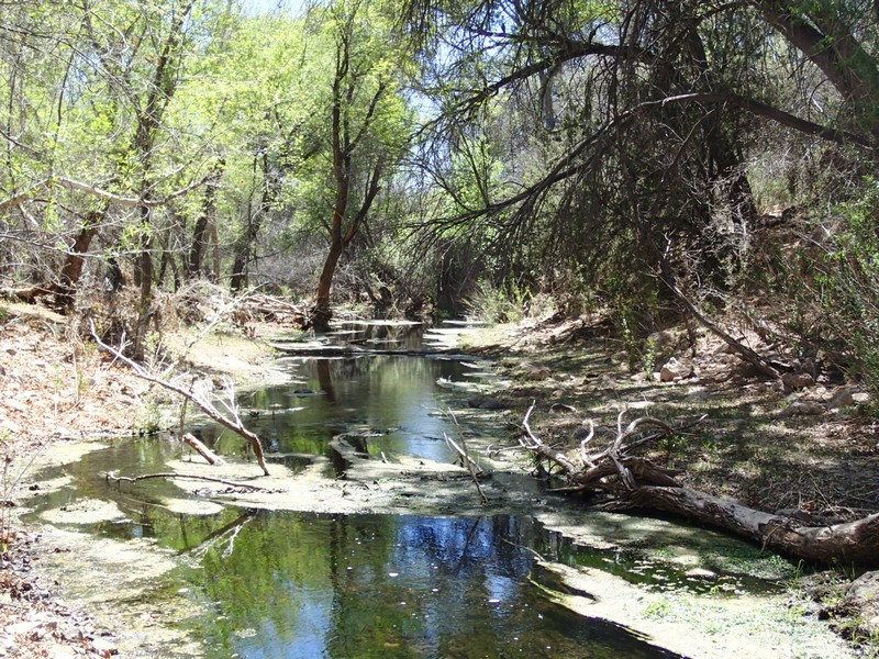
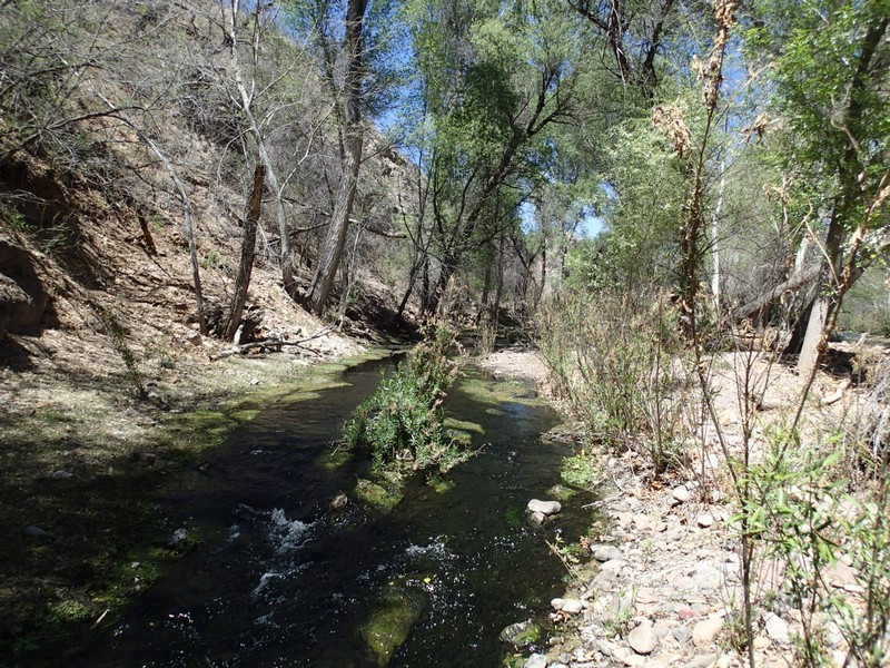
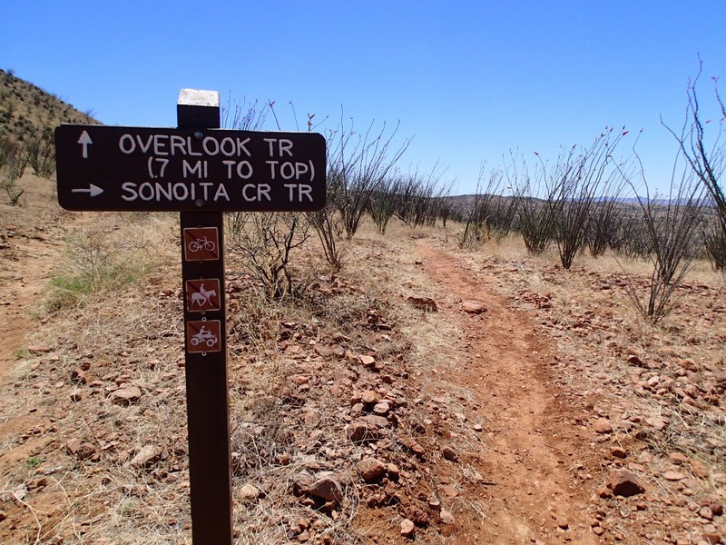
This hike is part of Sonoita Creek State Natural Area and requires a permit, which you can purchase at the nearby entrance to Patagonia lake. As of April 2022, it was $15 weekday, $20 weekend. From the parking area, there are two signed trailheads. For the loop hike described, we'll start on the Sonoita Creek trailhead. The trail here is well worn, signed, and easy to follow. You'll be dropping into the canyon where Sonoita creek makes it's home.
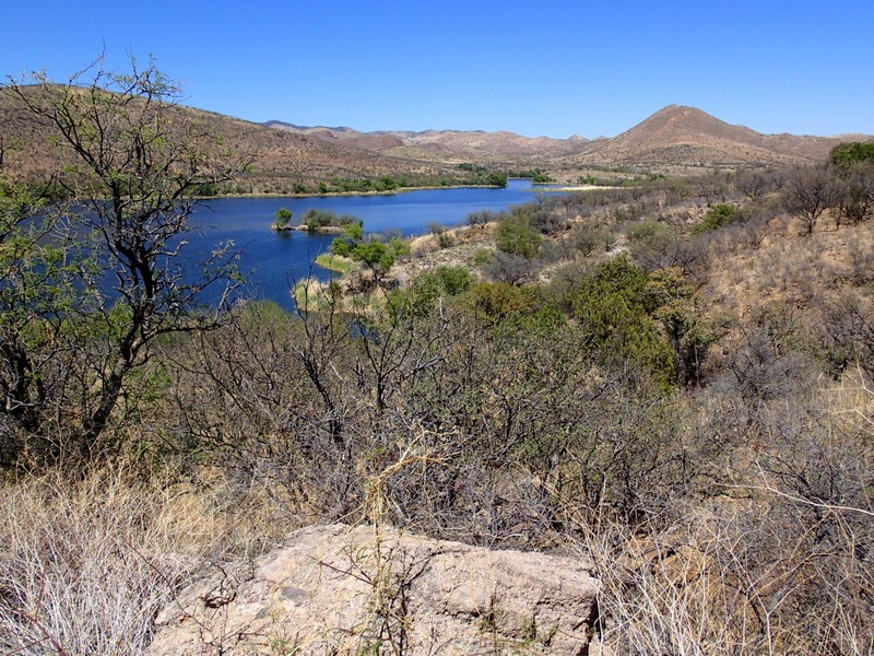
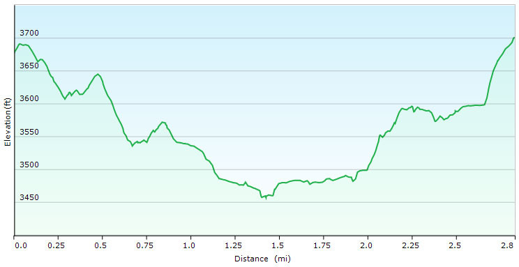
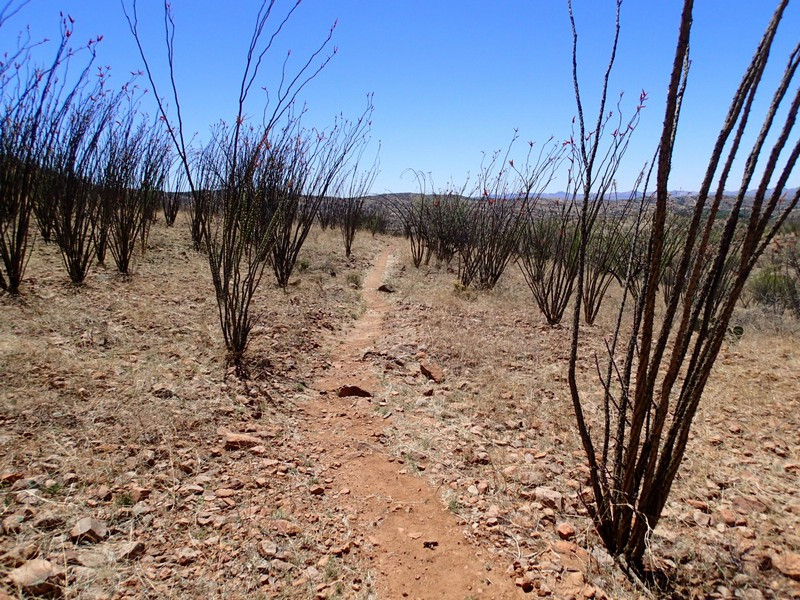
Following the signs to the Sonoita Creek trail, you'll hike through a small forest of Ocotillo trees 0.2 miles to the first signed trail junction (JCT_1R on the map). Stay right here. About a mile from the trailhead start, you'll reach the signed trail junction with the Horse Coral trail (JCT_2R on the map). Stay right again at this signed junction. The trail now drops about 0.5 miles into the canyon area and reaches Sonoita Creek. This riparian area is really lovely, and worth exploring a bit before continuing to the right on the signed return trail for the Black Hawk trail (JCT_3R on the map). This trail follows a bit off of the creek and after about a mile from the last trail junction, you'll reach a dirt road. Turn right and follow this dirt road as it becomes paved and crosses the creek. You'll get nice views of Patagonia Lake here. The paved road climbs up steeply to the trailhead and from the lake it is only about 0.2 miles to the parking area.
