
- Hikes in Arizona
- Phoenix Area and Central Arizona
- Jojoba Trail
Jojoba Trail

Location
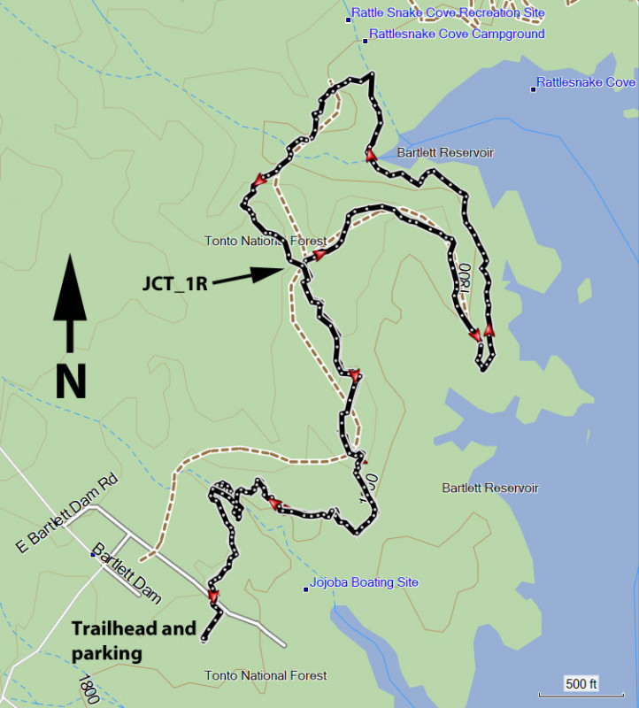
To get to the trailhead: From the Phoenix area, HWY-101 North to the Pima road exit and head North. Continue north on Pima until you reach the intersection of Pima Road and Cave creek Road. Make a right (East) onto Cave Creek Road. From Cave Creek Road, turn right onto Bartlett Dam Road and continue 13 miles into the park. Continue straight when you see the lake, following the sign to the Jojoba boat launch area. The signed trailhead is on the left side of the parking area. This is a fee area, so make sure you have a Tonto Pass ($7 as of December 2021) before you arrive.
Hike details
- Water
- Wild Flowers
Season
- January
- February
- March
- April
- October
- November
- December
- July
- August
Solitude
Difficulty
Permits
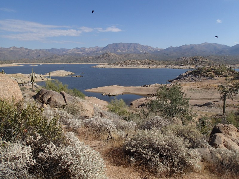
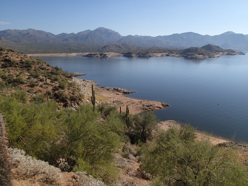
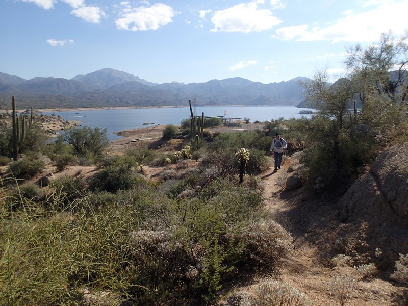
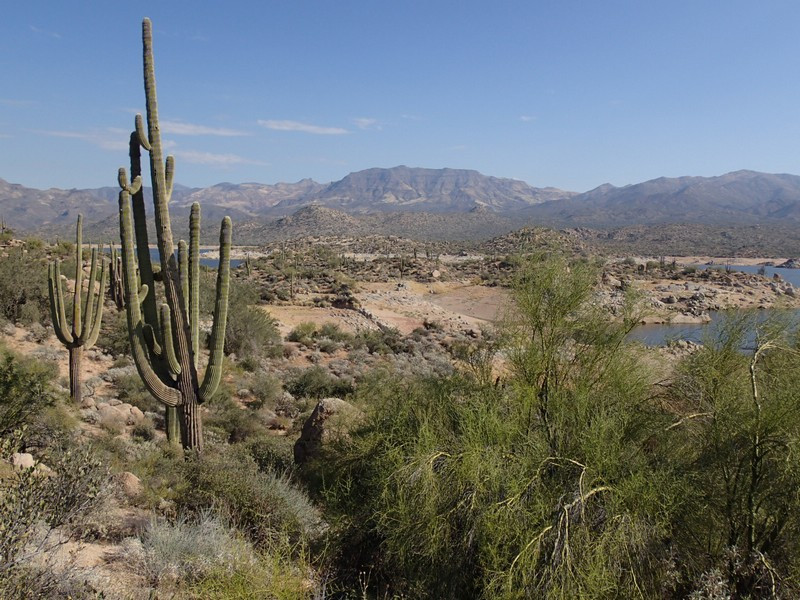
Hike the Jojoba trail along Bartlett Reservoir near Phoenix, Arizona.
Make sure you have a Tonto pass ($7 as of December 2021) before parking here
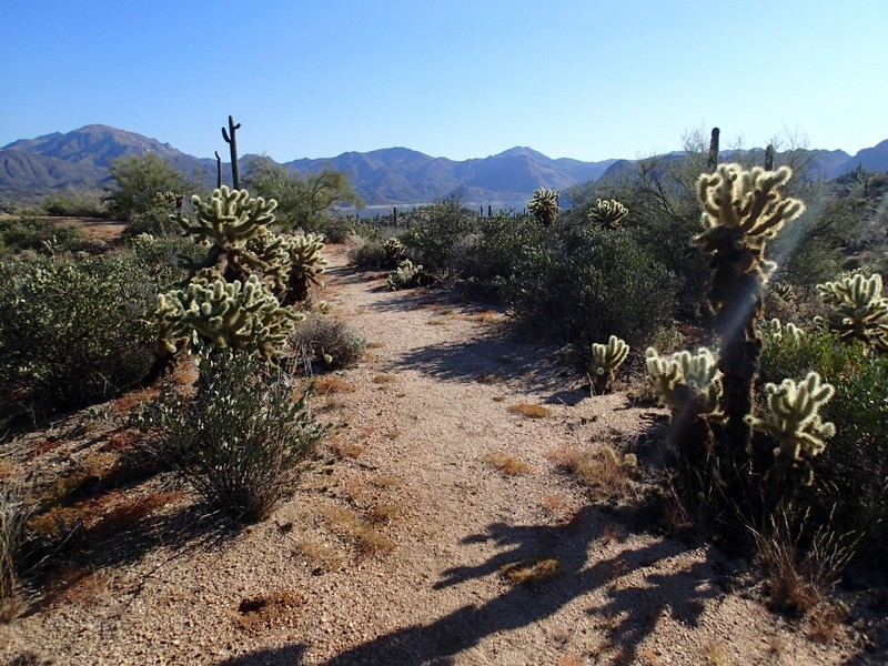
The signed trail starts at the north side of Jojoba boat ramp launch parking area and follows the western edge of the Bartlett Reservoir as it winds north. This is a classic Saguaro desert, with the usual suspects of Cholla cactus, Saguaro cactus, Barrel cactus and scrub, although with the very unique backdrop of a nearby lake. We hit this hike on a near perfect winter day, with a high of 74F, a light breeze off the lake, and clear skies. You can see the four peaks and the Mazatal mountains from this trail, but the eyes always seem to travel back to the Reservoir. The trail travels up and down through small coves created by the Reservoir.
The trail can be overgrown in places, so long pants are recommended. It can be tricky to follow the trail in sections too, so make sure you're using those route finding skills. At the marked trail junction (JCT_1R on the map) go right here and follow the trail out to an interesting viewpoint. Once you reach the water, you can follow the shoreline to the left to reach Rattlesnake cove. The return trail is signed, but can also be difficult to follow. It's best to take it slow, try to stay on the trail, and enjoy the great views of Bartlett lake.
