
- Hikes in Arizona
- Mogollon Rim
- Woods Canyon Lake Trail
Woods Canyon Lake Trail

Location
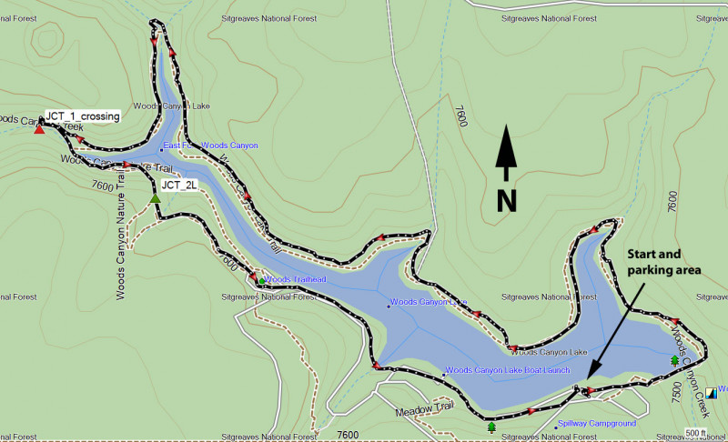
To get to the trailhead: from the Phoenix area, take HWY-87 North toward Payson. Once in Payson, take HWY-260 East towards Heber. After about 30 miles, turn left onto signed FR300 (also known as the Rim Road). After 3.3 miles on this paved road, turn right onto the signed road for Woods Canyon Lake. There are several access areas to the lake and they all access the trail. We chose the Spillway day use parking area ($7 for day use as of July 2021). Turn right at the sign for the Spillway campground and take this paved road 1.1 miles from the rim road to the day use area.
Hike details
Season
- June
- July
- August
- January
- February
- December
Solitude
Difficulty
Permits
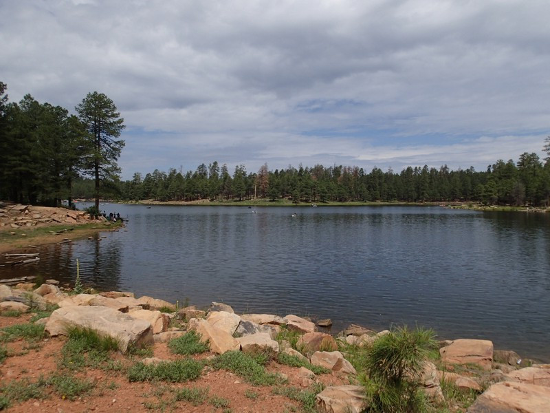
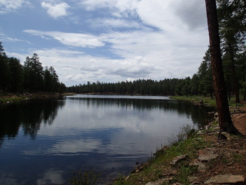
Loop hike around Woods Canyon Lake on the Mogollon rim (Arizona).
Woods Canyon is a popular place for boaters and fishermen and it's easy to see why. For us hikers, there's a great trail that loops around this pretty place.
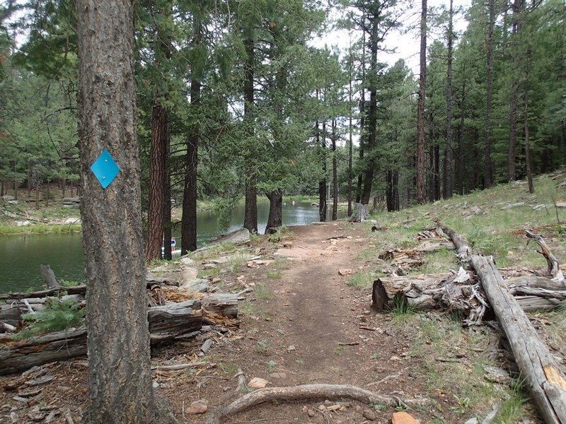
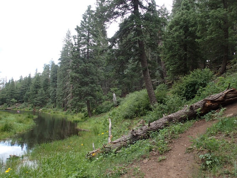
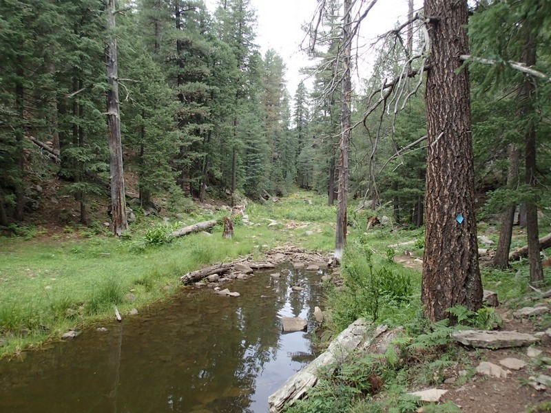
There are a number of parking areas that access the trail around the lake. We arbitrarily chose the Spillway day use parking area. Just as a heads up, it costs $7 to park here (as of July 2021). From the parking area, we decided to go counter clockwise. The first landmark is the earthen dam that creates Woods Canyon Lake. Once you reach the other side of the dam, you'll enjoy a long period of solitude as you walk along the flat trail through the pines. The trail can be tricky to find in spots, but as long as you can see the lake on your left, it would be tough to get lost. There are blue diamonds in the trees to help you stay on trail, but there are many trails made by animals and fishermen you can follow as well. At JCT_1_Crossing on the map, the crossing point will be a bit arbitrary, depending on lake water levels. Look for the blue diamond on the trees across the way to find one recommended route to keep your feet dry. At the JCT_2L point, you'll see a rock cairn. Stay left here and continue on the trail. Soon you'll reach the heavily trafficked South side of the lake and you'll lose your solitude for the remainder of the hike. Thankfully, you'll get through this section quickly and make it back to your waiting car.
