
- Hikes in Arizona
- Northern Arizona
- Anderson Mesa
Anderson Mesa


Location
From the Phoenix area, take I-17 North to the point where I-40, I-17, and HWY89A meet. Take the Lake Mary Road exit and head south. Go about 9.3 miles to the signed turn off for Marshall Lake (FR128) on your left. Turn left here and take this paved road 1.2 miles. Turn right here towards the Lowell Observatory. Take this road another 0.3 miles to the parking area on the left. The trail to Anderson mesa is across the road to the east.
Hike details
Season
- June
- July
- August
Solitude
Difficulty
Permits
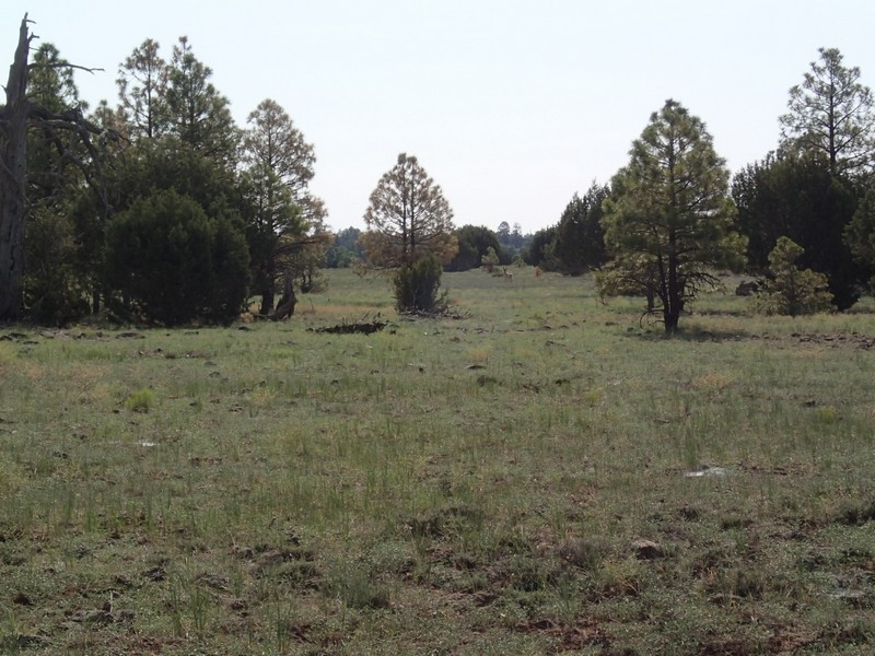
Hike along Anderson Mesa near Flagstaff, Arizona.
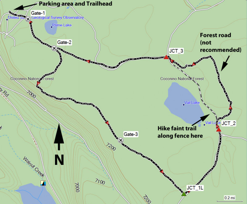
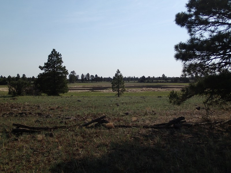
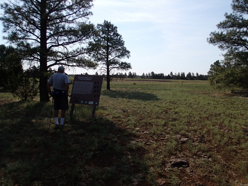
From the parking area, cross the road to the small Arizona trail marker sign and follow the dual track as it follows along side a dilapidated wood fence. After only 0.1 miles, you'll reach a gate to enter into Prime Lake (Gate-1 on the map). This natural lake is formed from snow melt and represents an important water source for the wild creatures in the area. Continue along the trail as it skirts the southern edge of Prime Lake. After 0.3 miles from the first gate, you'll reach a second gate (Gate-2 on the map). Leave the Prime Lake area and turn right at this junction. The trails along Anderson Mesa are pretty flat and travel along closed fire roads through a sparse pine forest. Along this section of trail, you'll be treated to some great views of Upper and Lower Lake Mary.
Continue along the trail 1.2 miles from the previous gate to another gate (Gate-3 on the map). It's an additional 0.7 miles to the next trail junction (JCT_1L on the map). The Arizona trail continues south east, but you'll want the dirt road that goes north east. 0.6 miles from this junction, you'll reach Vail lake. We lost the trail here and continued to follow a forest road. Don't do this. Instead, head towards the lake and follow the fence line to the right. There is a faint trail along the fence that travels along the north east side of Vale Lake. After 0.7 miles along this fence trail, you'll leave the lake area and see a dirt road with multiple junctions (JCT_3 on the map). Take the signed FR129A road west here. After hiking 0.9 miles, you'll reach Prime Lake again (Gate-2). Continue through this gate along Prime Lake again to return to your car.
