
- Hikes in Arizona
- Prescott Area
- Black Canyon Trail: Russian Well
Black Canyon Trail: Russian Well
Location
To the Trailhead: From the Phoenix area, take I-17 to the junction of HWY-69. Continue on I-17 past this junction and past the town of Cordes Junction to the Orme/Dugas road exit (exit #268). Turn left here (west) and take this well graded dirt road 7.1 miles to the unsigned dirt parking area to the left. There is a small brown trail marker that marks the start of the Black Canyon trail here.
Hike details
Season
- January
- February
- March
- October
- November
- December
- June
- July
- August
- September
Solitude
Difficulty
Permits
Hike along the Black Canyon trail to Russian Well near Prescott, Arizona.
The Black Canyon trail system is an ambitious plan to create a trail all the way from the Carefree highway to the Prescott National Forest. This northerly section of the trail is a good route to check out an old abandoned mine as well as a working well and ranch.
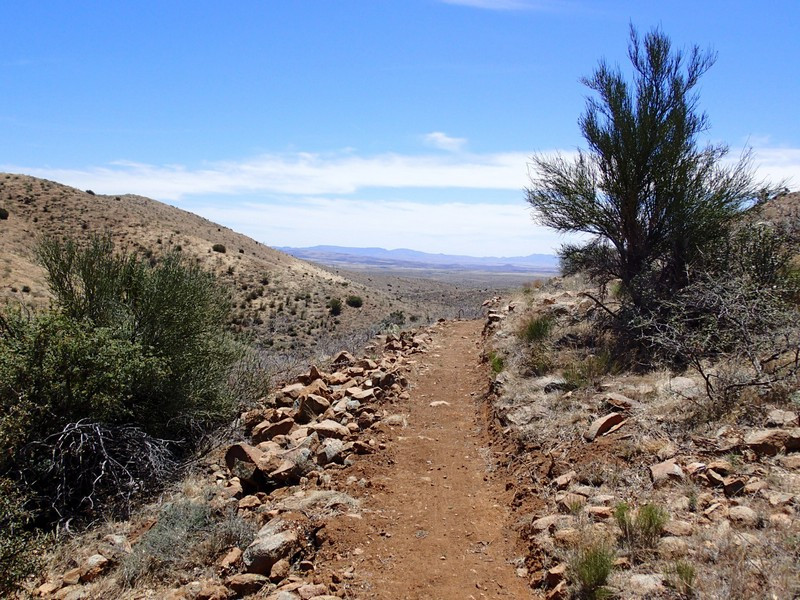
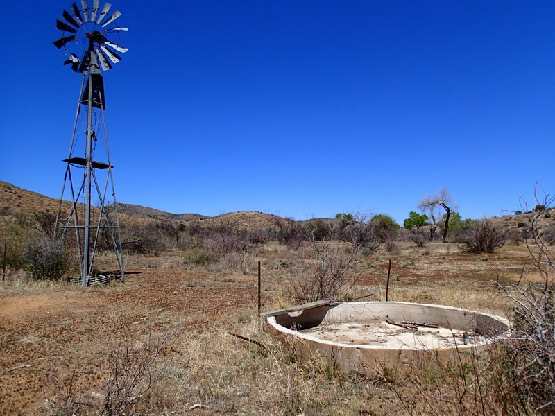
From the parking area, keep an eye out for a small, brown marker showing the faint trail headed South. This trail becomes more clear during the hike, but in the early sections it can be a bit faint. There is trailwork scheduled for this parking area and trail, so hopefully it continues to improve. Follow the trail as it undulates through the brown scrub grasslands of this area.
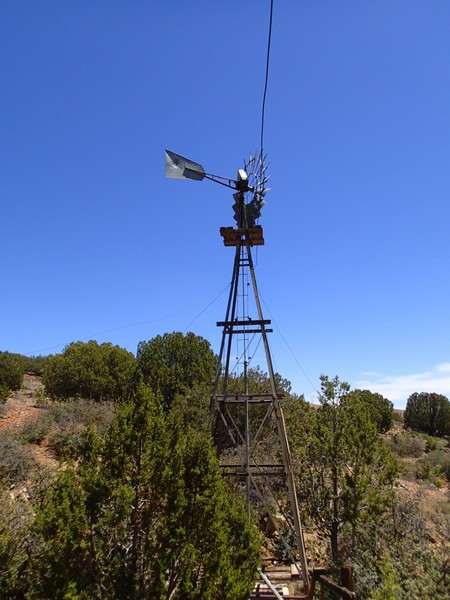
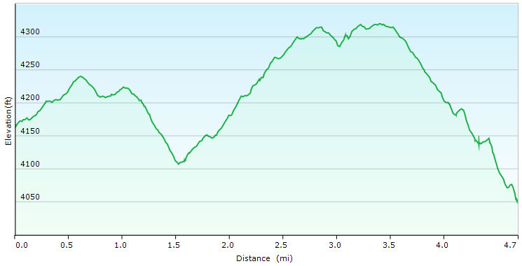
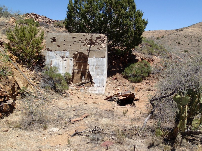
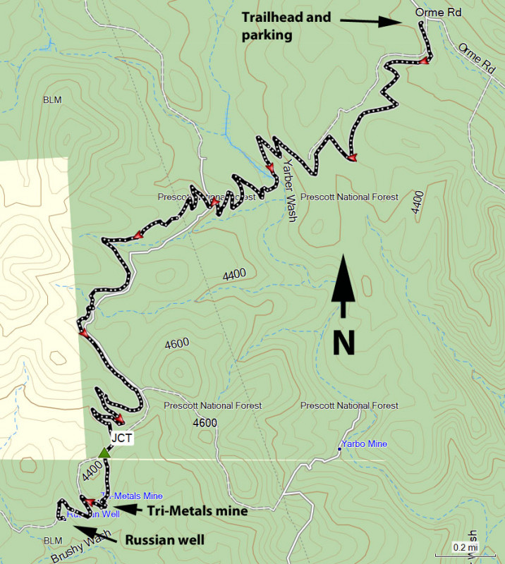
After about 4.1 miles of hiking, you'll cross the dirt road that this trail has been shadowing. Walk a few hundred feet along this road and look for a faint dirt road off to the left (JCT on the map). Turn left here and walk a bit further to see the ruins of the Tri-Metals mine. When you're finished checking out this area, continue along the road as it meets back up with the main road and follow the main road another 0.1 miles or so to the Russian well area. This spring has a working windmill and looks to still be in use by ranchers in the area. The area is interesting to explore (especially the well, windmill, and tanks) but don't touch anything.
When ready, return the way you came.
