
- Hikes in Arizona
- Phoenix Area and Central Arizona
- Camp Creek Falls
Camp Creek Falls


Location
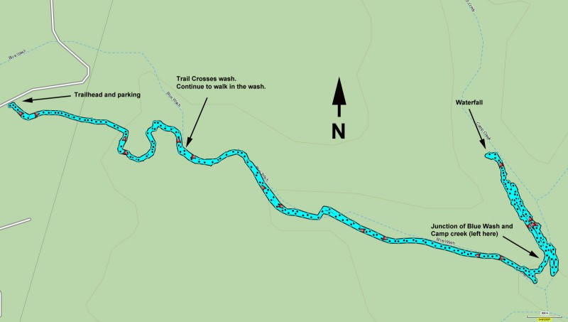
To get to the trailhead: from the Phoenix/Mesa area, take HWY-101 North to the Pima Road exit. Take Pima road North to Cave Creek Road. Turn East (Right) on Cave Creek Road. Continue 6.5 miles from the intersection on Cave Creek Road to an unsigned parking area on your right.
Hike details
Season
- February
- March
- April
- May
- October
- November
- December
- July
- August
Solitude
Difficulty
Permits
Hike to a seasonal waterfall on Camp Creek near Phoenix, Arizona.
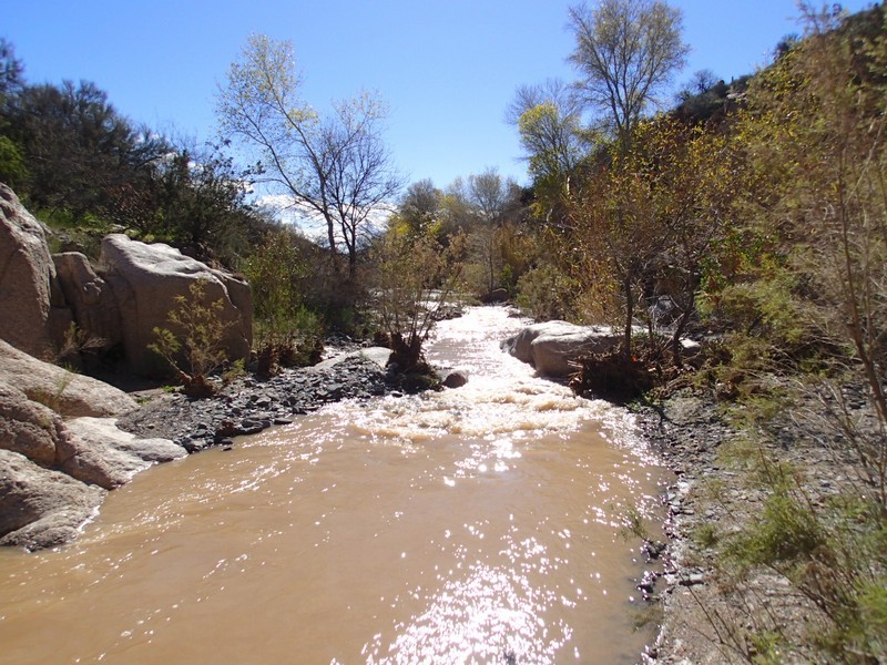
Waterfalls are rare enough in Arizona that they are worth seeking out when they appear. Camp Creek creates a seasonal waterfall and this hike is best done shortly after one of those rare Phoenix area rains.
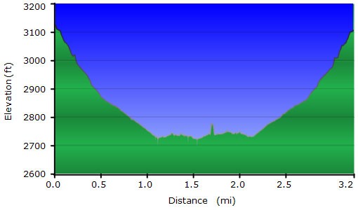
From the parking area, take the clear trail as it heads down towards Blue Wash. After 0.4 miles, you'll reach Blue wash. Instead of continuing on the trail, turn left here and walk along the floor of the wash. This wash is normally dry and the walking is pretty easy. After 1.1 miles of hiking, you'll reach the clear confluence of Blue Wash and Camp Creek.
Depending on recent rains or Spring runoff, Camp Creek may be a significant creek or a quiet one. When we did this hike in February of 2019, it was after a few days of rain, so the creek was pretty impressive. Turn left at the confluence and start walking up the left side of Camp Creek. For the first 0.2 miles, there is a clear trail. For the last 0.1 miles to the creek, we stayed on the left bank and bushwacked along the bank to get to the waterfall. Depending on water level, you may want to cross or the walking may be easier in the creekbed. Use your judgement here.
The waterfall is unmistakable and enjoyable. After appreciating this rare desert phenomenon, return the way you came.
