
- Hikes in Arizona
- Superstition and Mazatzal Wilderness
- Cougar Loop (Superstition Wilderness)
Cougar Loop (Superstition Wilderness)

Location
To get to the trailhead: From the Phoenix area, take US-60 East, leaving the city limits. After leaving Apache Junction, continue about 3 miles, turning left onto Kings Ranch Road. This is paved most of the way as you pass by Gold Canyon Ranch. Drive 2.7 miles on Kings Ranch Road and turn right on Baseline Avenue. After 0.2 miles, you'll turn left onto Mohican Road. After 0.2 miles, turn left onto Valley View Road. This road will soon turn into Valley View Road, and then into Whitetail road. Follow this road for 0.6 miles to Cloudview Road. Turn right onto Cloudview road and drive 0.5 more miles to the parking area.
Hike details
Season
- January
- February
- March
- April
- October
- November
- December
Solitude
Difficulty
Permits
Hike the Cougar Trail loop in the Superstition Wilderness, Arizona.
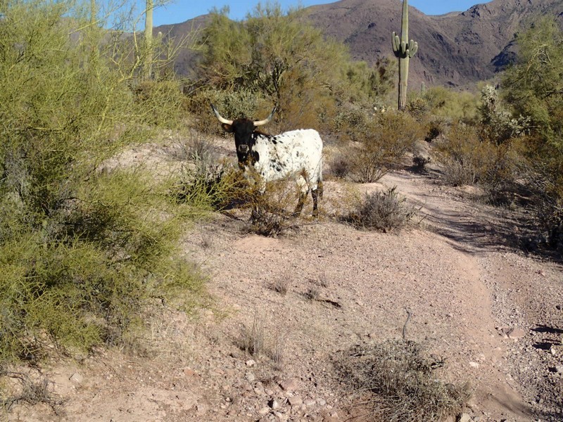
The Cougar trail is an unofficial trail near the Superstition Wilderness. It is primarily used for mountain bikers, but hikers can enjoy it too. I recommend taking this loop hike in the counter-clockwise direction to make it easier for navigation, so this write-up reflects this. There is some route finding needed, so even though this is an easy loop, you'll need those route finding skills to stay on the correct trail. After taking a driving tour of the Gold Canyon sprawl, following the directions above will get you to the trailhead. Parking may be another problem, as this is a popular trailhead.
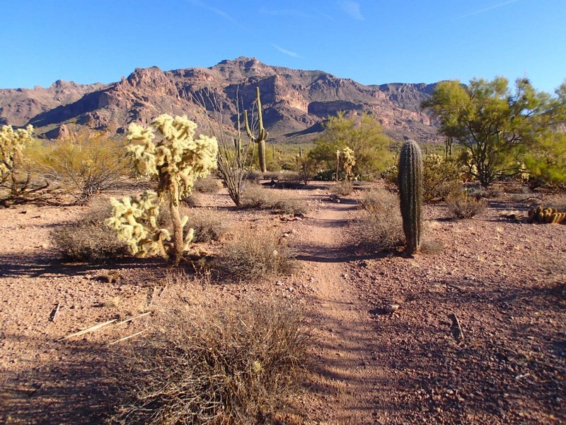
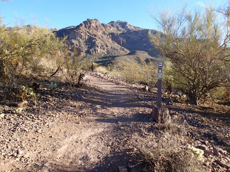
From the well signed trailhead, go through the gate and towards the Superstition Mountain range. After about 100 yards of hiking, you'll reach the turn off for the Hieroglyphic trail. Stay right to take the Lost Goldmine trail. All along this trail, you'll enjoy lovely views of the Superstition Mountains and the surrounding sonoran desert.
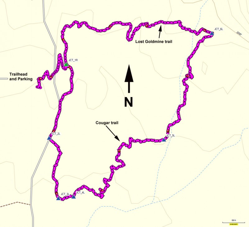
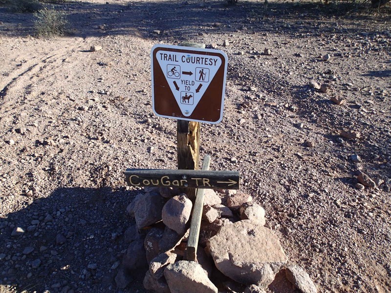
From here, the route finding starts pretty quickly. After about 0.3 miles of hiking, you'll see some rock cairns and an unsigned trial heading off to your right, heading generally South (JCT_1R on the map) Turn right here. If you're not looking for it, this junction can be easy to miss. After another 0.3 of a mile of hiking, you'll reach a signed junction for the Cougar trail (JCT_2L on the map). Turn left here. The hiking is easy, but you need to keep an eye out for multiple trails and the rock cairns that mark the unsigned trail junctions. The next trail junction is after another 0.3 miles of hiking (JCT_3L on the map). Stay left again here. Another 0.1 miles will get you to another unsigned trail junction (JCT_4L on the map). Turn left here. You'll walk 0.6 miles as the trail zigs and zags through desert washes to the next unsigned trail junction (JCT_5L on the map). Stay left here. It's another 0.5 miles of walking to get to the easily spotted Lost Goldmine trail (JCT_6L on the map). You'll turn left here. This trail junction is currently not well marked at all and would be very difficult to spot this trail if you were to try hiking this loop in the opposite direction. It looked to me as there were cairns marking the junction at one time, but someone has gone to some effort to knock them down and cover up the trail here.
Once you reach the Lost Goldmine trail, you'll walk about 1.1 miles West to the return to the trailhead.
