
- Hikes in Arizona
- Sedona
- Huckaby trail (Sedona)
Huckaby trail (Sedona)


Location
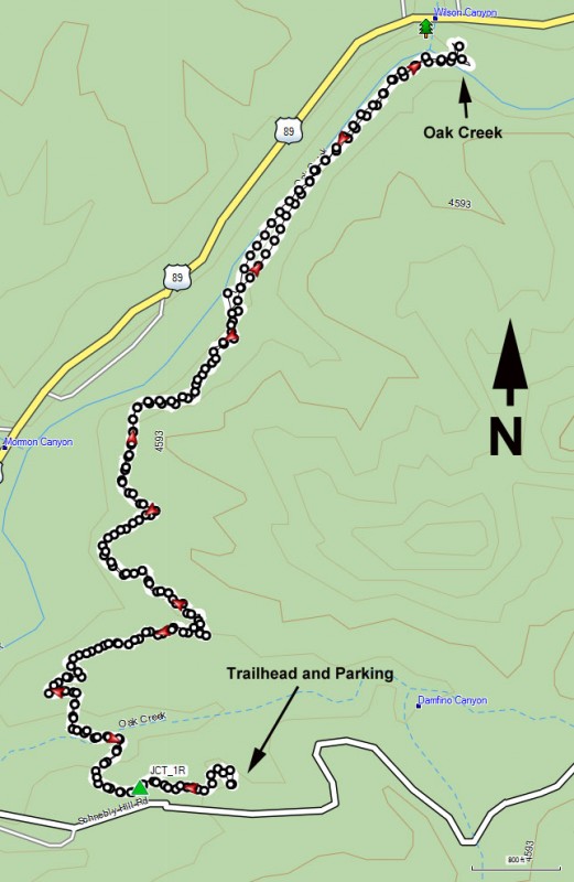
From the Phoenix area, take I-17 North to HWY-179. Take HWY 179 through the Village of Oak Creek towards Sedona. Before you cross a bridge that crosses Oak Creek, you'll reach a round about that is signed for Schnebly Hill Road. Stay straight on this round about to follow Schnebly hill road. Take this paved road for 0.9 miles to the trailhead and parking on the left. There are restrooms here, but no water. You need a red rocks parking pass to park at this trailhead ($5 as of August 2017).
Hike details
Season
- March
- April
- May
- September
- October
- November
Solitude
Difficulty
Permits
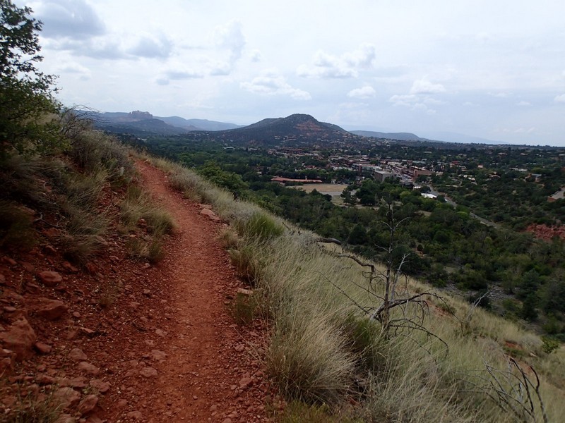
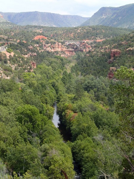
Hiking along the Huckaby trail through Oak Creek Canyon near Sedona, Arizona.
Sedona has instituted a "Red Rock Pass", which is a fancy way of saying you need to pay to play. As of March, 2017, the fee is $5 per day per vehicle. There are plenty of places in and around Sedona to pay this fee and get the hanger, which you need to hang on your rear view mirror to keep from being towed. This trailhead requires a Red Rocks Pass.
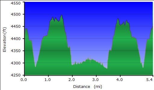
The hike starts from the well signed trailhead for the Huckaby trail. After about a quarter mile, stay right at the signed trail junction (JCT_1R on the map). This is really the only route finding on the hike. The hiking in this section is through typical red rock canyons that the Sedona area is known for. You'll travel generally North along a bench up above the town of Sedona, enjoying some unique views of the city.
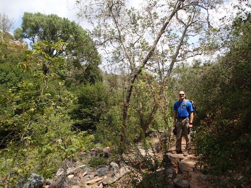
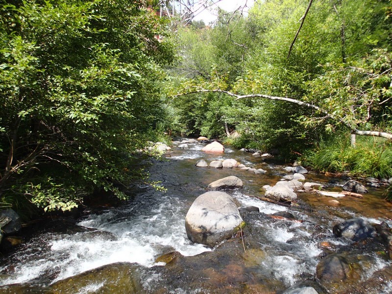
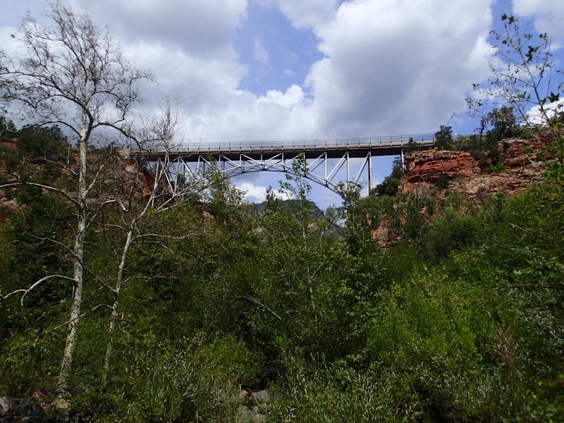
About 1.5 miles into the hike, the trail drops down into Oak Creek canyon. The trail is shaded here and noticeably cooler as you hike closer to the creek. After about 2.7 miles of hiking, you'll reach a creek crossing of Oak Creek under the shadow of Midgley bridge. This makes a great place for lunch.
From here, if you had a shuttle, you could take the short, steep climb up to Midgley bridge. If not, back track here to the trailhead parking.
