
- Hikes in Arizona
- Sedona
- Munds Wagon/Cow Pies/Hangover trail loop (Sedona)
Munds Wagon/Cow Pies/Hangover trail loop (Sedona)

Location
From the Phoenix area, take I-17 North to HWY-179. Take HWY 179 through the Village of Oak Creek towards Sedona. Before you cross a bridge that crosses Oak Creek, you'll reach a round about that is signed for Schnebly Hill Road. Stay straight on this round about to follow Schnebly hill road. Take this paved road for 0.9 miles to the trailhead and parking on the left. There are restrooms here, but no water. You need a red rocks parking pass to park at this trailhead ($5 as of August 2017).
Hike details
Season
- March
- April
- May
- September
- October
- November
Solitude
Difficulty
Permits
Loop hike made up of Munds Wagon, Cow Pies, and Hangover trails near Sedona, Arizona.
Sedona has instituted a "Red Rock Pass", which is a fancy way of saying you need to pay to play. As of March, 2017, the fee is $5 per day per vehicle. There are plenty of places in and around Sedona to pay this fee and get the hanger, which you need to hang on your rear view mirror to keep from being towed. This trailhead requires a Red Rocks Pass.
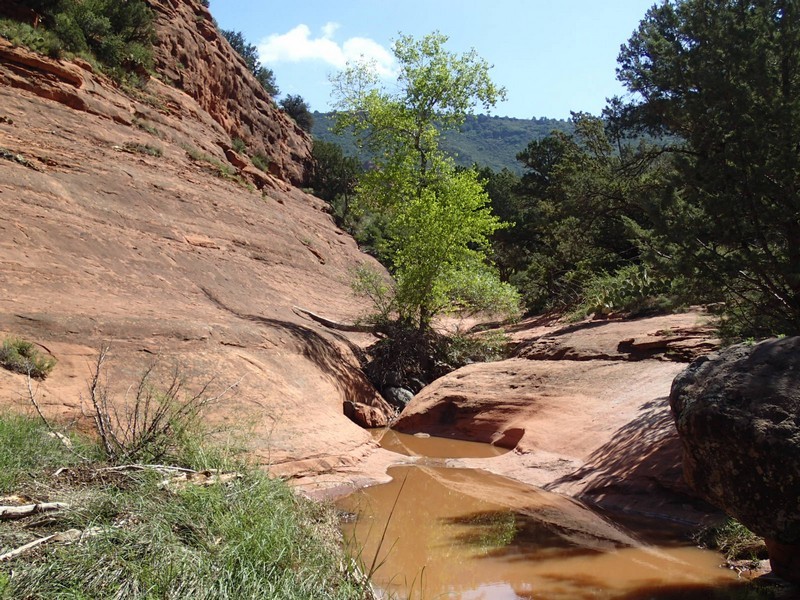
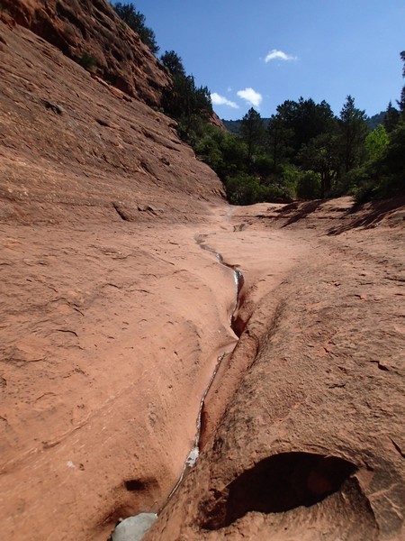
The hike starts from the well signed trailhead for Munds Wagon and heads east along Schnebly Hill road. This 4WD road heads up to I-17 and is popular with the 4WD community and the Sedona 4WD tour companies. Unfortunately, this means there will be some road noise along the trail. Worse, this is also a popular area for the tourist helicopters to fly, so you'll have to hear this noise as well. Thankfully, the views along this trail make up for the noise. This trail is even more charming during Arizona's monsoon season when there is water flowing in the normally dry wash.
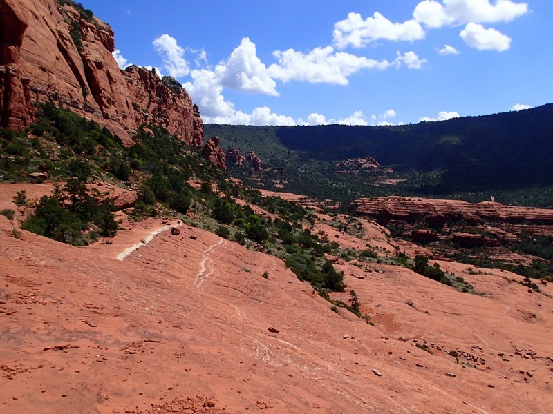
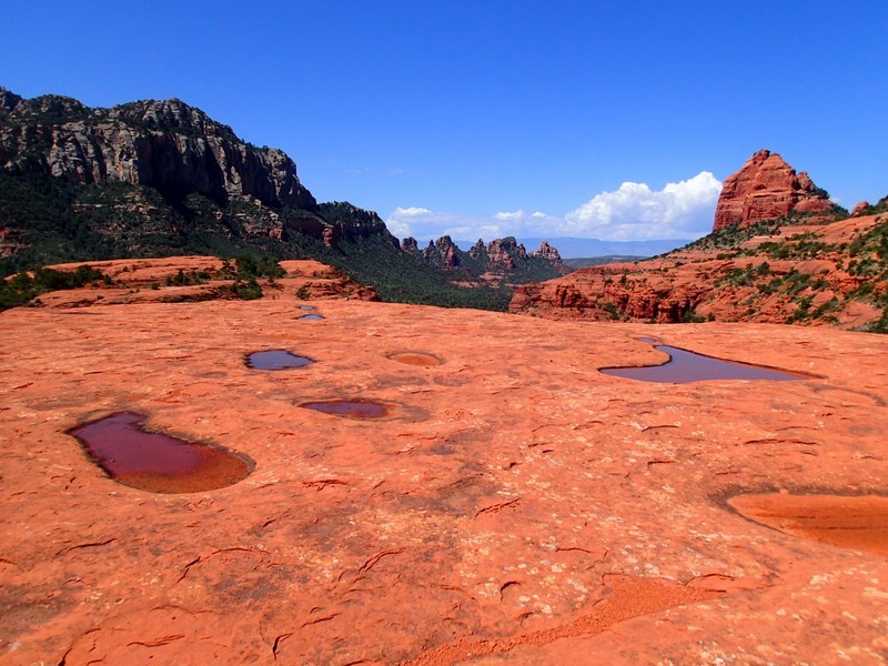
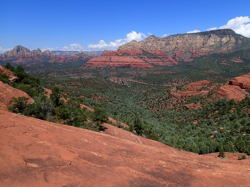
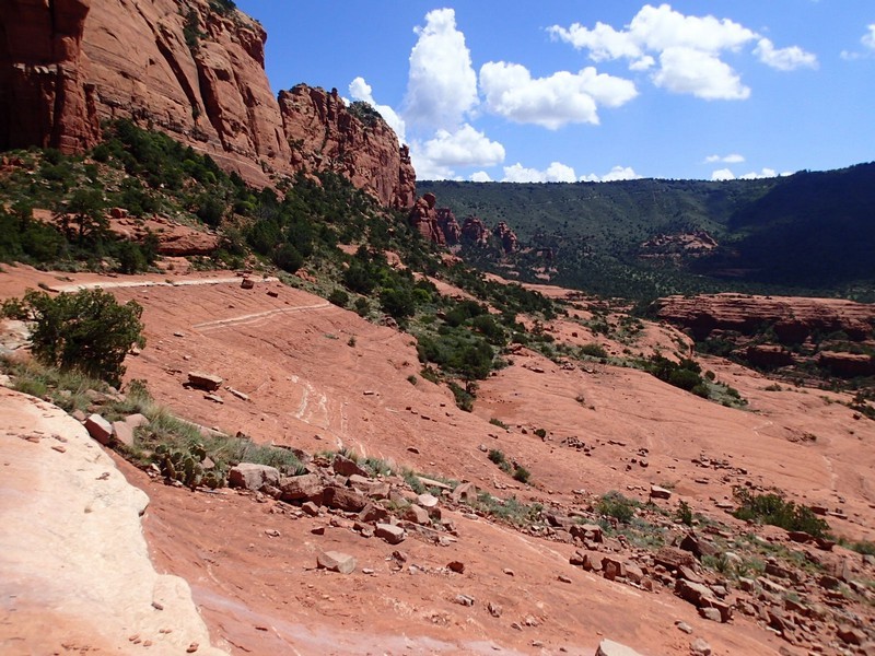
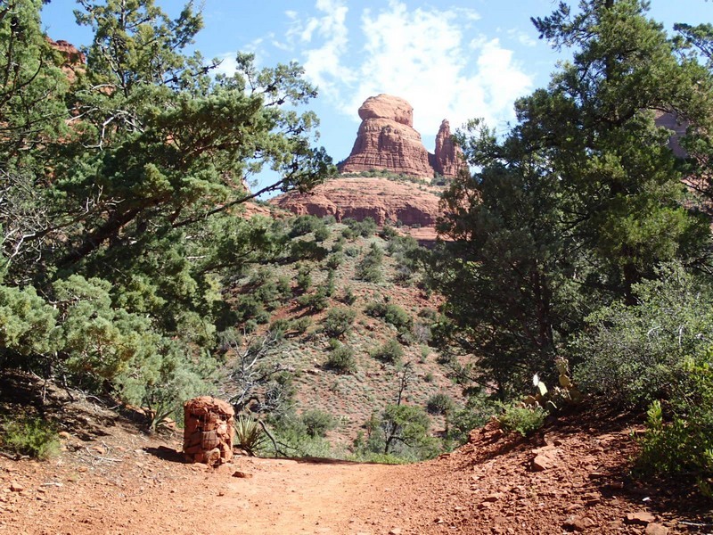
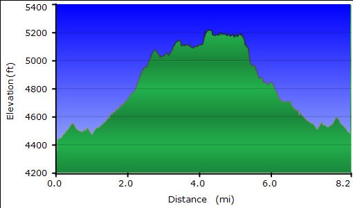
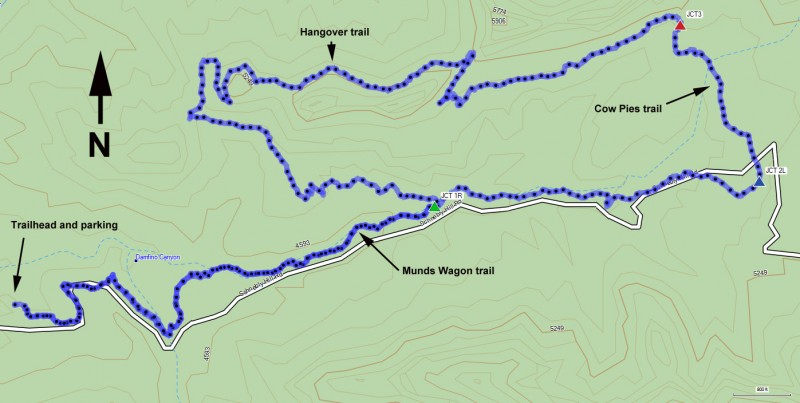
There is some route finding for the first mile of this trail, as there are several spur trails and the trail crosses Schnebly Hill road a few times. Keep an eye out for well placed cairns and you'll be able to stay on the trail. The trail heads up the dry wash for 1.6 miles where you'll reach a signed trail junction with the Hangover trail (JCT 1R on the map). Stay right here. This is where the lollypop loop returns. After 2.5 miles of hiking, you'll reach the signed junction with the Cow Pies trail (JCT 2L on the map). There are no actual Cowpies along this section. Some of the rock formations you'll be walking on look like Cowpies (sort of). The Cow Pies trail goes about 0.5 miles where it ends at the start of the signed junction with the Hangover trail (JCT3 on the map). The Hangover trail is built for expert mountain bikers, but is fun for the advanced hiker as well. This would be a good place to turn around if you want to keep the hike to a moderate difficulty, because after this point is where the hike gets challenging. Route finding is tricky. As this section of trail is often across featureless slick rock, there are white paint marks on the rock that help keep you on the trail. There is also some scrambling, tricky footing, and exposure along this trail, so be prepared. The reward is fantastic views of the area, including Wilson Mountain, Midgley bridge, Oak Creek canyon, and birds eye views of Sedona.
The Hangover trail is 3.2 miles long and ends back at the Munds Wagon trail (JCT 1R on the map). From this point, turn right and hike the 1.6 miles back to the trailhead start and parking area.
A special note: During monsoon season (July-August) make sure you're done with this trail by noon. Monsoon weather very typically rolls in during the early afternoon and you don't want to be on the exposed Cow Pies trail when it does!
