
- Hikes in Arizona
- Tucson Area and Southern Arizona
- Bog Springs loop
Bog Springs loop
Updated


Location
How to Get There
This hike is located near Green Valley, AZ.
To get to the Trailhead: From the Tucson area, take I-19 South towards Green Valley. Take the exit to Continental road (exit 63) and turn left. Take this road 1.2 miles and make a right onto signed Madera canyon road. Take this road for 12 miles to the signed junction with the Bog Springs campground. Turn left here and take the road 0.5 miles to the campground. Park at the trailhead parking (next to the restrooms) and walk to campsite #13 to where the signed trailhead starts. This is a fee area. At the self pay station at the entrance to the campground you'll pay $5 to park.
To get to the Trailhead: From the Tucson area, take I-19 South towards Green Valley. Take the exit to Continental road (exit 63) and turn left. Take this road 1.2 miles and make a right onto signed Madera canyon road. Take this road for 12 miles to the signed junction with the Bog Springs campground. Turn left here and take the road 0.5 miles to the campground. Park at the trailhead parking (next to the restrooms) and walk to campsite #13 to where the signed trailhead starts. This is a fee area. At the self pay station at the entrance to the campground you'll pay $5 to park.
city
Green Valley
state
AZ
country
USA
Region
Tucson Area and Southern Arizona
Hike details
Distance
4.50 [Miles] Total
Hike Distance- Details
4.5 miles for the lollypop loop hike
Time
2.00 [Hours]
Time-details
This hike took us 2 hours to complete
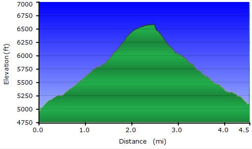
Elevation Change
1,600 Total gain/loss [Feet]
Elevation Details
1600 ft of elevation gain and loss
Hike Trail Type
- Out and Back
- Lollypop Loop
Special Features
- Water
- Wild Animals
Season
Best Season
- September
- October
- November
Worst Season
- January
- February
- December
Season Details
Fall is best, but this trail would be good in Spring and Summer also
Date Hike completed
November 07, 2016
Solitude
Solitude
Medium
Solitude Details
Pretty good. We shared the trail with perhaps 15 other hikers
Difficulty
difficulty detail
The climb up to Kent spring is pretty steep and the descent is even steeper. This fact makes it a moderate difficulty hike.
Permits
Be Aware of
Fee to part ($5 as of November 2016), trail overgrown in places
Hike Bog springs loop, Green Valley, AZ
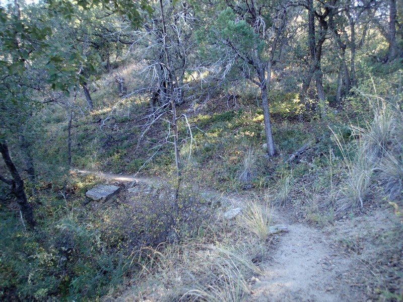
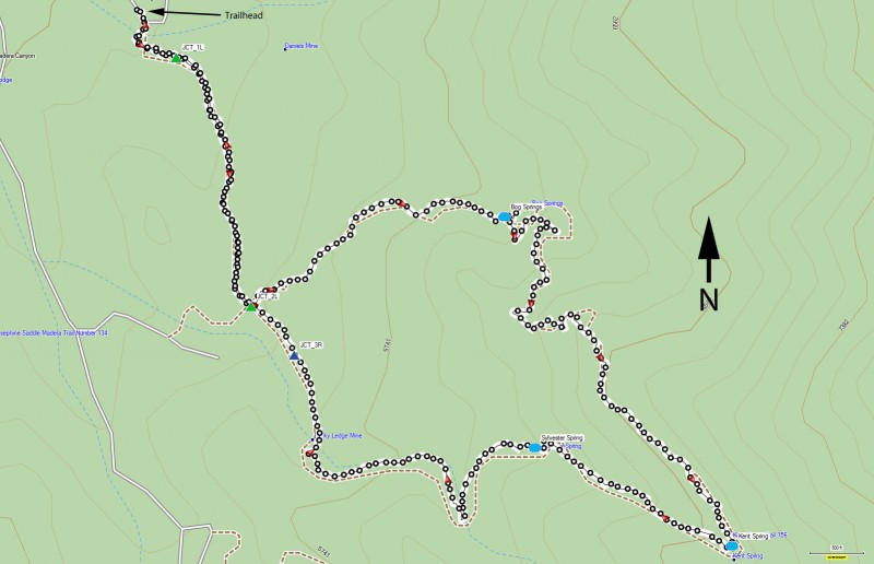
After you've paid your $5 (the signs are a bit confusing, but the $10 is just if you're camping) at the self pay station, walk over to campsite #13 where the well signed trailhead start lies. This section of the trail is an old closed road, so it is wide and easy to follow. Gaining elevation, you'll reach the signed junction with a spur trail to one of the other campgrounds (JCT_1L on the map). Stay left here. After about 0.6 miles of hiking you'll reach the signed trail junction that signals the start of the loop section (JCT_2L on the map). Turn left here on the trail signed for Bog Springs.
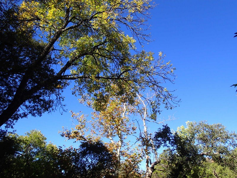
This section of trail narrows to a single track and has some nice scenery as you climb. The trees will part once in a while and you'll get a great view of the Madera Canyon area. Continue the climb to the signed Bog Springs trail junction (Bog Springs on the map). You'll take a short 0.1 mile spur trail to see the concrete spring. Backtrack and continue climbing (now more steeply) up towards Kent Spring. This section of trail is a bit overgrown, but not too bad. You'll have even more impressive views thanks to your hard work climbing on this section of trail. You'll also be treated to shade in the form of Sycamore, Oak, and Walnut trees. This section is especially pretty in the Autumn. The climbing peaks out at almost 6600 feet at signed Kent Spring (Kent Spring on the map). From this trail junction, you'll take the steep trail down the canyon. Watch your footing here as you'll lose elevation quickly as you reach easy to spot Sylvester spring (Sylvester Spring on the map). When we did this hike, we surprised some wild turkeys enjoying the spring water. From the spring, its an additional 0.8 miles of walking to another signed trail junction (JCT_3R on the map). Turn right here and walk 0.1 miles to where the loop section started. Stay left this time and walk 0.6 miles back to the trailhead start.