
- Hikes in Arizona
- Northern Arizona
- Dorsey Spring - Kelsey Spring Loop
Dorsey Spring - Kelsey Spring Loop


Location
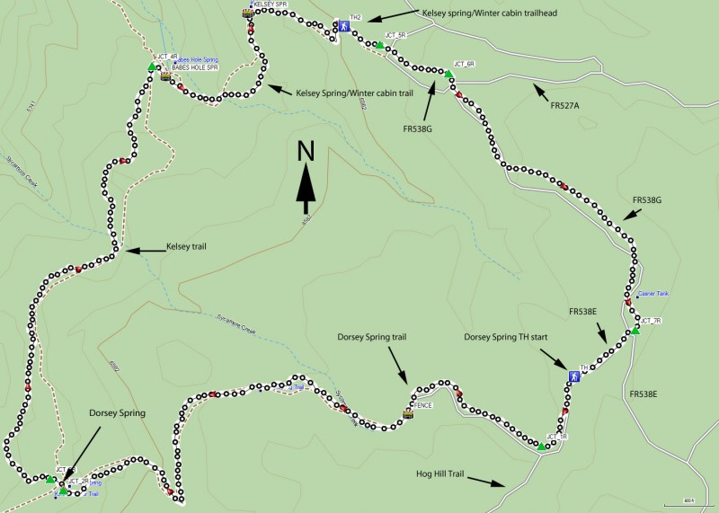
To get to the trailhead: from the Flagstaff area, take HWY-66 West out of town, turning South (left) onto Woody Mt Road (FR231). This road starts off as paved. Soon after it passes over I-40, the road turns into good graded dirt. Follow this road 14 miles to FR538. Make a right turn onto FR538 and take it 5.7 miles to FR538E. At this point, the road turns a bit nasty... high clearance vehicles recommended. Turn right on FR538E and go 0.4 miles to the junction with FR538G. Turn left to stay on FR538E and go 0.4 miles to the well signed trailhead.
Hike details
Season
- April
- May
- August
- September
Solitude
Difficulty
Permits
Hike to Dorsey spring near Flagstaff, Arizona
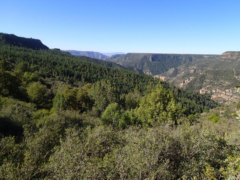
First I need to warn you about the drive. The road is really good until that last 0.65 miles. Drive slow and try not to puncture a tire or scrape the bottom of your automobile. After the long drive from Flagstaff, breathing in the clean air of the Sycamore Canyon wilderness area is welcome.
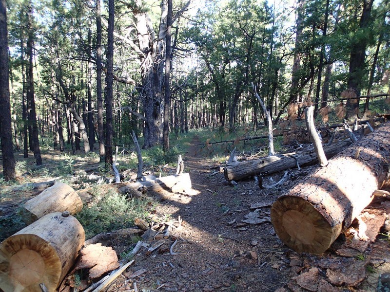
The well marked trailhead starts from the parking area. The trail follows an old (now closed) jeep road through a pine forest. Keep an eye out for deer here, as we spotted a few when we did this hike. After a mere 0.25 miles of hiking, you will reach a signed fork. To the left is the Hog Hill trailhead to Winter Cabin (JCT_1R on the map). We will go right here to the Dorsey Spring Trail.
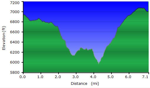
For the first 1.8 miles of this hike, the elevation stays mainly flat. Afterwards, you reach the rim, which is tantalizingly out of view because of the pine trees blocking the views. Here the trail starts down a drainage and begins to quickly loose elevation. You'll drop about 600 ft of elevation in the next 0.5 miles to Dorsey Spring.
Dorsey Spring is well signed within a lovely clearing. The spring itself comes from a pipe buried in the spring.
To continue on, now we'll take the Kelsey spring trail by staying right at the two signed trail junctions around Dorsey Spring (JCT_2R and JCT_3R on the map). This section of trail is a bit overgrown, but the lower elevation provides less obstructions for the views of Sycamore canyon. From Dorsey spring, you'll hike about 1.7 miles to the signed junction with the Kelsey Spring trail (JCT_4R). Go right here and after a few hundred yards, you'll reach peaceful Babes Hole spring. The shade of the forest returns as you climb 0.6 miles up to Kelsey Spring. This scenic spring is a bathtub sized tank in a small grassy meadow. From Kelsey spring, it is a quick 0.3 miles to the trailhead start of the Kelsey spring trail. From here, you'll be following forest roads for the final 1.7 miles to the Dorsey Spring trailhead and your car. Navigation is pretty easy, as you'll simply stay right at the next three intersections (JCT_5R, JCT_6R, and JCT_7R on the map).
