
- Hikes in Arizona
- Mogollon Rim
- Bear Canyon Lake Trail
Bear Canyon Lake Trail


Location
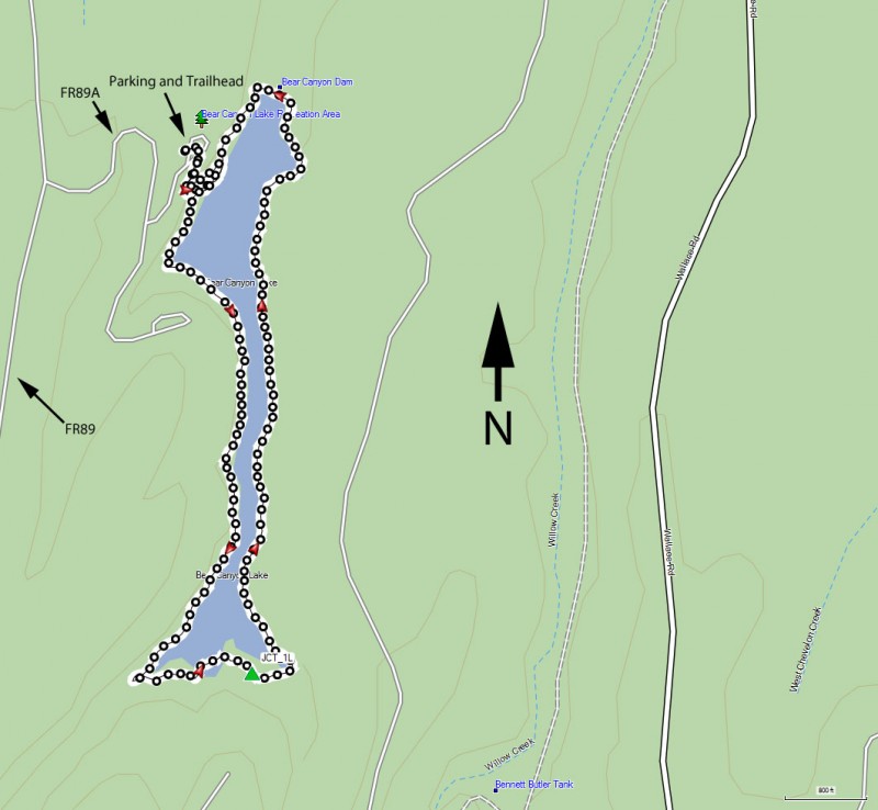
To get to the trailhead: from the Phoenix area, take HWY-87 North toward Payson. Once in Payson, take HWY-260 East towards Heber. After about 30 miles, turn left onto signed FR300 (also known as the Rim Road). Take this road 12 miles, following the signs for Bear Canyon lake. The road starts out paved, but turns to well graded dirt. After 12 miles, turn right at the signed intersection with FR89. After two miles on this road, turn right onto signed FR89A. This road takes you through a campground and down to the lake parking (stay left at the final fork). You'll reach the parking area after one more mile of driving. There is a restroom here but no drinking water.
Hike details
Season
- June
- July
- August
- January
- February
- December
Solitude
Difficulty
Permits
Loop hike around Bear Canyon Lake on the Mogollon rim (Arizona).
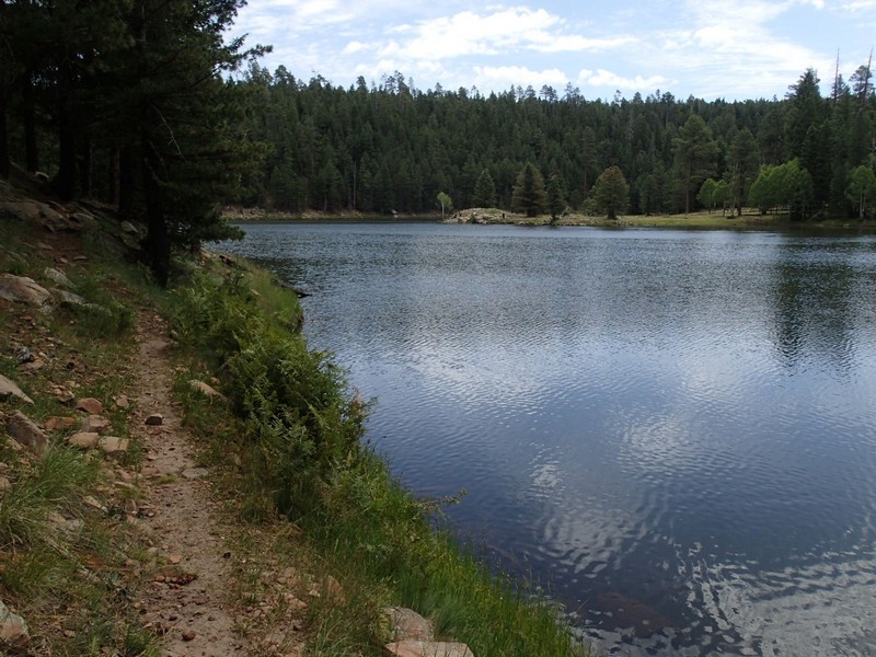
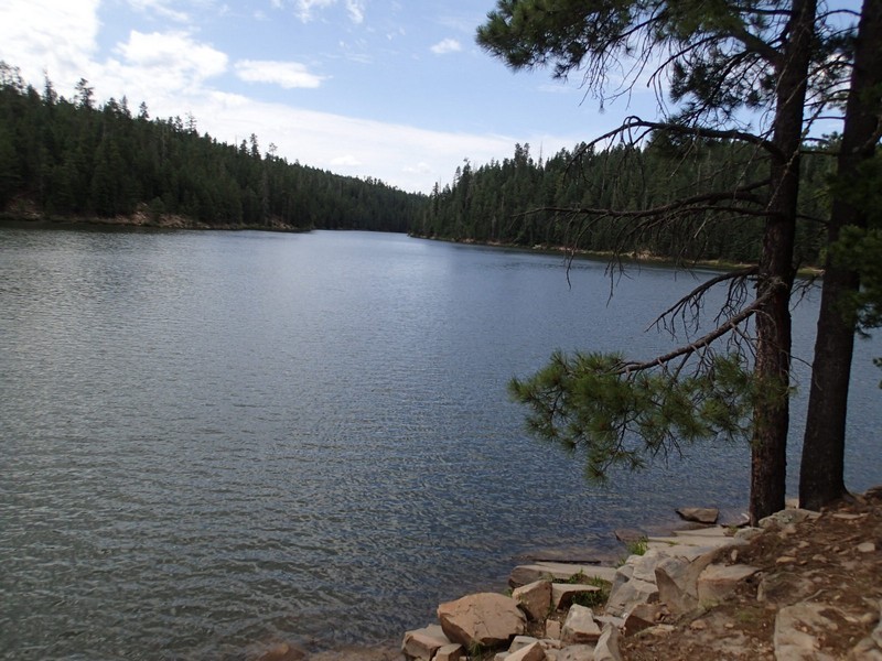
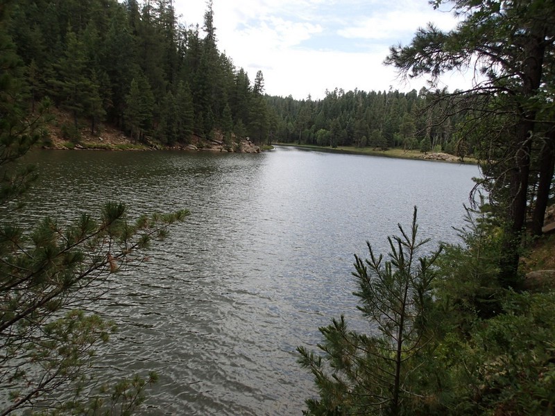
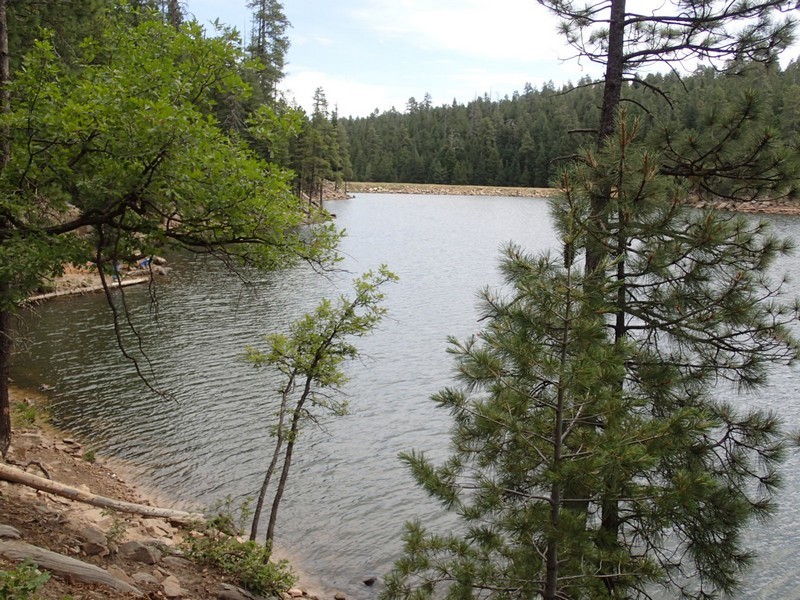
It's easy to see why Bear Canyon lake is so popular. Up at 7500 feet, this remote lake provides the fishing crowd with a scenic place to fish. For us hikers, there's a great trail that loops around this pretty place.
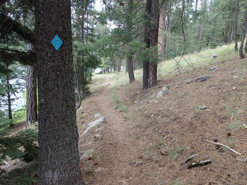
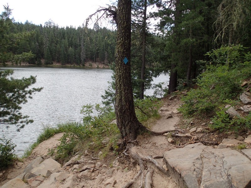
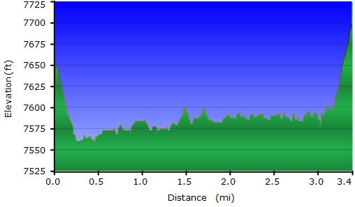
From the parking area, the signed trailhead is easily spotted to the East. Take the signed trail about 0.25 miles to a signed fork. Here you can go either left or right around the lake. We went right and made a counter-clockwise loop. This section of trail is well defined and marked with periodic blue diamonds on the pine trees. This trail hugs the lake for nearly its entirety, so the lake scenery follows you. As you head to the Southern tip of the lake, you'll reach the wild East side of the lake. The trail markers disappear and the trail becomes more of a fisherman path. There's a bit of scrambling and route finding here, but for the most part, the trail sticks very close to the lake shore. This section of the hike provides the best solitude from fishermen. Eventually you'll reach the North end of the lake and the dam. The blue diamonds return and it's a short 0.2 miles back to the first fork and then a brief climb to get back to the parking area.
