
- Hikes in Arizona
- Phoenix Area and Central Arizona
- Camelback Mountain (Cholla Trail)
Camelback Mountain (Cholla Trail)


Location
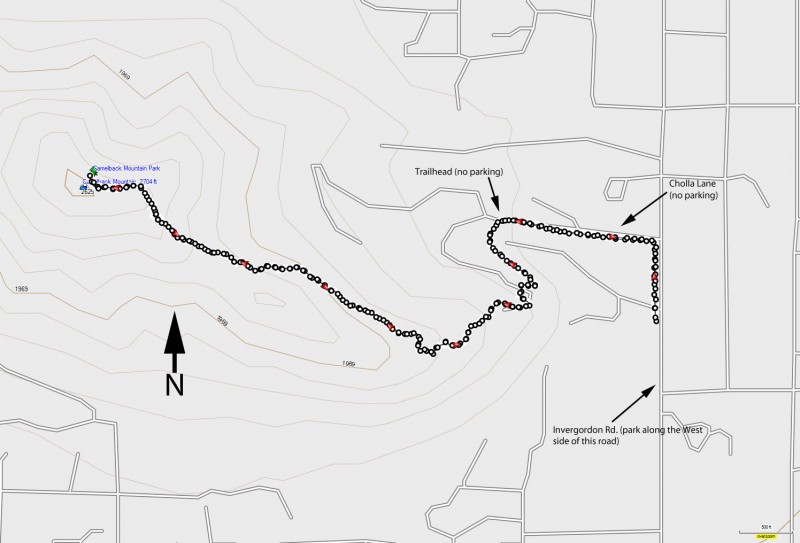
From Camelback Road, turn North on Invergordon Rd. Park along Invergordon Road on the west side. The signed trailhead is between Cholla lane and Chaparral Rd on the west side of Invergordon Road. There is no parking at the trailhead, but there are restrooms and water.
Hike details
Season
- January
- February
- March
- October
- November
- December
- May
- June
- July
- August
- September
Solitude
Difficulty
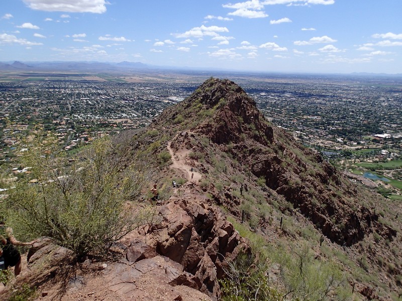
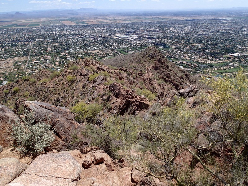
30 yr old Recommendation: Quick climb with some good city views at the top. This is a Moderate hike. There is some fun and slightly challenging scrambling near the top.
Permits
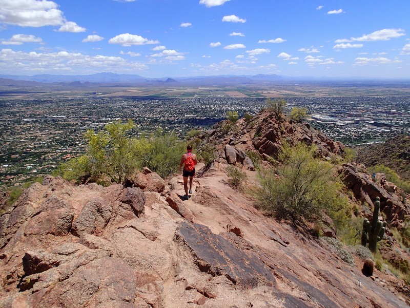
Hike up Camelback mountain using the Cholla trail in Phoenix, Arizona
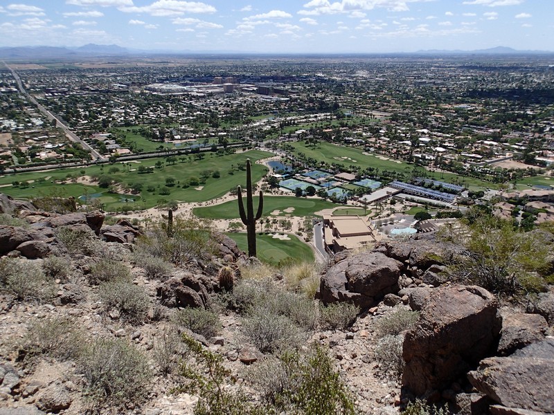
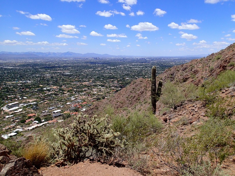
Camelback mountain is a popular hike, for good reason. The views from the top are spectacular and the hiking is fun. Recently (October 2022) the city of Phoenix revised and improved the start of this trail. The trailhead was moved out of the nearby neighborhood and restrooms/water were added. You still need to park along the west side of Invergordon road to get trailhead access, as there is no parking lot at the trailhead.
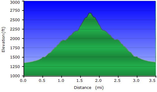
The Cholla Trail is less steep and a bit longer (3.5 miles round trip) than the Echo Canyon trail. From the trailhead, there are excellent views of the Phoenician resort as well as some of the finer houses and resorts surrounding the mountain. As you climb, views abound from right and left. The trail is well marked and easy to follow for the first 1.5 miles. The last 0.25 miles require some scrambling. Follow the blue reflectors reflectors on the rock to stay on the route. Enjoy the views from the top!
