
- Hikes in Arizona
- Phoenix Area and Central Arizona
- Poston Butte
Poston Butte


Location
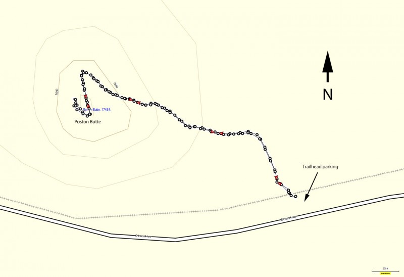
From the Phoenix area, take US-60 East to the Ellsworth Road Exit. Go South on Ellsworth Road, which eventually turns into the Hunt Highway going East. Take the Hunt Highway towards Florence, AZ. About 1.25 miles before you get to SR-79 and would turn right to Florence, you'll see a hill on your left (North) with a white F on it. This is Poston Butte. Look for a small, unsigned parking area on the left near a bridge that the railway goes over. Park here.
Hike details
- Out and Back
- Loop
Season
- January
- February
- March
- November
- December
- June
- July
Solitude
Difficulty
Permits
Hike up Poston Butte near Phoenix, Arizona.
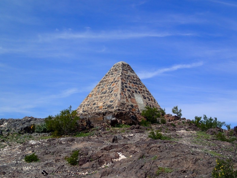
Charles Poston (1825 - 1902) had a historic impact on the early years of Arizona, lobbying then President Lincoln to make Arizona a territory. He held several jobs in the government of that era, including being the first Arizona territory congressional delegate. Long after his service to Arizona ended, he was buried on top of the hill now named after him.
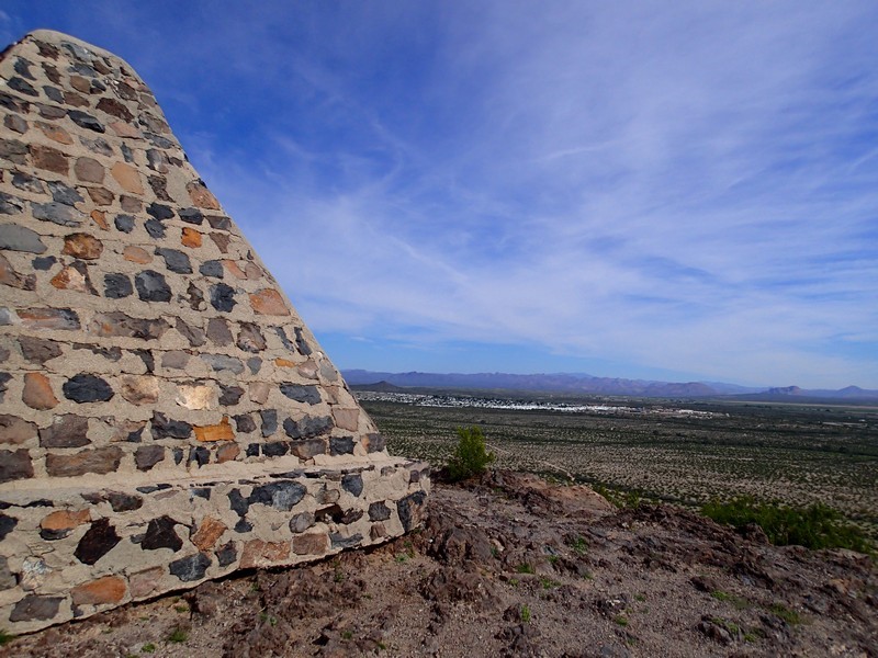
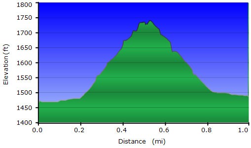
From the parking area, cross under the railroad bridge and look to your left. You can clearly see Poston butte, along with the pyramid built to mark Poston's burial site. There are several trails in the area, pick one of the first ones that splits off to the left towards the base of the hill. The wide trail is easy to follow and after a 300 ft climb leads to the top of the butte and the pyramid. There are some views of the surrounding desert and the town of Florence.
When ready, return the way you came.
