
- Hikes in Arizona
- Phoenix Area and Central Arizona
- Brown's Mountain (McDowell Sonoran Preserve)
Brown's Mountain (McDowell Sonoran Preserve)

Location
From the Phoenix area, take state HWY-101 North to the Pima Road exit. Drive north on Pima road and after six miles, turn right onto Dynamite road. Go east on Dynamite Road and after 3 miles turn left onto signed Alma School Parkway. After 1.5 miles of driving on this road, you'll reach the well signed Brown's Ranch trailhead. There are water and restrooms at this facility.
Hike details
Season
- January
- February
- March
- April
- October
- November
- December
Solitude
Difficulty
Permits
Hike around Brown's Mountain in the Scottsdale Sonoran Preserve near Phoenix, Arizona
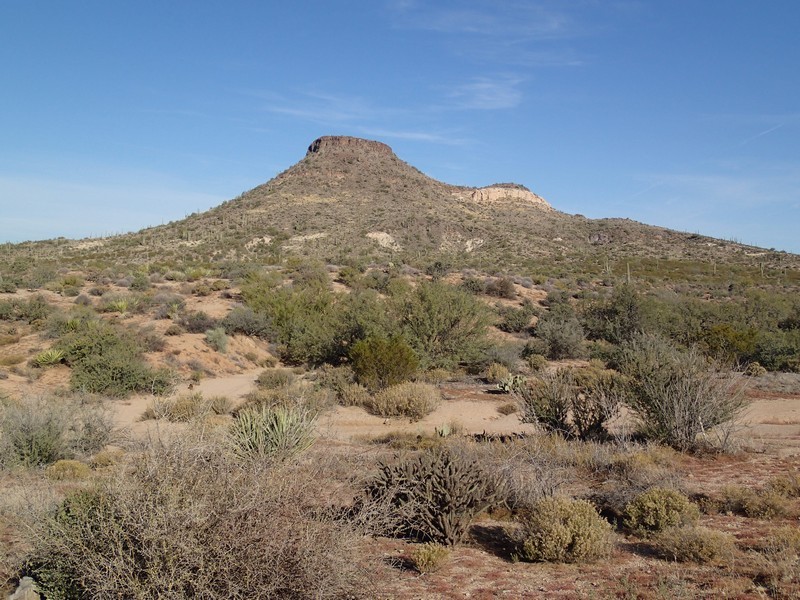
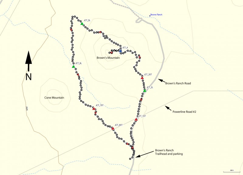
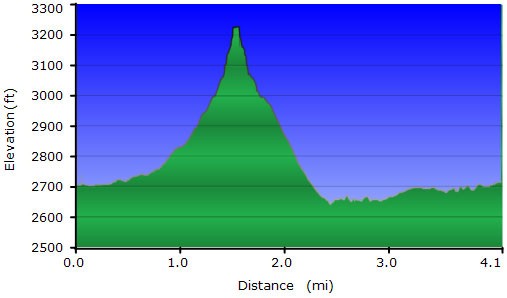
The most recent addition to the McDowell Mountain preserve is the area around Cholla mountain, Little Granite mountain, and Brown's Mountain. There are plenty of hiking opportunities in this area. One fun loop hike is around and on top of Brown's Mountain.
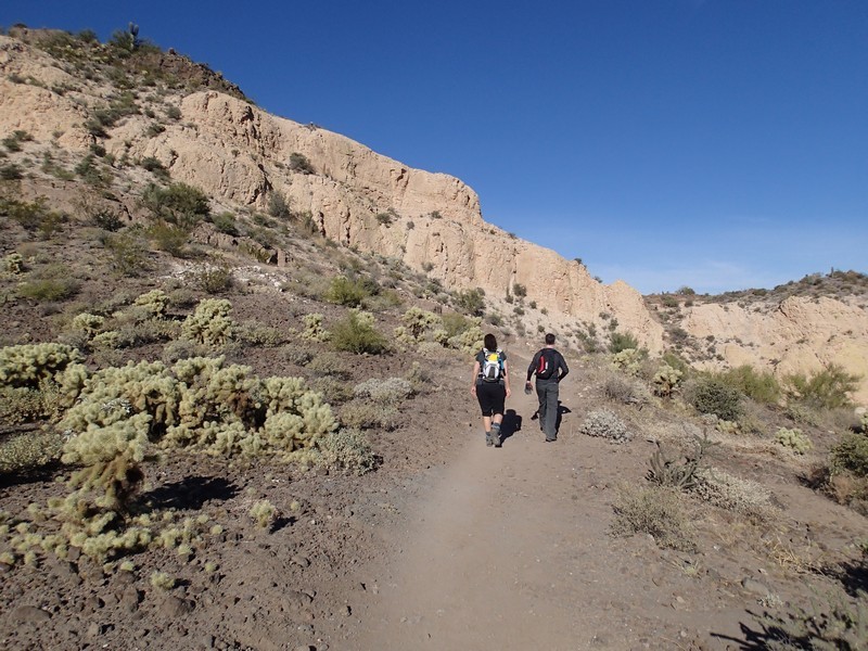
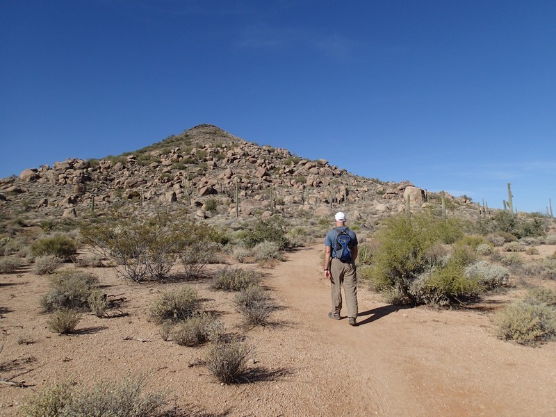
From the parking area, head north on the signed trail for Brown's Ranch Road. All the trails here are easy to follow and all trail junctions are well signed. After 0.3 miles of hiking on this trail, you'll cross the Powerline Road #2 (JCT_1ST on the map). Continue straight. You'll clearly see Brown's Mountain on your left. After 0.3 miles more, you'll reach the intersection with the Brown's Mountain trail (JCT_2L on the map). Turn left here. After 0.1 miles you'll continue straight at the intersection with the Wrangler trail (JCT_3ST on the map).
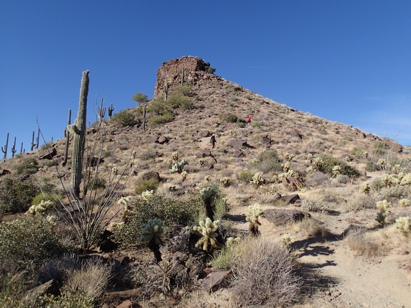
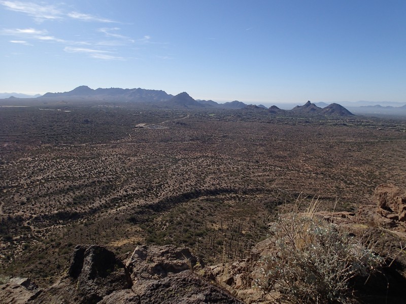
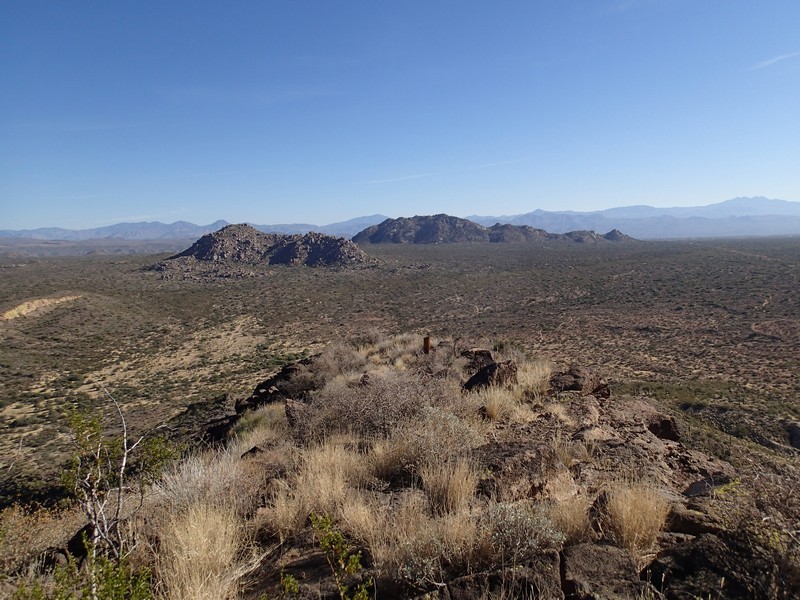
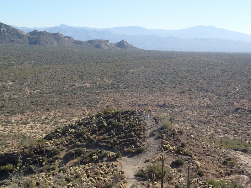
From here, the Brown's mountain trail starts to climb gently. After 0.6 miles, you'll reach a small saddle (JCT_4 on the map). To the right is a short walk to a view. To the left is a short 0.2 mile spur trail to the top of Brown's Mountain. This little spur trail is a bit steep, but straight forward. From the top of the mountain you get good views of Cholla mountain and Little Granite mountain to the North East, Cone Mountain to the South West, and Pinnacle peak with the rest of the McDowell mountain range to the South. Backtrack to Brown's Mountain trail when you're done enjoying the views.
From JCT_4, make a left (heading Northwest) and descend 0.6 miles to the interesction with the Upper Ranch Trail (JCT_5L on the map). Turn left here. After 0.7 miles of hiking, you'll reach the trail junction with the Cone Mountain trail (JCT_6L on the map). Stay left here and hike 0.5 miles along the Upper Ranch Trail. You'll reach the junction with the Wrangler trail (JCT_7ST on the map). Stay straight here and stay straight again at the junction with the Powerline Road #2 trail (JCT_8ST on the map). Continue the last 0.3 miles to the Brown's Ranch trailhead and parking area to complete the loop.
There are plenty of other hiking trails in this area to explore. Enjoy!
