
- Hikes in Arizona
- Phoenix Area and Central Arizona
- Kellner Canyon Trail #242
Kellner Canyon Trail #242


Location
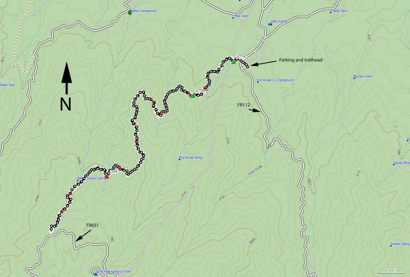
To get to the trailhead: from the Phoenix area, take US-60 East toward Globe. Once in Globe, turn right on Hill street, just past mile post 251. Please watch your speed in this area, as it is a residential area. Follow the Tonto Forest signs 1.2 miles and turn right onto Icehouse road. This soon becomes FR112. Drive 1.8 miles to a stop sign. Drive another 2 miles to the end of the pavement. Drive 0.5 more miles to the CCC picnic area and trailhead and turn left to park. The dirt road is in very good shape and passenger cars are no problem. The trailhead has a restroom, but no water.
Hike details
Season
- March
- April
- May
- September
- October
- November
Solitude
Difficulty
Permits
Hike up Kellner Canyon trail near Phoenix Arizona.
Driving through Globe on the way to other areas of the state, you would never know what kind of beauty lies in the mountains around this area if you never stop to see them. To the south of Globe is Pinal Mountain and there are some aggressive and impressive trails that head up to the top.
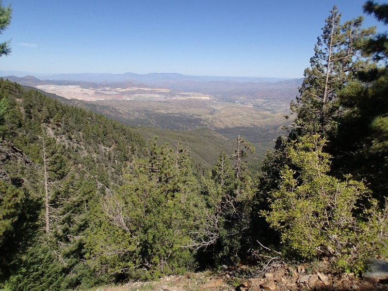
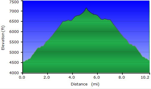
From the CCC picnic area, there are two trails that start from this location. From the east, the six shooter trail (Trail 197) heads towards the same destination. However, we are looking for the Telephone Trail (Trail 192) that starts from the west of the picnic area. The Telephone Trail quickly crosses a road and reaches a signed junction between the Telephone Trail and the Icehouse Canyon Trail (JCT1R on the map). Stay right to take the signed Icehouse Canyon trail (Trail 198). This area has some route finding, but thankfully all major trail junctions are signed. The one tricky one is just after you go through a barbed wire fence, take a hard right onto the narrow trail instead of staying on the road. As you're following the trail signs, you'll be walking on a wide dirt road, closed to vehicle traffic. About 1.1 miles from the start of the hike, you'll see the signed junction for the Kellner Canyon trail (Trail #242) on your right (JCT2R on the map). There are some water tanks here also and this makes the trail junction easier to find. Thankfully, the route finding gets much easier from here on, so you can turn your brain off for a while and enjoy the hike. The first two miles of this hike is through scrub oak and manzanita. As the trail continues to climb (steadily but not too steeply), the views to the North of the Superstition wilderness, Globe-Miami, and the nearby copper mine become more impressive. Soon the first of the pine trees appear to provide welcome shade.
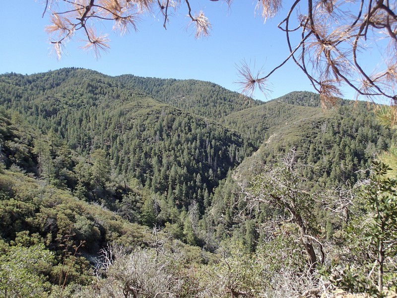
The forest becomes more lush the higher the climb, eventually hiding some of the views. About 3.8 miles into the hike, and well into the pine forest, you'll pass a old, abandoned mine (marked Cave on the map) on your left. You may not see it on the hike up because of the way it is facing, but you'll definitely see it on the way down. Unfortunately, it's filled with water. 0.4 miles of hiking later you'll be in the Kellner canyon spring area. The spring had water in it (well off the trail and down in the canyon) when we did this hike. More interesting is the remnants of a prior logging operation here. It's fun to poke around, but even without the rusty artifacts, it's still a very scenic and lovely place. If you're hiking this trail in the fall, you'll be rewarded with some yellow and red fall colors on the trees.
From the abandoned camp, it's another 0.7 miles to FR651 and your turn around point. We saw a few deer up here, so keep your eyes open for them. We were also surprised by a cow. We probably shouldn't have been, considering the amount of cow pies on the trail, but this is a grazing area for them.
When you're ready, return the way you came.
