
- Hikes in Arizona
- Phoenix Area and Central Arizona
- Apache Wash Loop hike (Phoenix Sonoran Preserve)
Apache Wash Loop hike (Phoenix Sonoran Preserve)


Location
From the Phoenix Area, take I-17 North to the Dove Valley Road Exit. After some driving along this road, Dove Valley road becomes Sonoran Desert drive. The signed Apache Wash trailhead is on your left. Turn left and drive a short distance into the parking area. There are restrooms here, but no water.
Alternate route from the Phoenix area, take US-101 North to the Cave Creek Exit. Head right (North) onto Cave Creek Road. Turn left onto Sonoran Desert drive. The signed Apache Wash trailhead is on your right. Turn right at the sign and drive a short distance to the parking area. There are restrooms here, but no water.
Hike details
Season
- January
- February
- March
- April
- October
- November
- December
Solitude
Difficulty
Permits
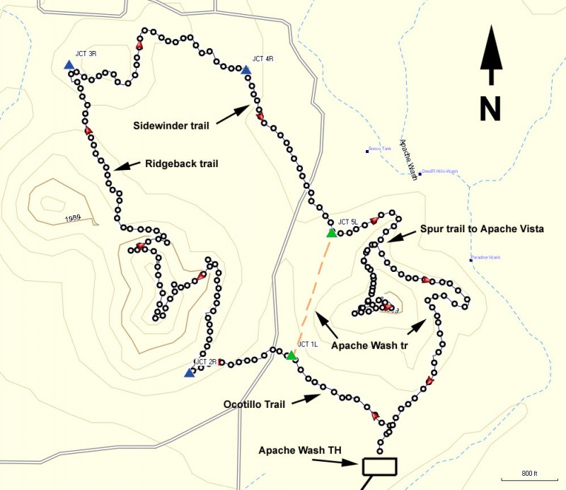
Loop hike using the Apache Wash trail in the Phoenix Sonoran Preserve in Arizona.
The cities of Phoenix and Scottsdale should be applauded for making a sincere effort to preserve the desert areas within their borders. Scottsdale has done an excellent job with the McDowell Sonoran Preserve and now Phoenix is also doing an excellent job with the Phoenix Sonoran Preserve. The Apache Wash trailhead is a good starting point for hiking access to the northern section of the Phoenix Sonoran Preserve. Although there are numerous trails in the area, a fun loop hike can be made by combining several trails as well as the Apache Wash trail.
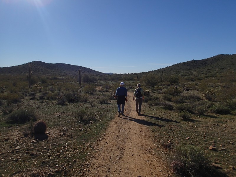
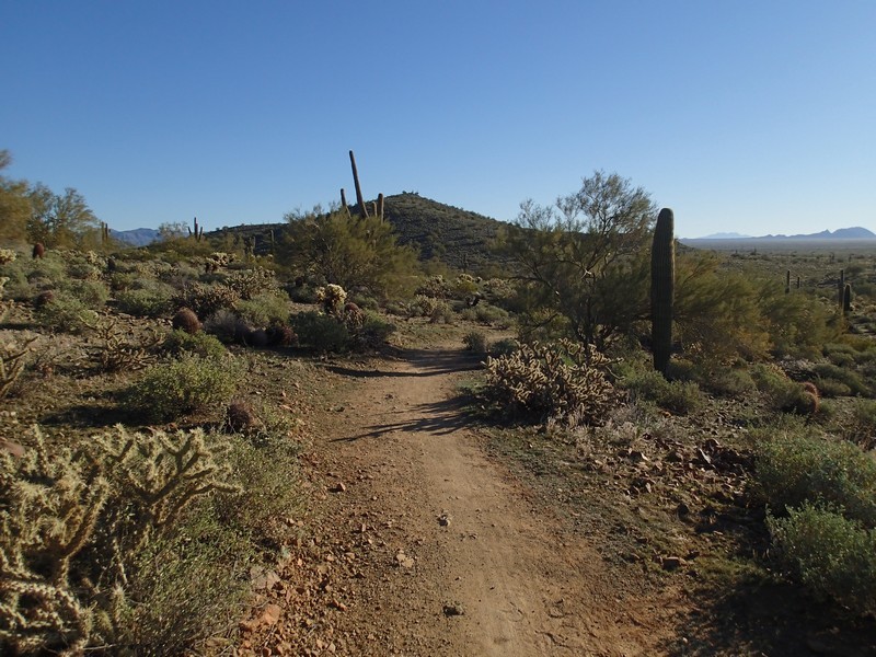
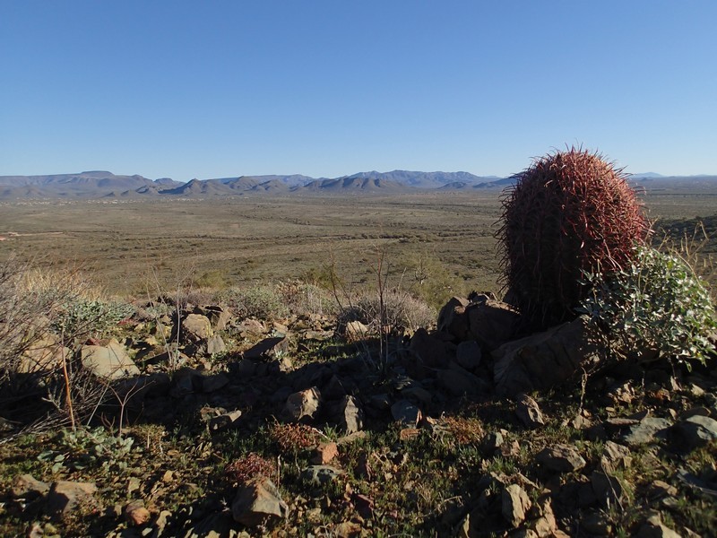
From the parking area, Turn left onto the Octotillo trail. The trail junctions in this area area all marked, so trail navigation is pretty straight forward. The easy to follow trail heads generally West through Sonoran desert. Saguaro, prickly pear, and barrel cactus abound. After 0.35 miles of hiking, stay left at the junction with the Apache Wash trail (JCT 1L on the map). You'll walk an additional 0.3 miles and then turn right onto the signed junction for the Ridgeback trail (JCT 2R on the map). The trail gains elevation here, but the ascent is gradual. Near the top there is a small spur loop to enjoy the views of the area. One nice thing about this section of the trail is it attracts fewer hikers, so enjoy the solitude. Continue along the Ridgeback trail generally North West as it gradually descends. From the top of the Ridgeback overlook, it's just under a mile to the signed junction with the Sidewinder trail. Turn right (JCT 3R on the map) to take the Sidewinder trail generally East. After walking 0.7 miles from the previous trail junction, you'll reach another trail junction for an alternate trail access (JCT 4R on the map). Stay right here to stay on the Sidewinder trail. You'll be heading directly for Apache Vista. Due to your now close proximity to the trailhead, you'll likely be sharing this section of trail with many more hikers. When you reach the trail junction with Apache Wash (JCT 5L on the map), turn left here. After hiking 0.3 miles from the previous trail junction, you'll reach a junction for the spur trail to the Apache Vista. Turn right here and take the short loop around the top of the vista for more views. Backtracking to the Apache Wash trail, turn right and hike the remaining 0.8 miles back to the parking area.
Since this is a popular area, it is also enjoyed by mountain bikers and equestrians. Please be polite and move to the side to let these folks pass so we can all continue to share access to this area.
