
- Hikes in Arizona
- Tucson Area and Southern Arizona
- Casa Grande Mountain Park - Bolt Trail
Casa Grande Mountain Park - Bolt Trail


Location
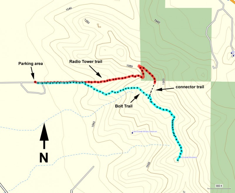
From the Phoenix area, take I-10 South to the Florence Blvd exit. Turn right when you get off the freeway onto Florence Blvd. Take this road into Casa Grande, turning left onto Trekell Road (South). You'll pass over I-8 and soon afterwards turn left onto Hanna Street (East). Take Hanna Street until the pavement ends at a wide parking area on the left. There is no water or other facilities at the trailhead.
Hike details
Season
- January
- February
- December
- June
- July
- August
Solitude
Difficulty
Permits
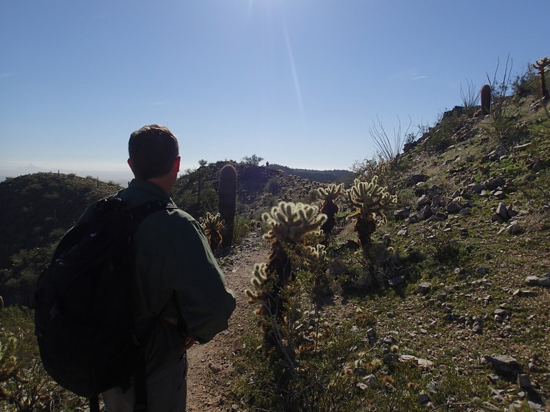
Hike up the Bolt trail in Casa Grande Mountain park in Arizona.
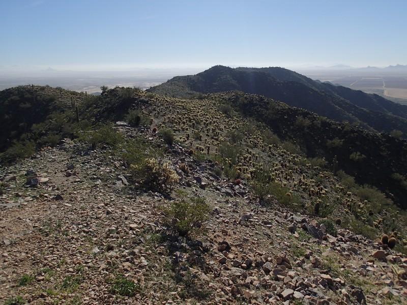
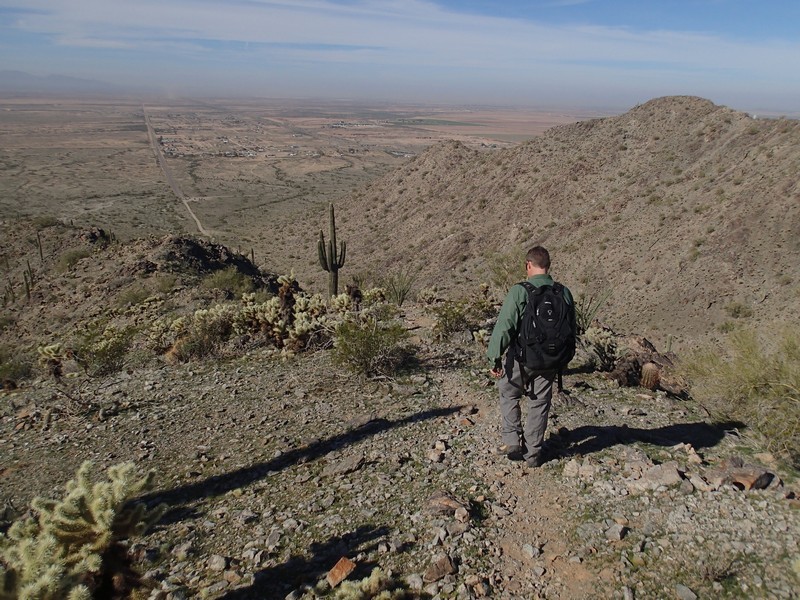
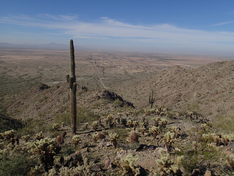
The Casa Grande Mountain Park is a popular destination for those living in Casa Grande, but relatively unknown to folks outside of this area. There are a number of good hiking trails here. Most folks follow the closed road up to the radio towers to get to the top. However, there is a more adventurous, peaceful, and challenging route to the very top of the Casa Grande Mountain that makes for a more enjoyable hike. The reward is expansive views of the area from the top of Casa Grande Mountain.
From the parking area, simply follow the dirt road. About 0.3 miles from the start, there is a small single track trail leading off to the right, marked by a cross that says "Bolt Trail". Leave the road here and start climbing. The trail can be difficult to follow sometimes, but use those route finding skills and you'll be OK. There are some steep sections, but nothing too scary. The trail follows the ridgeline to the right of the road for it's length. After 0.9 miles of hiking, you'll reach the ridge line overlooking the radio towers. To the left, the connector trail heads back towards the Radio Towers and makes for a good loop back to the car. Instead, we turned right and continued along the easy to follow trail along the ridge line of the Casa Grande mountains. After another 1.1 miles of hiking, we reached a USA flag and the summit of Casa Grande mountains.
There is a summit register, along with more great views of the area, including Picacho Peak to the South and the city of Casa Grande to the North. The trail continues along the ridge line, but we turned around here and headed back. You could make a nice return loop with the Radio tower trail by taking the connector trail (both shown on the map). One nice thing about descending on the Bolt trail is the trail is much easier to follow walking down and you are facing all the views of the desert. For our hike, we followed the Bolt trail back to the car.
