
- Hikes in Arizona
- Tucson Area and Southern Arizona
- Casa Grande Mountain Park - Radio tower trail
Casa Grande Mountain Park - Radio tower trail


Location
From the Phoenix area, take I-10 South to the Florence Blvd exit. Turn right when you get off the freeway onto Florence Blvd. Take this road into Casa Grande, turning left onto Trekell Road (South). You'll pass over I-8 and soon afterwards turn left onto Hanna Street (East). Take Hanna Street until the pavement ends at a wide parking area on the left. There is no water or other facilities at the trailhead.
Hike details
Season
- January
- February
- December
- June
- July
- August
Solitude
Difficulty
Hike up the Radio tower trail in the Casa Grande Mountain Park trail in Arizona.
If you're looking for an easy hike in the desert in the Casa Grande area, this is a good one.
The Casa Grande Mountain Park is a popular destination for those living in Casa Grande, but relatively unknown to folks outside of this area. There are a number of good hiking trails here. Following the closed road up to the radio towers is a good, easy hike that rewards with expansive views of the area.
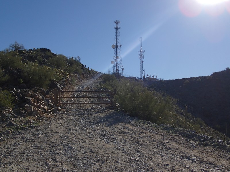
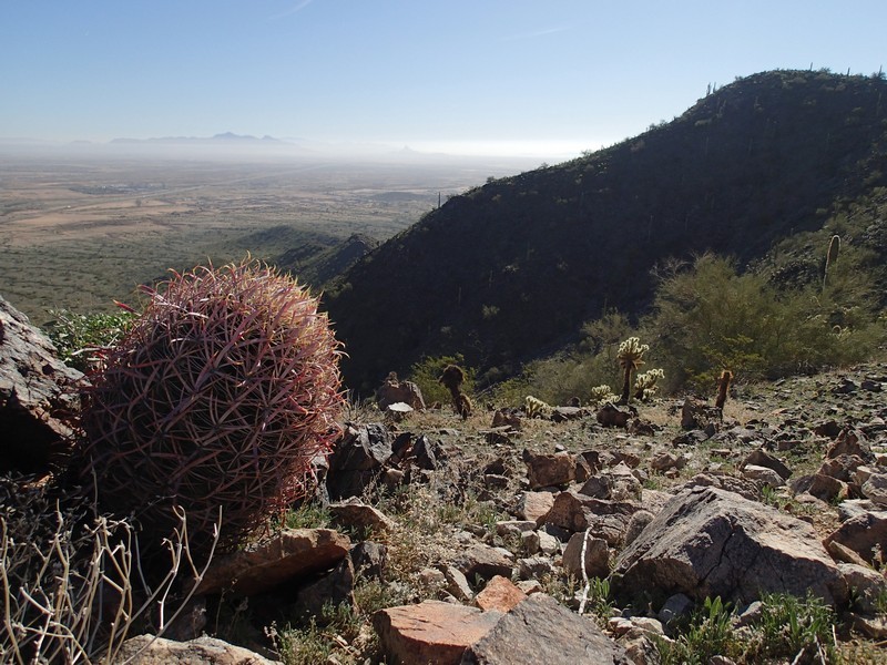
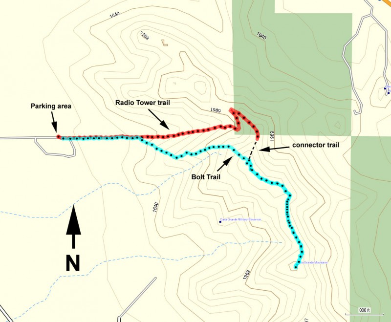
From the parking area, simply follow the dirt road up towards the visible radio towers. The grade of the road is made for 4WD vehicles needed to service the equipment on the top of the mountain, so the incline is pretty reasonable. Be sure to stop and look around once in a while. After 1.1 miles of hiking, you'll reach the radio equipment and the views of the area. To the south, you can see Picacho peak off in the distance. This is a good place to look around and enjoy the reward for your exertion.
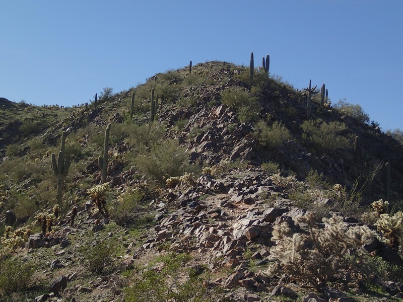
For your return, you have a choice. If you still have energy, take the connector trail (shown on the map) over to the Bolt trail, walking along the ridge line to the eventual summit of Casa Grande Mountain. There's a US flag here, along with a summit register, along with more great views of the area. Then you can take the Bolt trail back to the parking area. Alternatively, you could just backtrack on the Radio tower trail/road to your car... your choice! I'd highly recommend hiking up the Radio Tower trail and down the Bolt trail. Although the Bolt trail is steep in places, it's easier to follow when going down rather than hiking up.
