
- Hikes in Arizona
- Phoenix Area and Central Arizona
- Little Pan Loop (Black Canyon trail)
Little Pan Loop (Black Canyon trail)


Location
From the Phoenix area, take I-17 North to the Table Mesa exit. Take the road west over the bridge overpass and make a right just onto the signed frontage road and zero the odometer. The first 0.6 miles of this road is paved, then it turns into well graded dirt. After 1.2 miles, stay right at the fork. At 1.7 miles, bear left at the fork. At 2.9 miles, turn right at the fork and immediately park at the parking area on your left, next to the marked trailhead. There is a trail marker signed as the Black Canyon trail. This is the Table Mesa Road Trailhead.
Hike details
- Water
- Wild Animals
Season
- January
- February
- March
- November
- December
- July
- August
Solitude
Difficulty
Permits
Hike the Little Pan loop along the Black Canyon trail system near Phoenix, Arizona.
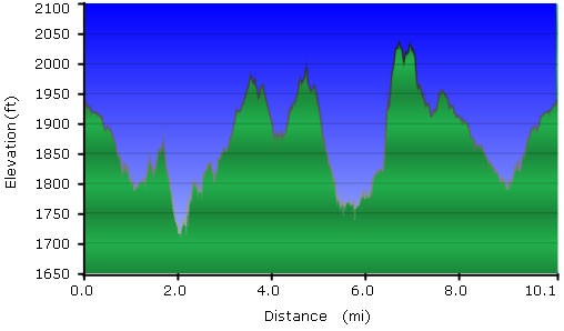
This ultimately frustrating hike started out poorly, got better and better, but ultimately ended in getting off trail and using dirt roads to get back on the trail. Hopefully you don't get as "temporarily off map" as I was. It's a shame, as I was really enjoying the hike until I missed a key trail junction. Make sure you have strong route finding skills before trying this hike.
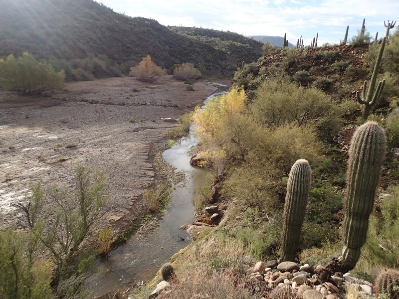
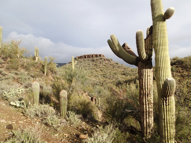
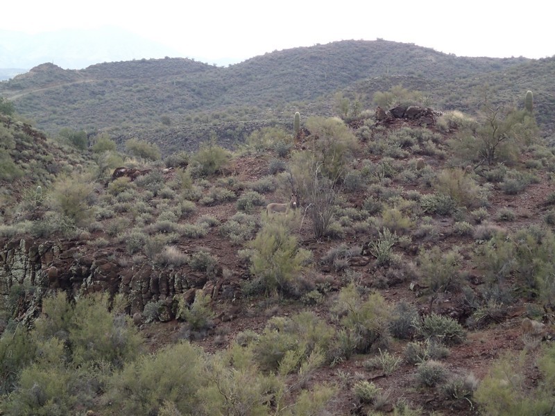
From the parking area, start walking along the easily followed trail. Very quickly you'll reach a marked trail junction. Turn right here for the Little Pan Loop. The trail stays in a typical Sonoran desert environment, with a good assortment of Saguaro, Barrel, and Cholla cactus. After 0.9 miles of hiking, You'll walk directly across a small desert wash. After 1.2 miles, you'll pass through a barbed wire fence (FENCE on the map) and soon afterwards reach an unsigned trail junction (but there is a large rock cairn here). Turn left at this junction (JCT 1 on the map) to take the loop in a clockwise direction as we did. The trail continues to be easy to follow until you reach the normally dry bed of the Agua Fria River. The river was flowing when we did this hike, as there had been a good size rain a few days before. There are some large cottonwoods here that keep watch over the area. Follow the brown trail marking signs until you reach the river bottom. Look directly across the river to (hopefully) see another brown trail marker. Cross the riverbed and walk towards the marker. When you reach this marker, it looks like the trail continues straight ahead into a gully. Actually, the trail goes left along the river bottom for about 100 ft before you will reach the well worn and signed trail that switchbacks up the small hill. Once you get back on the trail, you can relax your route finding skills and enjoy the well worn path. This was the most enjoyable section of the hike, as it feels quite remote and unspoiled. I even ran into a wild burro in this area.
After 2.5 miles of hiking from the previous fence, you'll reach another marked trail junction (JCT 2R on the map). Turn right here and follow the wide jeep road (which you may need to briefly share with off road vehicles) for about 0.3 miles before leaving the jeep road at the marked trail junction on your right (JCT 3R on the map). This begins the second tough route finding challenge on this hike, as there are a number of jeep roads in this area. Continue to follow the main jeep road and follow the brown hiking signs until they abruptly stop at the second crossing of the Agua Fria river. This is where I became "temporarily off map" so pay attention here.
Continue to follow the wide jeep path across the river. On the other side, there are a number of jeep trails, all thankfully closed to vehicle traffic. You want the jeep track that switchbacks directly south up the side of the canyon (see the green track on the Map). If you reach the FENCE2 on the map (which is a break in a fence meant to keep vehicles out and leads to a jeep road) you've gone too far East. This was my mistake. I ended up taking the dirt roads back to the trail (shown as 'alternate route not recommended' on the map). Sharing the roads with the ATV and jeep folks does not make for a peaceful or enjoyable walk so I don't recommend it.
Hopefully you found the correct turn here and are following the green line on the map. I can't tell you about this section because I missed it. However, I do know this section ends back at the trail junction marked JCT 1 on the map. Turn left at this trail junction and walk back to the parking area.
